TopoQuest Logo
Do you find TopoQuest useful?
Help keep TopoQuest running and adding new maps/features by donating!
Bitcoin:  19c7KJd3qBynnjoSw5npx9KScwjBe4ifkT
Litecoin:  LXs6TkuXGGXo1vDsWCkWVdjQX94eUKd6ui
Home View Maps Find Maps Find Places Resources & Links


Winslow, Arkansas Topographic Map

USGS Map Title: Winslow, AR
USGS Map MRC: 35094G2
DRG (GeoTIFF) Download: o35094g2.tif


Neighboring USGS Topographic Map Quads:


  Prairie Grove, AR  
35094H3
 

  West Fork, AR  
35094H2
 

  Sulphur City, AR  
35094H1
 

  Strickler, AR  
35094G3
 

  Winslow, AR  
35094G2
 

  Brentwood, AR  
35094G1
 

  Rudy NE, AR  
35094F3
 

  Mountainburg, AR  
35094F2
 

  Fern, AR  
35094F1


Map MRC Location:

N36°
W95°
N36°
W94°
H8 H7 H6 H5 H4 H3 H2 H1
G8 G7 G6 G5 G4 G3 G2 G1
F8 F7 F6 F5 F4 F3 F2 F1
E8 E7 E6 E5 E4 E3 E2 E1
D8 D7 D6 D5 D4 D3 D2 D1
C8 C7 C6 C5 C4 C3 C2 C1
B8 B7 B6 B5 B4 B3 B2 B1
A8 A7 A6 A5 A4 A3 A2 A1
N35°
W95°
N35°
W94°

Winslow, AR USGS 1:24K Topographic Map Preview:
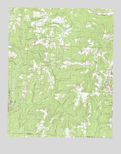
Winslow, AR USGS Topographic Map
Click on map above to begin viewing in our Map Viewer.

This topographic map contains these locations and features:
Feature Name Type Latitude Longitude GNIS ID View Map
BanyardPopulated PlaceN35.7601°W94.2069°70502View Map
Bethlehem ChurchChurchN35.8504°W94.2163°70647View Map
BlackburnPopulated PlaceN35.8165°W94.2197°70703View Map
Blackburn ChurchChurchN35.8176°W94.2091°70704View Map
Blackburn Post Office (historical)Post OfficeN35.8162°W94.2199°84857View Map
Boston Mountain Fire Department Station 2BuildingN35.8145°W94.1310°2116182View Map
Boston Mountain Fire Department Station 3BuildingN35.8174°W94.1884°2116183View Map
Boyd HollowValleyN35.8723°W94.1774°70786View Map
City of WinslowCivilN35.8010°W94.1303°2405770View Map
Coal Bank HollowValleyN35.8192°W94.2405°71176View Map
Collier CemeteryCemeteryN35.7942°W94.1560°71198View Map
Courtney HollowValleyN35.8562°W94.2280°71243View Map
Dripoff HollowValleyN35.7820°W94.2188°71419View Map
Falls HollowValleyN35.7709°W94.1591°71587View Map
Filmore Parrish HollowValleyN35.8045°W94.1927°71612View Map
Flander HollowValleyN35.8220°W94.1871°71619View Map
Gafield HollowValleyN35.8109°W94.1721°71710View Map
Gum Spring HollowValleyN35.8545°W94.1849°71859View Map
Hess CreekStreamN35.7879°W94.2019°71980View Map
Honey HollowValleyN35.8637°W94.2285°72058View Map
Kelton CemeteryCemeteryN35.7981°W94.1388°72246View Map
Oak Grove ChurchChurchN35.8298°W94.1463°72911View Map
Oak Grove SchoolSchoolN35.8295°W94.1463°65400View Map
Porter HollowValleyN35.8277°W94.1824°73164View Map
Rich HollowValleyN35.8298°W94.2316°73286View Map
Riley CreekStreamN35.8498°W94.1863°73299View Map
Rose HollowValleyN35.8440°W94.2322°73380View Map
Rotten Bluff HollowValleyN35.7806°W94.1858°73388View Map
Seventh Day Adventist ChurchChurchN35.8465°W94.1299°74386View Map
Seventh Day Adventist ChurchChurchN35.8467°W94.1299°65441View Map
Sinclair CreekStreamN35.8123°W94.1288°73586View Map
Township of Lees CreekCivilN35.8250°W94.2069°69793View Map
Wattle HollowValleyN35.8337°W94.2352°74025View Map
Weaver HollowValleyN35.8473°W94.1863°74033View Map
WinslowPopulated PlaceN35.8009°W94.1349°78790View Map
Winslow Elementary SchoolSchoolN35.7955°W94.1278°65497View Map
Winslow High SchoolSchoolN35.7965°W94.1279°65498View Map
Winslow School (historical)SchoolN35.7942°W94.1474°65499View Map

Note: Coordinates in the location and feature list above are referenced to NAD83 datum.


Copyright (C) 2008-2024 Ryan Niemi / Sunset Dynamics ... All Rights Reserved