TopoQuest Logo
Do you find TopoQuest useful?
Help keep TopoQuest running and adding new maps/features by donating!
Bitcoin:  19c7KJd3qBynnjoSw5npx9KScwjBe4ifkT
Litecoin:  LXs6TkuXGGXo1vDsWCkWVdjQX94eUKd6ui
Home View Maps Find Maps Find Places Resources & Links


Winkle, Illinois Topographic Map

USGS Map Title: Winkle, IL
USGS Map MRC: 38089B4
DRG (GeoTIFF) Download: o38089b4.tif


Neighboring USGS Topographic Map Quads:


  Oakdale, IL  
38089C5
 

  Nashville, IL  
38089C4
 

  Beaucoup, IL  
38089C3
 

  Coulterville, IL  
38089B5
 

  Winkle, IL  
38089B4
 

  Todds Mill, IL  
38089B3
 

  Percy, IL  
38089A5
 

  Pinckneyville, IL  
38089A4
 

  Pyatts, IL  
38089A3


Map MRC Location:

N39°
W90°
N39°
W89°
H8 H7 H6 H5 H4 H3 H2 H1
G8 G7 G6 G5 G4 G3 G2 G1
F8 F7 F6 F5 F4 F3 F2 F1
E8 E7 E6 E5 E4 E3 E2 E1
D8 D7 D6 D5 D4 D3 D2 D1
C8 C7 C6 C5 C4 C3 C2 C1
B8 B7 B6 B5 B4 B3 B2 B1
A8 A7 A6 A5 A4 A3 A2 A1
N38°
W90°
N38°
W89°

Winkle, IL USGS 1:24K Topographic Map Preview:
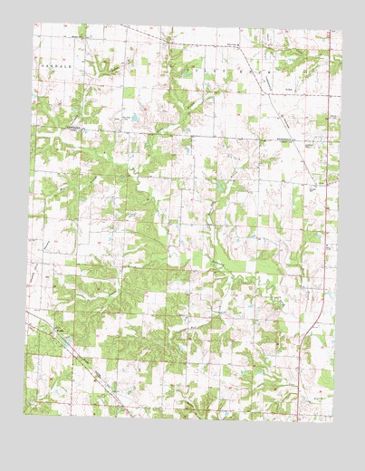
Winkle, IL USGS Topographic Map
Click on map above to begin viewing in our Map Viewer.

This topographic map contains these locations and features:
Feature Name Type Latitude Longitude GNIS ID View Map
Bethel ChurchChurchN38.1581°W89.4348°404291View Map
Board Tree BranchStreamN38.1742°W89.4245°404634View Map
Brush BranchStreamN38.1584°W89.3895°405010View Map
Carson BranchStreamN38.2342°W89.4729°405644View Map
Chapman CemeteryCemeteryN38.2131°W89.3892°405970View Map
Concord Baptist CemeteryCemeteryN38.2223°W89.3762°406441View Map
Concord CemeteryCemeteryN38.2000°W89.3862°406440View Map
Dodds BranchStreamN38.2028°W89.4559°407272View Map
Duncan School (historical)SchoolN38.2014°W89.4031°1705806View Map
Eichholz School (historical)SchoolN38.1603°W89.3801°1705807View Map
Kellerman School (historical)SchoolN38.1978°W89.4381°1705811View Map
Luney School (historical)SchoolN38.2398°W89.4579°1705844View Map
Maxwell CemeteryCemeteryN38.2450°W89.4804°413147View Map
Moores BranchStreamN38.2051°W89.4665°413790View Map
Pilot Knob CemeteryCemeteryN38.2200°W89.4629°415686View Map
Pinckneyville Number 8 Election PrecinctCivilN38.1355°W89.4255°1928600View Map
Pleasant Grove School (historical)SchoolN38.1914°W89.4704°1705818View Map
RicePopulated PlaceN38.2006°W89.3837°416579View Map
Russian BranchStreamN38.1773°W89.4426°417071View Map
School Number 212SchoolN38.1817°W89.3793°425460View Map
Schumaier RLA AirportAirportN38.1277°W89.4637°427680View Map
Slade School (historical)SchoolN38.2295°W89.3984°1705847View Map
Spring Hill CemeteryCemeteryN38.1692°W89.4929°2042818View Map
Threemile PrairieFlatN38.2256°W89.4020°419700View Map
WinklePopulated PlaceN38.1501°W89.4887°423323View Map
Wolf CreekStreamN38.1701°W89.4165°421365View Map
Wylie School (historical)SchoolN38.1506°W89.4351°1705828View Map

Note: Coordinates in the location and feature list above are referenced to NAD83 datum.


Copyright (C) 2008-2024 Ryan Niemi / Sunset Dynamics ... All Rights Reserved