TopoQuest Logo
Do you find TopoQuest useful?
Help keep TopoQuest running and adding new maps/features by donating!
Bitcoin:  19c7KJd3qBynnjoSw5npx9KScwjBe4ifkT
Litecoin:  LXs6TkuXGGXo1vDsWCkWVdjQX94eUKd6ui
Home View Maps Find Maps Find Places Resources & Links


Wilson, North Carolina Topographic Map

USGS Map Title: Wilson, NC
USGS Map MRC: 35077F8
DRG (GeoTIFF) Download: o35077f8.tif


Neighboring USGS Topographic Map Quads:


  Bailey, NC  
35078G1
 

  Winstead Crossroads, NC  
35077G8
 

  Elm City, NC  
35077G7
 

  Lucama, NC  
35078F1
 

  Wilson, NC  
35077F8
 

  Saratoga, NC  
35077F7
 

  Kenly East, NC  
35078E1
 

  Fremont, NC  
35077E8
 

  Stantonsburg, NC  
35077E7


Map MRC Location:

N36°
W78°
N36°
W77°
H8 H7 H6 H5 H4 H3 H2 H1
G8 G7 G6 G5 G4 G3 G2 G1
F8 F7 F6 F5 F4 F3 F2 F1
E8 E7 E6 E5 E4 E3 E2 E1
D8 D7 D6 D5 D4 D3 D2 D1
C8 C7 C6 C5 C4 C3 C2 C1
B8 B7 B6 B5 B4 B3 B2 B1
A8 A7 A6 A5 A4 A3 A2 A1
N35°
W78°
N35°
W77°

Wilson, NC USGS 1:24K Topographic Map Preview:
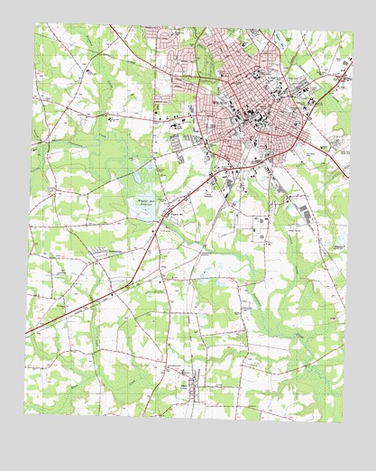
Wilson, NC USGS Topographic Map
Click on map above to begin viewing in our Map Viewer.

This topographic map contains these locations and features:
Feature Name Type Latitude Longitude GNIS ID View Map
A P Simpson HouseBuildingN35.7302°W77.9130°1006993View Map
Adams SchoolSchoolN35.7152°W77.9140°980046View Map
Barnes SchoolSchoolN35.7129°W77.8861°980573View Map
Barton CollegeSchoolN35.7355°W77.9137°980359View Map
Beddingfield High SchoolSchoolN35.6617°W77.8760°1007006View Map
Bel-Air ForestPopulated PlaceN35.7052°W77.8803°1005354View Map
Belle MeadePopulated PlaceN35.7421°W77.9611°1005365View Map
Black CreekPopulated PlaceN35.6352°W77.9330°981520View Map
Black Creek Police DepartmentBuildingN35.6365°W77.9336°2130899View Map
Black Creek Post OfficePost OfficeN35.6354°W77.9346°2774199View Map
Black Creek Volunteer Fire DepartmentBuildingN35.6365°W77.9337°2639562View Map
Bloomery SwampStreamN35.7160°W77.9697°1019220View Map
BoswellvillePopulated PlaceN35.6746°W77.9725°981754View Map
Boulevard PlazaLocaleN35.7210°W77.9364°1007886View Map
BreckenridgePopulated PlaceN35.7227°W77.9483°1005362View Map
British WoodsPopulated PlaceN35.7363°W77.9464°1005371View Map
Brookside ManorPopulated PlaceN35.7415°W77.9397°1005326View Map
Bunches ChurchChurchN35.6296°W77.9119°982252View Map
Cavalier ParkPopulated PlaceN35.7488°W77.9319°1005321View Map
Cavalier TerracePopulated PlaceN35.7460°W77.9311°1005366View Map
Cedar CreekStreamN35.6388°W77.9703°982812View Map
City of WilsonCivilN35.7312°W77.9284°2405758View Map
Contentnea JunctionPopulated PlaceN35.6782°W77.9325°1019760View Map
Contentnea Volunteer Fire DepartmentBuildingN35.7209°W77.9883°2639550View Map
Coon SchoolSchoolN35.7254°W77.9155°983501View Map
CrestviewPopulated PlaceN35.7129°W77.9439°1005361View Map
Criminal DivisionBuildingN35.7251°W77.9104°2131032View Map
Daniels ChapelChurchN35.6590°W77.9161°983942View Map
Darden High SchoolSchoolN35.7199°W77.8961°983953View Map
Davis-Whitehead-Harris HouseBuildingN35.7329°W77.9164°1006991View Map
DixiePopulated PlaceN35.6727°W77.9483°1019981View Map
Doctor William S Anderson HouseBuildingN35.7304°W77.9133°1006992View Map
E L Jordan HouseBuildingN35.7307°W77.9147°1006989View Map
East Nash Volunteer Fire Department SubstationBuildingN35.7329°W77.8795°2639590View Map
Eastern North Carolina School for DeafSchoolN35.7274°W77.8897°984555View Map
EdgewoodPopulated PlaceN35.7485°W77.9564°1005368View Map
Elvie Street SchoolSchoolN35.7127°W77.9075°984757View Map
Farmington HeightsPopulated PlaceN35.7374°W77.9397°1005324View Map
Farrior ParkPopulated PlaceN35.7010°W77.9050°1005350View Map
Five PointsPopulated PlaceN35.7143°W77.9244°1005318View Map
Fleming StadiumParkN35.7185°W77.9305°985207View Map
Forest HillsPopulated PlaceN35.7468°W77.9489°1005367View Map
Forest Hills ParkParkN35.7488°W77.9453°985277View Map
Forrest Road HomesPopulated PlaceN35.7257°W77.9308°1005320View Map
Friendship ChurchChurchN35.6596°W77.9850°985445View Map
Glenwood HillsPopulated PlaceN35.7160°W77.8803°1005315View Map
Gold Park Shopping CenterLocaleN35.7396°W77.9039°1007887View Map
Greenfield SchoolSchoolN35.7200°W77.9693°986099View Map
Happy Valley Country ClubLocaleN35.7118°W77.8766°1024563View Map
Happy Valley Country ClubLocaleN35.7135°W77.8755°986380View Map
Hearne SchoolSchoolN35.7318°W77.9083°1024572View Map
Hominy HeightsPopulated PlaceN35.7224°W77.9261°1005358View Map
Hominy SwampStreamN35.6527°W77.9000°987009View Map
Hotel CherryBuildingN35.7249°W77.9086°1006984View Map
Imperial EstatesPopulated PlaceN35.7071°W77.8761°1005313View Map
James Rountree HouseBuildingN35.7274°W77.9122°1006986View Map
Jennings AcresPopulated PlaceN35.7413°W77.9461°1005325View Map
Johnston Ambulance ServiceBuildingN35.6829°W77.9532°2720551View Map
JR Boykin-Haywood Edmundson HouseBuildingN35.7293°W77.9136°1006987View Map
Judge H G Connor HouseBuildingN35.7313°W77.9144°1006990View Map
Kings PlazaLocaleN35.7202°W77.9364°1007888View Map
Law Enforcement CenterBuildingN35.7382°W77.9035°2130918View Map
Lincoln HeightsPopulated PlaceN35.6940°W77.9047°1005349View Map
Living Hope ChurchChurchN35.6699°W77.9880°988821View Map
Longleaf Neuro - Medical Treatment CenterBuildingN35.7253°W77.8928°1023960View Map
Lower Black Creek ChurchChurchN35.6410°W77.9442°989090View Map
Lucas-Barnes HouseBuildingN35.7282°W77.9108°1006995View Map
Maplewood CemeteryCemeteryN35.7343°W77.9061°989324View Map
Mill BranchStreamN35.7077°W77.9950°989886View Map
MillbrookPopulated PlaceN35.7193°W77.9789°1005369View Map
MontclairPopulated PlaceN35.7424°W77.9064°1005359View Map
North Carolina State Highway Patrol Troop C District 5BuildingN35.7051°W77.9274°2131034View Map
OakforestPopulated PlaceN35.7396°W77.9436°1005364View Map
Parkwood MallLocaleN35.7238°W77.9372°1007008View Map
Parkwood Post OfficePost OfficeN35.7219°W77.9384°2773943View Map
Patterson ChapelChurchN35.7043°W77.9505°991936View Map
Pinewood EstatesPopulated PlaceN35.7271°W77.9550°1005316View Map
Quail HollowPopulated PlaceN35.7140°W77.9361°1005317View Map
Quail RidgePopulated PlaceN35.7079°W77.9414°1005360View Map
Regency PlazaLocaleN35.7182°W77.9503°1007889View Map
Rest Haven CemeteryCemeteryN35.7096°W77.8930°993245View Map
Saint Johns ChurchChurchN35.6360°W77.9247°993951View Map
Saint Pauls ChurchChurchN35.6696°W77.9433°994090View Map
Saint Timothys Episcopal ChurchChurchN35.7257°W77.9086°1006996View Map
Sandy CreekPopulated PlaceN35.7088°W77.8841°1005353View Map
Sandy CreekStreamN35.6724°W77.8947°1005370View Map
Seven HillsPopulated PlaceN35.7293°W77.9308°1005319View Map
Shepard BranchStreamN35.7102°W77.9942°994652View Map
Temple ChurchChurchN35.7024°W77.9489°995919View Map
Toisnot ParkParkN35.7477°W77.9025°996127View Map
Toisnot ReservoirReservoirN35.7469°W77.9038°996128View Map
Town of Black CreekCivilN35.6365°W77.9330°2405271View Map
Township of Black CreekCivilN35.6345°W77.9358°1027342View Map
Township of WilsonCivilN35.7290°W77.9072°1027351View Map
Trinity ChurchChurchN35.7465°W77.9658°1024576View Map
Valleydale EstatesPopulated PlaceN35.7129°W77.8797°1005314View Map
Vick SchoolSchoolN35.7235°W77.8978°996613View Map
Vinson-Bynum SchoolSchoolN35.7204°W77.9405°996637View Map
Washington PlacePopulated PlaceN35.7163°W77.8930°1005356View Map
WaterfordPopulated PlaceN35.7465°W77.9422°1005322View Map
Wedgewood Country ClubLocaleN35.6815°W77.8758°996924View Map
Wells SchoolSchoolN35.7449°W77.9180°996953View Map
WestwoodPopulated PlaceN35.7304°W77.9400°1005363View Map
Whitfield HomesPopulated PlaceN35.7129°W77.9153°1005357View Map
Wiggins MillPopulated PlaceN35.6896°W77.9467°1023236View Map
Wiggins Mill ReservoirReservoirN35.6971°W77.9557°997292View Map
Wiggins Millpond DamDamN35.6882°W77.9483°999248View Map
Wiggins-Hadley HouseBuildingN35.7249°W77.9075°1007000View Map
Wilco Industrial ParkLocaleN35.6868°W77.9192°1007001View Map
Wilco Manor Mobile Home ParkPopulated PlaceN35.7004°W77.9322°1005352View Map
WildwoodPopulated PlaceN35.7477°W77.9375°1005323View Map
Wilkins-Walston HouseBuildingN35.7321°W77.9153°1006994View Map
WilsonPopulated PlaceN35.7213°W77.9155°1023273View Map
Wilson Christian SchoolSchoolN35.7352°W77.9789°997442View Map
Wilson CountyCivilN35.7051°W77.9187°1008596View Map
Wilson County Department of Emergency Medical ServicesBuildingN35.7154°W77.9453°2720671View Map
Wilson County Rescue SquadBuildingN35.7203°W77.9505°2720578View Map
Wilson County Sheriff's OfficeBuildingN35.7263°W77.9098°2130921View Map
Wilson County SpeedwayLocaleN35.6990°W77.9303°1024577View Map
Wilson County Technical InstituteSchoolN35.7296°W77.8866°1024574View Map
Wilson Medical CenterHospitalN35.7187°W77.9443°1024575View Map
Wilson Police DepartmentBuildingN35.7254°W77.9090°2131009View Map
Wilson Post OfficePost OfficeN35.7215°W77.9166°1024573View Map
Wilson Primitive Baptist ChurchChurchN35.7290°W77.9128°1006988View Map
Wilson Rescue Fire Department Station 1BuildingN35.7259°W77.9192°2638946View Map
Wilson Rescue Fire Department Station 2BuildingN35.7231°W77.9525°2638561View Map
Wilson Rescue Fire Department Station 3BuildingN35.7107°W77.9001°2638422View Map
Wilson TheatreBuildingN35.7263°W77.9111°1006985View Map
Winoca Shopping CenterLocaleN35.7140°W77.9314°1007890View Map
Winstead SchoolSchoolN35.7129°W77.9314°997497View Map
WLLY-AM (Wilson)TowerN35.7235°W77.9208°1018484View Map
Woodard SchoolSchoolN35.6396°W77.9378°997575View Map
Woodard SchoolSchoolN35.7327°W77.9211°997576View Map
WoodfieldPopulated PlaceN35.7057°W77.8950°1005351View Map
WVOT-AM (Wilson)TowerN35.7357°W77.8836°1018490View Map
WXYY-FM (Wilson)TowerN35.7357°W77.8836°1018298View Map

Note: Coordinates in the location and feature list above are referenced to NAD83 datum.


Copyright (C) 2008-2024 Ryan Niemi / Sunset Dynamics ... All Rights Reserved