TopoQuest Logo
Do you find TopoQuest useful?
Help keep TopoQuest running and adding new maps/features by donating!
Bitcoin:  19c7KJd3qBynnjoSw5npx9KScwjBe4ifkT
Litecoin:  LXs6TkuXGGXo1vDsWCkWVdjQX94eUKd6ui
Home View Maps Find Maps Find Places Resources & Links


Willowdale, Oregon Topographic Map

USGS Map Title: Willowdale, OR
USGS Map MRC: 44120G8
DRG (GeoTIFF) Download: o44120g8.tif


Neighboring USGS Topographic Map Quads:


  Kaskela, OR  
44121H1
 

  Shaniko Junction, OR  
44120H8
 

  Shaniko Summit, OR  
44120H7
 

  Gateway, OR  
44121G1
 

  Willowdale, OR  
44120G8
 

  Degner Canyon, OR  
44120G7
 

  Madras East, OR  
44121F1
 

  Teller Butte, OR  
44120F8
 

  Ashwood, OR  
44120F7


Map MRC Location:

N45°
W121°
N45°
W120°
H8 H7 H6 H5 H4 H3 H2 H1
G8 G7 G6 G5 G4 G3 G2 G1
F8 F7 F6 F5 F4 F3 F2 F1
E8 E7 E6 E5 E4 E3 E2 E1
D8 D7 D6 D5 D4 D3 D2 D1
C8 C7 C6 C5 C4 C3 C2 C1
B8 B7 B6 B5 B4 B3 B2 B1
A8 A7 A6 A5 A4 A3 A2 A1
N44°
W121°
N44°
W120°

Willowdale, OR USGS 1:24K Topographic Map Preview:
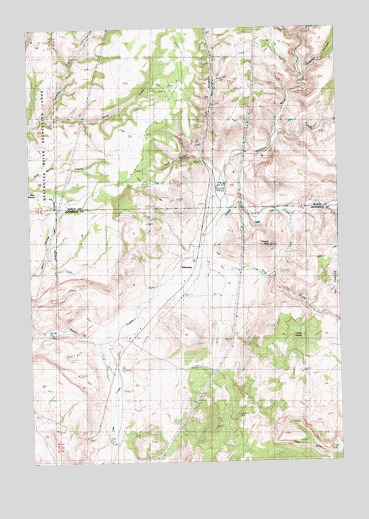
Willowdale, OR USGS Topographic Map
Click on map above to begin viewing in our Map Viewer.

This topographic map contains these locations and features:
Feature Name Type Latitude Longitude GNIS ID View Map
Antelope CreekStreamN44.8221°W120.9212°1116973View Map
Bostick SpringSpringN44.8070°W120.9067°1131980View Map
Bull CanyonValleyN44.8376°W120.9334°1118271View Map
Carter SpringSpringN44.7858°W120.8915°1118636View Map
Cow CanyonValleyN44.8385°W120.9320°1119417View Map
Cow Canyon Safety Rest AreaLocaleN44.8623°W120.9262°1162325View Map
Cow Canyon SpringsSpringN44.8437°W120.9334°1131979View Map
Cram DitchCanalN44.7996°W120.9314°1119504View Map
Cross Keys (historical)LocaleN44.8151°W120.9325°1131984View Map
Cross Keys Post Office (historical)Post OfficeN44.8151°W120.9325°1165113View Map
Deadman CanyonValleyN44.8612°W120.8903°1119755View Map
Delco CreekStreamN44.8485°W120.9942°1119848View Map
Friends PeakSummitN44.8125°W120.9039°1136303View Map
Gate SpringSpringN44.8276°W120.9984°1121077View Map
Hay CreekStreamN44.7848°W120.9728°1143393View Map
Ochs Private AirportAirportN44.7887°W120.9582°2646039View Map
Pony ButteRidgeN44.7546°W120.8887°1125551View Map
Pony CreekStreamN44.8062°W120.9237°1125552View Map
Tenmile CreekStreamN44.8485°W120.9942°1127932View Map
The FlatironsSummitN44.8068°W120.8762°1127968View Map
Trout Creek Post Office (historical)Post OfficeN44.8151°W120.9331°1164738View Map
Trout Creek ValleyValleyN44.7837°W120.9748°1131981View Map
Ward CreekStreamN44.8448°W120.9017°1128635View Map
WillowdalePopulated PlaceN44.8054°W120.9431°1136910View Map
Willowdale Post Office (historical)Post OfficeN44.8054°W120.9431°1166189View Map

Note: Coordinates in the location and feature list above are referenced to NAD83 datum.


Copyright (C) 2008-2024 Ryan Niemi / Sunset Dynamics ... All Rights Reserved