TopoQuest Logo
Do you find TopoQuest useful?
Help keep TopoQuest running and adding new maps/features by donating!
Bitcoin:  19c7KJd3qBynnjoSw5npx9KScwjBe4ifkT
Litecoin:  LXs6TkuXGGXo1vDsWCkWVdjQX94eUKd6ui
Home View Maps Find Maps Find Places Resources & Links


Boston, Arkansas Topographic Map

USGS Map Title: Boston, AR
USGS Map MRC: 35093G5
DRG (GeoTIFF) Download: o35093g5.tif


Neighboring USGS Topographic Map Quads:


  Witter, AR  
35093H6
 

  Weathers, AR  
35093H5
 

  Boxley, AR  
35093H4
 

  Pettigrew, AR  
35093G6
 

  Boston, AR  
35093G5
 

  Fallsville, AR  
35093G4
 

  Yale, AR  
35093F6
 

  Oark, AR  
35093F5
 

  Ozone, AR  
35093F4


Map MRC Location:

N36°
W94°
N36°
W93°
H8 H7 H6 H5 H4 H3 H2 H1
G8 G7 G6 G5 G4 G3 G2 G1
F8 F7 F6 F5 F4 F3 F2 F1
E8 E7 E6 E5 E4 E3 E2 E1
D8 D7 D6 D5 D4 D3 D2 D1
C8 C7 C6 C5 C4 C3 C2 C1
B8 B7 B6 B5 B4 B3 B2 B1
A8 A7 A6 A5 A4 A3 A2 A1
N35°
W94°
N35°
W93°

Boston, AR USGS 1:24K Topographic Map Preview:
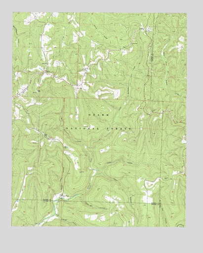
Boston, AR USGS Topographic Map
Click on map above to begin viewing in our Map Viewer.

This topographic map contains these locations and features:
Feature Name Type Latitude Longitude GNIS ID View Map
ArbaughPopulated PlaceN35.7817°W93.5016°70458View Map
Beech Hurricane CreekStreamN35.7967°W93.5705°70614View Map
BostonPopulated PlaceN35.8406°W93.6013°70768View Map
Boston - Pettigrew Volunteer Fire DepartmentBuildingN35.8270°W93.6212°2116181View Map
Boston ChapelChurchN35.8292°W93.6069°70769View Map
Boston ChurchChurchN35.8451°W93.6010°70770View Map
Boston Lookout TowerTowerN35.8015°W93.5996°81979View Map
Buckhorn CemeteryCemeteryN35.7779°W93.5135°70904View Map
Clifty HollowValleyN35.7829°W93.5632°71171View Map
Eldrige HollowValleyN35.7559°W93.5919°71547View Map
Evans CemeteryCemeteryN35.7517°W93.6082°71570View Map
Locust GapGapN35.8579°W93.5396°72435View Map
Lynn HollowValleyN35.7809°W93.5627°72522View Map
Muddy GapGapN35.8020°W93.6016°72809View Map
New Home ChurchChurchN35.8431°W93.5721°72855View Map
Pine Grove CemeteryCemeteryN35.7820°W93.5766°73086View Map
Pour Off HollowValleyN35.7676°W93.5769°73182View Map
Ratford CemeteryCemeteryN35.8170°W93.5257°73241View Map
Red StarPopulated PlaceN35.8667°W93.5307°73259View Map
Smith RidgeRidgeN35.8620°W93.5641°73625View Map
Spoke PlantLocaleN35.7684°W93.5891°73668View Map
Spoke Plant HollowValleyN35.7690°W93.5896°73669View Map
Township of BostonCivilN35.8531°W93.5796°68841View Map
Township of Mulberry (historical)CivilN35.7917°W93.5669°66406View Map

Note: Coordinates in the location and feature list above are referenced to NAD83 datum.


Copyright (C) 2008-2024 Ryan Niemi / Sunset Dynamics ... All Rights Reserved