TopoQuest Logo
Do you find TopoQuest useful?
Help keep TopoQuest running and adding new maps/features by donating!
Bitcoin:  19c7KJd3qBynnjoSw5npx9KScwjBe4ifkT
Litecoin:  LXs6TkuXGGXo1vDsWCkWVdjQX94eUKd6ui
Home View Maps Find Maps Find Places Resources & Links


Wilkinson, Texas Topographic Map

USGS Map Title: Wilkinson, TX
USGS Map MRC: 33094C8
DRG (GeoTIFF) Download: o33094c8.tif


Neighboring USGS Topographic Map Quads:


  Cuthand, TX  
33095D1
 

  Boxelder, TX  
33094D8
 

  Lydia, TX  
33094D7
 

  Talco, TX  
33095C1
 

  Wilkinson, TX  
33094C8
 

  Coopers Chapel, TX  
33094C7
 

  Winfield, TX  
33095B1
 

  Mount Pleasant, TX  
33094B8
 

  Cookville, TX  
33094B7


Map MRC Location:

N34°
W95°
N34°
W94°
H8 H7 H6 H5 H4 H3 H2 H1
G8 G7 G6 G5 G4 G3 G2 G1
F8 F7 F6 F5 F4 F3 F2 F1
E8 E7 E6 E5 E4 E3 E2 E1
D8 D7 D6 D5 D4 D3 D2 D1
C8 C7 C6 C5 C4 C3 C2 C1
B8 B7 B6 B5 B4 B3 B2 B1
A8 A7 A6 A5 A4 A3 A2 A1
N33°
W95°
N33°
W94°

Wilkinson, TX USGS 1:24K Topographic Map Preview:
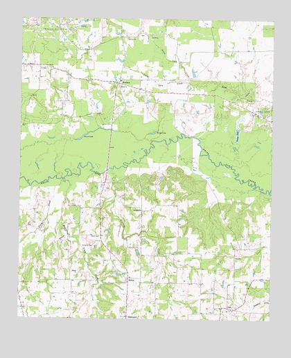
Wilkinson, TX USGS Topographic Map
Click on map above to begin viewing in our Map Viewer.

This topographic map contains these locations and features:
Feature Name Type Latitude Longitude GNIS ID View Map
ArgoPopulated PlaceN33.2551°W94.8949°1380819View Map
Blackmon Farms Reservoir Number 5ReservoirN33.3743°W94.9388°1865517View Map
Brooks LakeLakeN33.3279°W94.9342°1372736View Map
Brown LakeLakeN33.3260°W94.9690°1372741View Map
Cuckoo PondLakeN33.3279°W94.8926°1373307View Map
Deshiell CemeteryCemeteryN33.3665°W94.9483°1373379View Map
East Piney CreekStreamN33.3084°W94.9780°1373556View Map
Five Star Volunteer Fire DepartmentBuildingN33.2600°W94.9995°2655262View Map
Harris ChurchChurchN33.3468°W94.9510°1374007View Map
MidwayPopulated PlaceN33.2673°W94.9455°1374922View Map
Mount Sylvia ChurchChurchN33.2957°W94.9394°1375035View Map
North Lacy CreekStreamN33.3484°W94.9102°1375177View Map
PineyLocaleN33.2704°W94.9747°1375469View Map
Piney CreekStreamN33.3084°W94.9780°1375472View Map
South Lacy CreekStreamN33.3487°W94.9102°1376217View Map
Springhill CemeteryCemeteryN33.2807°W94.9633°1376275View Map
Stinking CreekStreamN33.3126°W94.9541°1376312View Map
Sugar Hill Volunteer Fire DepartmentBuildingN33.3504°W94.9195°2655447View Map
Talco DivisionCivilN33.3349°W94.9897°1939247View Map
Trix-Liz Oil FieldOilfieldN33.3729°W94.9866°1376508View Map
WilkinsonPopulated PlaceN33.3484°W94.9516°1376800View Map

Note: Coordinates in the location and feature list above are referenced to NAD83 datum.


Copyright (C) 2008-2024 Ryan Niemi / Sunset Dynamics ... All Rights Reserved