TopoQuest Logo
Do you find TopoQuest useful?
Help keep TopoQuest running and adding new maps/features by donating!
Bitcoin:  19c7KJd3qBynnjoSw5npx9KScwjBe4ifkT
Litecoin:  LXs6TkuXGGXo1vDsWCkWVdjQX94eUKd6ui
Home View Maps Find Maps Find Places Resources & Links


Whiteflat, Texas Topographic Map

USGS Map Title: Whiteflat, TX
USGS Map MRC: 34100A8
DRG (GeoTIFF) Download: o34100a8.tif


Neighboring USGS Topographic Map Quads:


  Quitaque Peaks, TX  
34101B1
 

  Flomot, TX  
34100B8
 

  Hornica Creek, TX  
34100B7
 

  Dick Moore Canyon, TX  
34101A1
 

  Whiteflat, TX  
34100A8
 

  Matador, TX  
34100A7
 

  Dougherty, TX  
33101H1
 

  Mac Bain, TX  
33100H8
 

  Roaring Springs, TX  
33100H7


Map MRC Location:

N35°
W101°
N35°
W100°
H8 H7 H6 H5 H4 H3 H2 H1
G8 G7 G6 G5 G4 G3 G2 G1
F8 F7 F6 F5 F4 F3 F2 F1
E8 E7 E6 E5 E4 E3 E2 E1
D8 D7 D6 D5 D4 D3 D2 D1
C8 C7 C6 C5 C4 C3 C2 C1
B8 B7 B6 B5 B4 B3 B2 B1
A8 A7 A6 A5 A4 A3 A2 A1
N34°
W101°
N34°
W100°

Whiteflat, TX USGS 1:24K Topographic Map Preview:
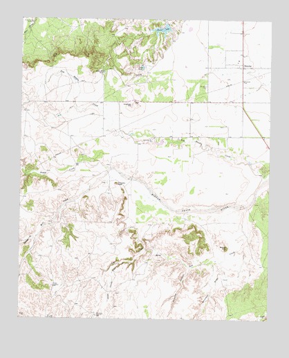
Whiteflat, TX USGS Topographic Map
Click on map above to begin viewing in our Map Viewer.

This topographic map contains these locations and features:
Feature Name Type Latitude Longitude GNIS ID View Map
Antelope HillSummitN34.0892°W100.9446°1351155View Map
Boggy CreekStreamN34.0623°W100.9532°1352589View Map
Boone MountainSummitN34.0301°W100.8968°1352681View Map
Bull Cod WindmillLocaleN34.0001°W100.9857°1353233View Map
Cedar TankReservoirN34.1051°W100.9397°1354157View Map
Cedar WindmillLocaleN34.1012°W100.9421°1354167View Map
Chimney CreekStreamN34.0342°W100.9924°1354408View Map
Connally PeakSummitN34.0562°W100.9521°1354876View Map
Dripping SpringsStreamN34.0220°W100.9135°1373447View Map
Hackberry WindmillLocaleN34.0012°W100.9618°1358608View Map
Hawk Hill TankReservoirN34.1030°W100.9593°1358904View Map
Horner LakeReservoirN34.1210°W100.9296°1359574View Map
Horner Lake DamDamN34.1234°W100.9271°1861783View Map
Jack Spray LakeReservoirN34.0735°W100.9302°1861782View Map
Jack Spray Lake DamDamN34.0734°W100.9288°1861781View Map
Jesse James DrawValleyN34.0230°W100.9498°1360243View Map
Lost CanyonValleyN34.0383°W100.9388°1361812View Map
Miller Springs WindmillLocaleN34.1234°W100.9949°1362908View Map
Mott CreekStreamN34.0620°W100.9529°1363214View Map
Old Whiteflat CemeteryCemeteryN34.1198°W100.9207°2773396View Map
Rincon WindmillLocaleN34.1095°W100.9849°1366488View Map
Salt CreekStreamN34.0473°W100.8860°1367392View Map
Shinnery DrawValleyN34.0239°W100.8990°1368190View Map
Stokes WindmillLocaleN34.0134°W100.9832°1369232View Map
Tom Handle CreekStreamN34.0587°W100.8779°1369997View Map
WhiteflatPopulated PlaceN34.1054°W100.8896°1371438View Map
Whiteflat CemeteryCemeteryN34.0971°W100.9076°1371439View Map

Note: Coordinates in the location and feature list above are referenced to NAD83 datum.


Copyright (C) 2008-2024 Ryan Niemi / Sunset Dynamics ... All Rights Reserved