TopoQuest Logo
Do you find TopoQuest useful?
Help keep TopoQuest running and adding new maps/features by donating!
Bitcoin:  19c7KJd3qBynnjoSw5npx9KScwjBe4ifkT
Litecoin:  LXs6TkuXGGXo1vDsWCkWVdjQX94eUKd6ui
Home View Maps Find Maps Find Places Resources & Links


White Sand, Mississippi Topographic Map

USGS Map Title: White Sand, MS
USGS Map MRC: 30089G6
DRG (GeoTIFF) Download: o30089g6.tif


Neighboring USGS Topographic Map Quads:


  Angie, LA  
30089H7
 

  Fords Creek, MS  
30089H6
 

  Orvisburg, MS  
30089H5
 

  Bogalusa East, LA  
30089G7
 

  White Sand, MS  
30089G6
 

  Poplarville, MS  
30089G5
 

  Henleyfield, MS  
30089F7
 

  McNeill, MS  
30089F6
 

  Millard, MS  
30089F5


Map MRC Location:

N31°
W90°
N31°
W89°
H8 H7 H6 H5 H4 H3 H2 H1
G8 G7 G6 G5 G4 G3 G2 G1
F8 F7 F6 F5 F4 F3 F2 F1
E8 E7 E6 E5 E4 E3 E2 E1
D8 D7 D6 D5 D4 D3 D2 D1
C8 C7 C6 C5 C4 C3 C2 C1
B8 B7 B6 B5 B4 B3 B2 B1
A8 A7 A6 A5 A4 A3 A2 A1
N30°
W90°
N30°
W89°

White Sand, MS USGS 1:24K Topographic Map Preview:
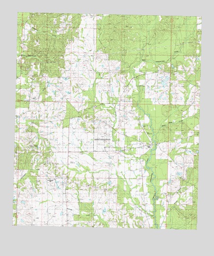
White Sand, MS USGS Topographic Map
Click on map above to begin viewing in our Map Viewer.

This topographic map contains these locations and features:
Feature Name Type Latitude Longitude GNIS ID View Map
A and G Cafeteria Lake DamDamN30.8319°W89.6467°680513View Map
Amacker Church (historical)ChurchN30.8460°W89.7473°688107View Map
Buck Branch Lookout TowerTowerN30.7974°W89.7359°711210View Map
Burkley Burgess Lake DamDamN30.8452°W89.6801°680517View Map
Earl Smith Lake DamDamN30.8302°W89.6834°680512View Map
Glorice P Wills Airport (historical)AirportN30.8049°W89.6592°680307View Map
Holdens CemeteryCemeteryN30.8118°W89.6362°671280View Map
Long BranchStreamN30.7896°W89.6595°672804View Map
Mississippi Agricultural and Forestry Experiment StationLocaleN30.8002°W89.6890°690885View Map
New Bethel ChurchChurchN30.7677°W89.6462°674570View Map
Oreck AirportAirportN30.7765°W89.7304°2676422View Map
Pearl River Golf ClubLocaleN30.7880°W89.7091°2596225View Map
Serenity Missionary Baptist ChurchChurchN30.8051°W89.6734°2596747View Map
Supervisor District 2CivilN30.8346°W89.6860°704462View Map
T Wayne Lake DamDamN30.7669°W89.6967°680493View Map
Taylor Land Company Lake DamDamN30.7835°W89.7451°680502View Map
White SandPopulated PlaceN30.7994°W89.6581°679611View Map
White Sand Baptist ChurchChurchN30.8002°W89.6567°688183View Map
White Sand CreekStreamN30.8019°W89.6548°679612View Map
White Sand SchoolSchoolN30.7846°W89.6642°679613View Map

Note: Coordinates in the location and feature list above are referenced to NAD83 datum.


Copyright (C) 2008-2024 Ryan Niemi / Sunset Dynamics ... All Rights Reserved