TopoQuest Logo
Do you find TopoQuest useful?
Help keep TopoQuest running and adding new maps/features by donating!
Bitcoin:  19c7KJd3qBynnjoSw5npx9KScwjBe4ifkT
Litecoin:  LXs6TkuXGGXo1vDsWCkWVdjQX94eUKd6ui
Home View Maps Find Maps Find Places Resources & Links


White Cloud, Michigan Topographic Map

USGS Map Title: White Cloud, MI
USGS Map MRC: 43085E7
DRG (GeoTIFF) Download: o43085e7.tif


Neighboring USGS Topographic Map Quads:


  Walkup Lake, MI  
43085F8
 

  Woodland Park, MI  
43085F7
 

  Woodville, MI  
43085F6
 

  Dayton Center, MI  
43085E8
 

  White Cloud, MI  
43085E7
 

  Big Prairie, MI  
43085E6
 

  Fremont, MI  
43085D8
 

  Newaygo, MI  
43085D7
 

  Croton, MI  
43085D6


Map MRC Location:

N44°
W86°
N44°
W85°
H8 H7 H6 H5 H4 H3 H2 H1
G8 G7 G6 G5 G4 G3 G2 G1
F8 F7 F6 F5 F4 F3 F2 F1
E8 E7 E6 E5 E4 E3 E2 E1
D8 D7 D6 D5 D4 D3 D2 D1
C8 C7 C6 C5 C4 C3 C2 C1
B8 B7 B6 B5 B4 B3 B2 B1
A8 A7 A6 A5 A4 A3 A2 A1
N43°
W86°
N43°
W85°

White Cloud, MI USGS 1:24K Topographic Map Preview:
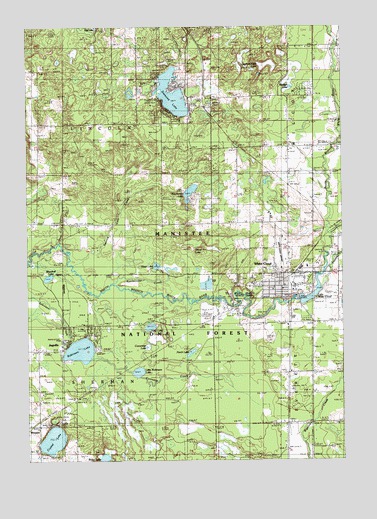
White Cloud, MI USGS Topographic Map
Click on map above to begin viewing in our Map Viewer.

This topographic map contains these locations and features:
Feature Name Type Latitude Longitude GNIS ID View Map
Alley LakeLakeN43.5386°W85.8264°1619011View Map
Alley Lake ParkParkN43.5397°W85.8250°2542006View Map
Alleyton (historical)Populated PlaceN43.5411°W85.7881°2541861View Map
Alleyton Post Office (historical)Post OfficeN43.5411°W85.7881°2541862View Map
Blacksmith LakeLakeN43.5772°W85.8102°1619245View Map
Bolen LakeLakeN43.5007°W85.8449°1619276View Map
Christ Lutheran ChurchChurchN43.5422°W85.7722°2541997View Map
City of White CloudCivilN43.5541°W85.7720°1627259View Map
Coonskin CreekStreamN43.5292°W85.8512°1619574View Map
Crystal LakeLakeN43.5059°W85.8652°1619632View Map
Cucumber LakeLakeN43.5327°W85.8278°1619637View Map
Diamond LakeLakeN43.6053°W85.8170°1619713View Map
Diamond Lake County ParkParkN43.6133°W85.8144°2542000View Map
Everett Township HallBuildingN43.5397°W85.7628°2541987View Map
Faith Bible ChurchChurchN43.5511°W85.7697°2541998View Map
Family Health CenterHospitalN43.5503°W85.7719°2541975View Map
First Cole CreekStreamN43.5628°W85.8626°1622823View Map
Fivemile CreekStreamN43.5656°W85.7548°1619922View Map
Flinton CreekStreamN43.5561°W85.7573°1619931View Map
Flowing Well ParkParkN43.5453°W85.7928°2541972View Map
Hoyt LakeLakeN43.5560°W85.8237°1620265View Map
Jack D Jones Elementary SchoolSchoolN43.5528°W85.7833°2541986View Map
JugvillePopulated PlaceN43.5342°W85.8606°1620391View Map
Lake White CloudLakeN43.5476°W85.7612°1622138View Map
Life Emergency Medical Services White Cloud StationBuildingN43.5610°W85.7712°2662069View Map
Little Robinson LakeLakeN43.5255°W85.8311°1620580View Map
Mudget LakeLakeN43.6075°W85.7702°1620946View Map
Newaygo CountyCivilN43.5542°W85.8009°1623004View Map
Newaygo County Sheriff's OfficeBuildingN43.5481°W85.7751°2541982View Map
Newaygo County Snowmobile TrailTrailN43.5536°W85.8601°1622809View Map
Pearl LakeLakeN43.5310°W85.8103°1621177View Map
Prospect Hill CemeteryCemeteryN43.5528°W85.7917°1621320View Map
RamonaPopulated PlaceN43.6042°W85.8020°1621338View Map
Ramona Post Office (historical)SchoolN43.6042°W85.8019°2541819View Map
Ramona StationLocaleN43.6042°W85.8025°2541805View Map
Rattlesnake CreekStreamN43.5506°W85.8428°1621349View Map
Robinson LakeLakeN43.5318°W85.8543°1621409View Map
Saint Joseph Catholic ChurchChurchN43.5492°W85.7775°2541976View Map
Second Cole CreekStreamN43.5564°W85.8570°1622824View Map
Section Eight LakeSwampN43.6144°W85.7783°2106663View Map
Section Five LakeSwampN43.6142°W85.7795°1621558View Map
Seventh Day Baptist ChurchChurchN43.5503°W85.7728°2541977View Map
Sherman Township CemeteryCemeteryN43.5194°W85.8697°2541869View Map
Sherman Township HallBuildingN43.5100°W85.8708°2542119View Map
Township of LincolnCivilN43.5973°W85.8609°1626624View Map
Township of ShermanCivilN43.5103°W85.8607°1627076View Map
Trout LakeLakeN43.5609°W85.8095°1621959View Map
Upper Elementary SchoolSchoolN43.5528°W85.7858°2541992View Map
White CloudPopulated PlaceN43.5503°W85.7720°1622135View Map
White Cloud AirportAirportN43.5570°W85.7724°1624198View Map
White Cloud ChurchChurchN43.5253°W85.7731°1622136View Map
White Cloud Church of GodChurchN43.5244°W85.7722°2541995View Map
White Cloud Church of God in ChristChurchN43.5806°W85.7706°2541996View Map
White Cloud City CampgroundLocaleN43.5494°W85.7836°2541979View Map
White Cloud City HallBuildingN43.5542°W85.7711°2541980View Map
White Cloud Community LibraryBuildingN43.5497°W85.7753°2541981View Map
White Cloud District Rangers OfficeBuildingN43.5542°W85.7712°1622876View Map
White Cloud Fire DepartmentBuildingN43.5498°W85.7766°2541974View Map
White Cloud High SchoolSchoolN43.5508°W85.7853°2541993View Map
White Cloud Medical CenterHospitalN43.5503°W85.7758°2541983View Map
White Cloud Middle SchoolSchoolN43.5511°W85.7861°2541994View Map
White Cloud Police DepartmentBuildingN43.5541°W85.7713°2541984View Map
White Cloud Post OfficePost OfficeN43.5506°W85.7742°2541985View Map
White Cloud State ParkParkN43.5481°W85.7895°1622878View Map
White Cloud StationLocaleN43.5508°W85.7706°2541991View Map
White Cloud United Methodist ChurchChurchN43.5492°W85.7736°2541978View Map
White River Roughing Area CampgroundLocaleN43.6095°W85.7576°1622837View Map
Woodrail LakeLakeN43.5527°W85.8667°1622211View Map
WoosterPopulated PlaceN43.5106°W85.8739°1622220View Map
Wooster Post Office (historical)Post OfficeN43.5106°W85.8739°2541809View Map
Wooster Station (historical)LocaleN43.5097°W85.8739°2541793View Map

Note: Coordinates in the location and feature list above are referenced to NAD83 datum.


Copyright (C) 2008-2024 Ryan Niemi / Sunset Dynamics ... All Rights Reserved