TopoQuest Logo
Do you find TopoQuest useful?
Help keep TopoQuest running and adding new maps/features by donating!
Bitcoin:  19c7KJd3qBynnjoSw5npx9KScwjBe4ifkT
Litecoin:  LXs6TkuXGGXo1vDsWCkWVdjQX94eUKd6ui
Home View Maps Find Maps Find Places Resources & Links


Whelen Springs, Arkansas Topographic Map

USGS Map Title: Whelen Springs, AR
USGS Map MRC: 33093G2
DRG (GeoTIFF) Download: o33093g2.tif


Neighboring USGS Topographic Map Quads:


  Okolona South, AR  
33093H3
 

  Gurdon, AR  
33093H2
 

  Curtis, AR  
33093H1
 

  Prescott East, AR  
33093G3
 

  Whelen Springs, AR  
33093G2
 

  Reader, AR  
33093G1
 

  Laneburg, AR  
33093F3
 

  Bluff City, AR  
33093F2
 

  Chidester, AR  
33093F1


Map MRC Location:

N34°
W94°
N34°
W93°
H8 H7 H6 H5 H4 H3 H2 H1
G8 G7 G6 G5 G4 G3 G2 G1
F8 F7 F6 F5 F4 F3 F2 F1
E8 E7 E6 E5 E4 E3 E2 E1
D8 D7 D6 D5 D4 D3 D2 D1
C8 C7 C6 C5 C4 C3 C2 C1
B8 B7 B6 B5 B4 B3 B2 B1
A8 A7 A6 A5 A4 A3 A2 A1
N33°
W94°
N33°
W93°

Whelen Springs, AR USGS 1:24K Topographic Map Preview:
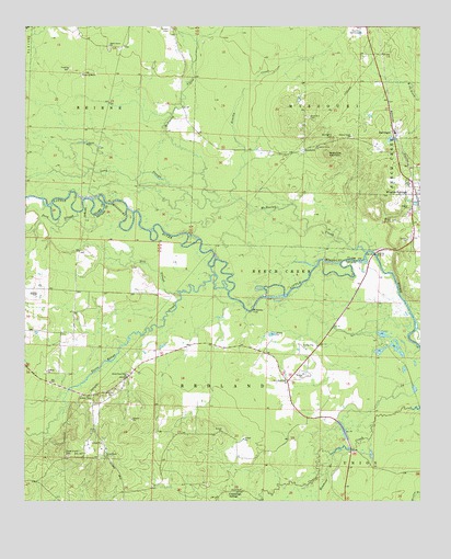
Whelen Springs, AR USGS Topographic Map
Click on map above to begin viewing in our Map Viewer.

This topographic map contains these locations and features:
Feature Name Type Latitude Longitude GNIS ID View Map
BarringerPopulated PlaceN33.8482°W93.1341°57332View Map
Brown CemeteryCemeteryN33.8743°W93.2052°46990View Map
Brushy CreekStreamN33.8293°W93.1838°47072View Map
Cummings SpringsPopulated PlaceN33.7529°W93.1838°56979View Map
Deep SloughStreamN33.8262°W93.2341°48451View Map
Dewoodys Store (historical)LocaleN33.7632°W93.1471°60350View Map
Gurdon Golf CourseLocaleN33.8745°W93.1443°82439View Map
Hill SloughStreamN33.8051°W93.2021°50123View Map
Long SloughStreamN33.8290°W93.1916°51445View Map
McNeeley CreekStreamN33.8159°W93.1427°51872View Map
McNeeley FordLocaleN33.8004°W93.1785°51873View Map
Meadows BranchStreamN33.7623°W93.1541°51890View Map
New Hope ChurchChurchN33.7821°W93.1677°52675View Map
New Hope School (historical)SchoolN33.7790°W93.1785°60375View Map
Rose Hill CemeteryCemeteryN33.8512°W93.1610°54199View Map
Saint Mark ChurchChurchN33.7843°W93.2432°54395View Map
Shady Grove Baptist ChurchChurchN33.8698°W93.2241°78323View Map
Springhill CemeteryCemeteryN33.8459°W93.1535°55134View Map
Sweet Home CemeteryCemeteryN33.7620°W93.2365°55382View Map
Sweet Home ChurchChurchN33.7615°W93.2246°55387View Map
Sweet Home Number 2 ChurchChurchN33.7834°W93.2177°82563View Map
SycamorePopulated PlaceN33.8426°W93.1624°58724View Map
Sycamore Grove ChurchChurchN33.8432°W93.1588°78517View Map
Terre Rouge CreekStreamN33.8054°W93.1860°78540View Map
Town of Whelen SpringsCivilN33.8330°W93.1260°2406873View Map
Township of Beirne (historical)CivilN33.8709°W93.2252°65014View Map
Township of RedlandCivilN33.7832°W93.2351°68907View Map
Whelen SpringsPopulated PlaceN33.8309°W93.1263°78743View Map
Whelen Springs Fire StationBuildingN33.8308°W93.1258°2117311View Map
Whelen Springs Post OfficePost OfficeN33.8313°W93.1263°2781907View Map
Whetstone MountainSummitN33.8412°W93.1552°58862View Map

Note: Coordinates in the location and feature list above are referenced to NAD83 datum.


Copyright (C) 2008-2024 Ryan Niemi / Sunset Dynamics ... All Rights Reserved