TopoQuest Logo
Do you find TopoQuest useful?
Help keep TopoQuest running and adding new maps/features by donating!
Bitcoin:  19c7KJd3qBynnjoSw5npx9KScwjBe4ifkT
Litecoin:  LXs6TkuXGGXo1vDsWCkWVdjQX94eUKd6ui
Home View Maps Find Maps Find Places Resources & Links


Westerville, Nebraska Topographic Map

USGS Map Title: Westerville, NE
USGS Map MRC: 41099D4
DRG (GeoTIFF) Download: o41099d4.tif


Neighboring USGS Topographic Map Quads:


  Round Valley, NE  
41099E5
 

  Sargent SW, NE  
41099E4
 

  Sargent SE, NE  
41099E3
 

  Broken Bow NE, NE  
41099D5
 

  Westerville, NE  
41099D4
 

  Ansley NE, NE  
41099D3
 

  Broken Bow SE, NE  
41099C5
 

  Ansley, NE  
41099C4
 

  Ansley SE, NE  
41099C3


Map MRC Location:

N42°
W100°
N42°
W99°
H8 H7 H6 H5 H4 H3 H2 H1
G8 G7 G6 G5 G4 G3 G2 G1
F8 F7 F6 F5 F4 F3 F2 F1
E8 E7 E6 E5 E4 E3 E2 E1
D8 D7 D6 D5 D4 D3 D2 D1
C8 C7 C6 C5 C4 C3 C2 C1
B8 B7 B6 B5 B4 B3 B2 B1
A8 A7 A6 A5 A4 A3 A2 A1
N41°
W100°
N41°
W99°

Westerville, NE USGS 1:24K Topographic Map Preview:
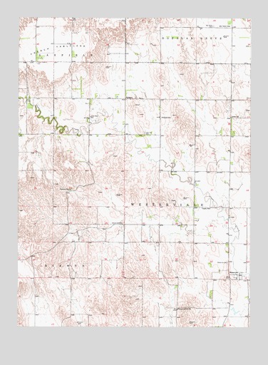
Westerville, NE USGS Topographic Map
Click on map above to begin viewing in our Map Viewer.

This topographic map contains these locations and features:
Feature Name Type Latitude Longitude GNIS ID View Map
Allen School (historical)SchoolN41.4603°W99.3854°826962View Map
Cherryvale School (historical)SchoolN41.4167°W99.4443°828117View Map
Copsey School (historical)SchoolN41.4231°W99.3970°828336View Map
Dry Valley CemeteryCemeteryN41.4967°W99.3959°828855View Map
Dry Valley School (historical)SchoolN41.4967°W99.3870°828857View Map
Franch Tableland CemeteryCemeteryN41.4819°W99.4909°829382View Map
French TablelandSummitN41.4878°W99.4823°829415View Map
Hanna Corners School (historical)SchoolN41.3822°W99.4140°829770View Map
Lone Tree CemeteryCemeteryN41.4536°W99.4326°830846View Map
Lone Tree School (historical)SchoolN41.4600°W99.4615°830850View Map
Pederson RanchLocaleN41.4306°W99.4718°832028View Map
Township of WestervilleCivilN41.4141°W99.3925°838325View Map
United Methodist ChurchChurchN41.3961°W99.3809°1847934View Map
WeissertPopulated PlaceN41.4672°W99.4432°834535View Map
Weissert Church of GodChurchN41.4672°W99.4432°1847935View Map
Weissert Post Office (historical)Post OfficeN41.4672°W99.4432°1847936View Map
Weissert SchoolSchoolN41.4600°W99.4234°834536View Map
WestervillePopulated PlaceN41.3961°W99.3809°834645View Map
Westerville CemeteryCemeteryN41.4014°W99.3876°834646View Map
Westerville Census Designated PlaceCensusN41.3962°W99.3818°2583905View Map
Westerville Historical MarkerParkN41.3958°W99.3865°1848035View Map
Westerville Post OfficePost OfficeN41.3961°W99.3809°1847933View Map
Westerville School (historical)SchoolN41.3947°W99.3809°1847844View Map

Note: Coordinates in the location and feature list above are referenced to NAD83 datum.


Copyright (C) 2008-2024 Ryan Niemi / Sunset Dynamics ... All Rights Reserved