TopoQuest Logo
Do you find TopoQuest useful?
Help keep TopoQuest running and adding new maps/features by donating!
Bitcoin:  19c7KJd3qBynnjoSw5npx9KScwjBe4ifkT
Litecoin:  LXs6TkuXGGXo1vDsWCkWVdjQX94eUKd6ui
Home View Maps Find Maps Find Places Resources & Links


Werney Hill, New Mexico Topographic Map

USGS Map Title: Werney Hill, NM
USGS Map MRC: 32108D3
DRG (GeoTIFF) Download: o32108d3.tif


Neighboring USGS Topographic Map Quads:


  Burro Peak, NM  
32108E4
 

  White Signal, NM  
32108E3
 

  Whitewater, NM  
32108E2
 

  C Bar Ranch, NM  
32108D4
 

  Werney Hill, NM  
32108D3
 

  Cow Springs Mountain, NM  
32108D2
 

  Ninetysix Ranch, NM  
32108C4
 

  Soldiers Farewell Hill, NM  
32108C3
 

  Grandmother Mountain West, NM  
32108C2


Map MRC Location:

N33°
W109°
N33°
W108°
H8 H7 H6 H5 H4 H3 H2 H1
G8 G7 G6 G5 G4 G3 G2 G1
F8 F7 F6 F5 F4 F3 F2 F1
E8 E7 E6 E5 E4 E3 E2 E1
D8 D7 D6 D5 D4 D3 D2 D1
C8 C7 C6 C5 C4 C3 C2 C1
B8 B7 B6 B5 B4 B3 B2 B1
A8 A7 A6 A5 A4 A3 A2 A1
N32°
W109°
N32°
W108°

Werney Hill, NM USGS 1:24K Topographic Map Preview:
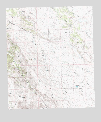
Werney Hill, NM USGS Topographic Map
Click on map above to begin viewing in our Map Viewer.

This topographic map contains these locations and features:
Feature Name Type Latitude Longitude GNIS ID View Map
00488 Water WellWellN32.4773°W108.2856°919247View Map
00497 Water WellWellN32.4501°W108.2645°919285View Map
Antelope DrawValleyN32.3856°W108.2909°885771View Map
Arvin TanksReservoirN32.4453°W108.3087°885915View Map
Back TankReservoirN32.4626°W108.3607°885975View Map
Big Deeper WellWellN32.3981°W108.2731°886296View Map
Brown TankReservoirN32.4011°W108.2761°886771View Map
Brushy CanyonValleyN32.4404°W108.3675°886800View Map
Coon Den TankReservoirN32.4370°W108.3368°887805View Map
Cottonwood WindmillLocaleN32.4995°W108.3064°887953View Map
Eubank CorralLocaleN32.4690°W108.3145°928935View Map
Frost RanchLocaleN32.4948°W108.3031°889251View Map
Gunn CanyonValleyN32.4276°W108.3589°889657View Map
Hinds WellWellN32.4501°W108.2642°890028View Map
Hines DepositMineN32.4395°W108.2673°921062View Map
Horse CanyonValleyN32.4262°W108.3587°907091View Map
J P B MountainSummitN32.3754°W108.3507°899683View Map
John Bull CorralLocaleN32.4309°W108.3142°928965View Map
Jonnie TankReservoirN32.3902°W108.3549°890563View Map
Jonnie TanksReservoirN32.4579°W108.3362°890564View Map
Malpais HillsSummitN32.3856°W108.3098°891561View Map
McDaniel RanchLocaleN32.4009°W108.3420°891739View Map
Middle TankReservoirN32.3950°W108.3721°891977View Map
Morrell TankReservoirN32.4883°W108.3443°902306View Map
Morrow RanchLocaleN32.4429°W108.3698°892246View Map
North Well CanyonValleyN32.3820°W108.3720°909207View Map
Number 472 WellWellN32.3765°W108.2734°921645View Map
Oak Canyon TankReservoirN32.4192°W108.2584°892790View Map
Patterson CanyonValleyN32.4151°W108.3512°893119View Map
Patterson WindmillLocaleN32.4165°W108.3531°893123View Map
Pete WindmillLocaleN32.3845°W108.3259°893210View Map
Ray Gun TankReservoirN32.4395°W108.3217°893705View Map
Road TankReservoirN32.4222°W108.3190°894001View Map
Still CanyonValleyN32.3948°W108.3359°911419View Map
Trimmer MineMineN32.4679°W108.2887°895825View Map
University TankReservoirN32.4959°W108.3003°911968View Map
Werney HillSummitN32.4554°W108.2728°896322View Map
Werney MineMineN32.4398°W108.2670°896323View Map
White Rock TankReservoirN32.4949°W108.3528°896528View Map

Note: Coordinates in the location and feature list above are referenced to NAD83 datum.


Copyright (C) 2008-2024 Ryan Niemi / Sunset Dynamics ... All Rights Reserved