TopoQuest Logo
Do you find TopoQuest useful?
Help keep TopoQuest running and adding new maps/features by donating!
Bitcoin:  19c7KJd3qBynnjoSw5npx9KScwjBe4ifkT
Litecoin:  LXs6TkuXGGXo1vDsWCkWVdjQX94eUKd6ui
Home View Maps Find Maps Find Places Resources & Links


Aldrich Gulch, Oregon Topographic Map

USGS Map Title: Aldrich Gulch, OR
USGS Map MRC: 44119C5
DRG (GeoTIFF) Download: o44119c5.tif


Neighboring USGS Topographic Map Quads:


  Day Basin, OR  
44119D6
 

  Dayville, OR  
44119D5
 

  Aldrich Mountain North, OR  
44119D4
 

  Wolf Mountain, OR  
44119C6
 

  Aldrich Gulch, OR  
44119C5
 

  Aldrich Mountain South, OR  
44119C4
 

  Powell Mountain, OR  
44119B6
 

  Suplee Butte, OR  
44119B5
 

  Graylock Butte, OR  
44119B4


Map MRC Location:

N45°
W120°
N45°
W119°
H8 H7 H6 H5 H4 H3 H2 H1
G8 G7 G6 G5 G4 G3 G2 G1
F8 F7 F6 F5 F4 F3 F2 F1
E8 E7 E6 E5 E4 E3 E2 E1
D8 D7 D6 D5 D4 D3 D2 D1
C8 C7 C6 C5 C4 C3 C2 C1
B8 B7 B6 B5 B4 B3 B2 B1
A8 A7 A6 A5 A4 A3 A2 A1
N44°
W120°
N44°
W119°

Aldrich Gulch, OR USGS 1:24K Topographic Map Preview:
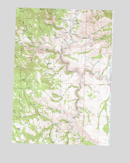
Aldrich Gulch, OR USGS Topographic Map
Click on map above to begin viewing in our Map Viewer.

This topographic map contains these locations and features:
Feature Name Type Latitude Longitude GNIS ID View Map
Aldrich GulchValleyN44.3340°W119.5653°1137115View Map
Battle Creek MountainSummitN44.3738°W119.5953°1137589View Map
Big SpringSpringN44.3514°W119.5097°1138075View Map
Black CanyonValleyN44.3338°W119.5664°1138185View Map
Black Canyon CreekStreamN44.3338°W119.5664°1138191View Map
Black Canyon RanchLocaleN44.3532°W119.5578°1138192View Map
Black Pine CreekStreamN44.3021°W119.5405°1138209View Map
Cameron CreekStreamN44.3379°W119.5903°1139187View Map
Chickenhouse GulchValleyN44.3121°W119.5158°1139633View Map
Clark SpringSpringN44.3622°W119.5462°1139760View Map
Congleton CreekStreamN44.2774°W119.5908°1150252View Map
Corner CreekStreamN44.3235°W119.5572°1140126View Map
Cow GulchValleyN44.3174°W119.5258°1140286View Map
Deadman FlatFlatN44.3735°W119.5514°1140736View Map
Deer GulchValleyN44.3435°W119.5564°1140848View Map
Doghouse GulchValleyN44.2849°W119.5427°1141149View Map
Dry Corner SpringSpringN44.3153°W119.5674°1141268View Map
Dry ProngStreamN44.3490°W119.5319°1141351View Map
Elbow GulchValleyN44.2732°W119.5558°1141714View Map
Frazier CreekStreamN44.2682°W119.5725°1142420View Map
Groundhog KnollSummitN44.3479°W119.5747°1143117View Map
Happy ReservoirReservoirN44.2626°W119.6188°1143290View Map
Jackass CreekStreamN44.3532°W119.5550°1144180View Map
Jackass MountainSummitN44.3415°W119.5289°1144182View Map
Lost Indian ReservoirReservoirN44.3242°W119.5822°1145541View Map
Lost Indian TrailTrailN44.3218°W119.5825°1145542View Map
Martin CreekStreamN44.2643°W119.5483°1145843View Map
Murderers CreekStreamN44.3146°W119.5397°1146670View Map
North Corner ReservoirReservoirN44.3190°W119.5785°1146891View Map
North Fork Wind CreekStreamN44.2693°W119.5705°1147025View Map
Payten CreekStreamN44.3393°W119.6000°1147514View Map
Payten TrailTrailN44.3457°W119.6155°1147515View Map
Pine Tree CampgroundLocaleN44.3646°W119.5500°1147731View Map
Placedor GulchValleyN44.3079°W119.5397°1147786View Map
Ringsmeyer ReservoirReservoirN44.3008°W119.6090°1148478View Map
Rock Pit ReservoirReservoirN44.2963°W119.5989°1148617View Map
Rockpile RanchLocaleN44.2707°W119.5516°1148647View Map
Roop SpringSpringN44.3478°W119.5255°1148712View Map
Seven Sixty ReservoirReservoirN44.3733°W119.6214°1149251View Map
Seven Sixty SpringSpringN44.3723°W119.6198°1149252View Map
Soup SpringSpringN44.2819°W119.5702°1149883View Map
South Prong Black Canyon CreekStreamN44.3388°W119.5994°1150070View Map
Sundstrom Place (historical)LocaleN44.3474°W119.6091°1150660View Map
Thicket ReservoirReservoirN44.3088°W119.6144°1151050View Map
Twin Stoves CreekStreamN44.2946°W119.5619°1151595View Map
Wigwam ReservoirReservoirN44.2686°W119.6095°1152322View Map
Wind CreekStreamN44.2721°W119.5511°1152485View Map
Youngs ButteSummitN44.3701°W119.5841°1152757View Map
Youngs CreekStreamN44.3526°W119.5566°1152759View Map

Note: Coordinates in the location and feature list above are referenced to NAD83 datum.


Copyright (C) 2008-2024 Ryan Niemi / Sunset Dynamics ... All Rights Reserved