TopoQuest Logo
Do you find TopoQuest useful?
Help keep TopoQuest running and adding new maps/features by donating!
Bitcoin:  19c7KJd3qBynnjoSw5npx9KScwjBe4ifkT
Litecoin:  LXs6TkuXGGXo1vDsWCkWVdjQX94eUKd6ui
Home View Maps Find Maps Find Places Resources & Links


Wendt Butte, Oregon Topographic Map

USGS Map Title: Wendt Butte, OR
USGS Map MRC: 44117D7
DRG (GeoTIFF) Download: o44117d7.tif


Neighboring USGS Topographic Map Quads:


  Brannan Gulch, OR  
44117E8
 

  Dooley Mountain, OR  
44117E7
 

  French Gulch, OR  
44117E6
 

  Devils Heel, OR  
44117D8
 

  Wendt Butte, OR  
44117D7
 

  Bridgeport, OR  
44117D6
 

  Ironside, OR  
44117C8
 

  Cow Valley West, OR  
44117C7
 

  Cow Valley East, OR  
44117C6


Map MRC Location:

N45°
W118°
N45°
W117°
H8 H7 H6 H5 H4 H3 H2 H1
G8 G7 G6 G5 G4 G3 G2 G1
F8 F7 F6 F5 F4 F3 F2 F1
E8 E7 E6 E5 E4 E3 E2 E1
D8 D7 D6 D5 D4 D3 D2 D1
C8 C7 C6 C5 C4 C3 C2 C1
B8 B7 B6 B5 B4 B3 B2 B1
A8 A7 A6 A5 A4 A3 A2 A1
N44°
W118°
N44°
W117°

Wendt Butte, OR USGS 1:24K Topographic Map Preview:
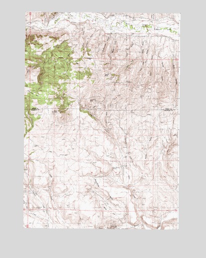
Wendt Butte, OR USGS Topographic Map
Click on map above to begin viewing in our Map Viewer.

This topographic map contains these locations and features:
Feature Name Type Latitude Longitude GNIS ID View Map
Alder CreekStreamN44.3779°W117.7771°1116814View Map
Baldy MountainSummitN44.4424°W117.8502°1117201View Map
Cary SpringSpringN44.4296°W117.7517°1118642View Map
Cave HollowValleyN44.4054°W117.8024°1638668View Map
Cave Hollow SpringSpringN44.4102°W117.8034°1118712View Map
Chicken CreekStreamN44.3882°W117.8741°1118881View Map
Clarks Creek DitchCanalN44.4874°W117.8155°1118977View Map
Clement DitchCanalN44.4979°W117.8513°1119012View Map
Cornet CreekStreamN44.4915°W117.8622°1119285View Map
Dry Grouse CreekStreamN44.4282°W117.8747°1120156View Map
Dry GulchValleyN44.4877°W117.7733°1120159View Map
East Fork Evans GulchValleyN44.4752°W117.7819°1120307View Map
East Fork Koontz CreekStreamN44.4699°W117.8627°1120312View Map
Elliot DitchCanalN44.4954°W117.7833°1120483View Map
Evans GulchValleyN44.4865°W117.7788°1120537View Map
Fish CreekStreamN44.3790°W117.8544°1120762View Map
Glasgow GulchValleyN44.4977°W117.8108°1132064View Map
Golden Eagle MineMineN44.3763°W117.8049°1121218View Map
Groundhog GulchValleyN44.3765°W117.7869°1121456View Map
Indian GulchValleyN44.3768°W117.7644°1122230View Map
Koontz CreekStreamN44.4935°W117.8516°1122834View Map
Little Alder CreekStreamN44.4327°W117.8088°1123119View Map
Lone Pine GulchValleyN44.4868°W117.7860°1123381View Map
Lynns DitchCanalN44.4207°W117.8402°1123637View Map
Mahogany CreekStreamN44.4935°W117.8180°1123678View Map
Mahogany FlatFlatN44.4732°W117.8205°1123680View Map
McClellan CreekStreamN44.4963°W117.7722°1123906View Map
McPherson DitchCanalN44.4957°W117.8280°1124018View Map
McPherson GulchValleyN44.4874°W117.8069°1124019View Map
Mill CreekStreamN44.4988°W117.8435°1124162View Map
Mill DitchCanalN44.4893°W117.8633°1124172View Map
Miller CreekStreamN44.3804°W117.7927°1131938View Map
Miller FlatFlatN44.3852°W117.8038°1124197View Map
Nickols SpringSpringN44.4518°W117.7587°1160909View Map
Picnic SpringSpringN44.4467°W117.8409°1125359View Map
Pole GulchValleyN44.4868°W117.7641°1125537View Map
Pole Gulch ReservoirReservoirN44.4625°W117.7731°1131951View Map
Porter GulchValleyN44.4049°W117.7808°1125575View Map
Rattlesnake GulchValleyN44.4235°W117.7566°1160908View Map
Road CanyonValleyN44.4857°W117.7588°1126079View Map
Rockaby CreekStreamN44.3982°W117.7880°1126221View Map
Schofield FlatFlatN44.4532°W117.8685°1126649View Map
Shasta GapGapN44.3952°W117.7663°1638669View Map
Spring GulchValleyN44.4860°W117.7622°1127440View Map
Stack CreekStreamN44.4938°W117.8347°1127508View Map
Three Pine ButteSummitN44.4504°W117.8249°1128066View Map
Wendt ButteSummitN44.4652°W117.8094°1136887View Map
Wendt GulchValleyN44.4885°W117.8022°1128803View Map
West Fork Evans GulchValleyN44.4754°W117.7816°1128848View Map
West Fork Koontz CreekStreamN44.4699°W117.8627°1128854View Map
West Fork Stack CreekStreamN44.4896°W117.8313°1128870View Map

Note: Coordinates in the location and feature list above are referenced to NAD83 datum.


Copyright (C) 2008-2024 Ryan Niemi / Sunset Dynamics ... All Rights Reserved