TopoQuest Logo
Do you find TopoQuest useful?
Help keep TopoQuest running and adding new maps/features by donating!
Bitcoin:  19c7KJd3qBynnjoSw5npx9KScwjBe4ifkT
Litecoin:  LXs6TkuXGGXo1vDsWCkWVdjQX94eUKd6ui
Home View Maps Find Maps Find Places Resources & Links


Welaka, Florida Topographic Map

USGS Map Title: Welaka, FL
USGS Map MRC: 29081D6
DRG (GeoTIFF) Download: o29081d6.tif


Neighboring USGS Topographic Map Quads:


  Rodman, FL  
29081E7
 

  Satsuma, FL  
29081E6
 

  San Mateo, FL  
29081E5
 

  Lake Delancy, FL  
29081D7
 

  Welaka, FL  
29081D6
 

  Crescent City, FL  
29081D5
 

  Lake Kerr, FL  
29081C7
 

  Salt Springs, FL  
29081C6
 

  Welaka SE, FL  
29081C5


Map MRC Location:

N30°
W82°
N30°
W81°
H8 H7 H6 H5 H4 H3 H2 H1
G8 G7 G6 G5 G4 G3 G2 G1
F8 F7 F6 F5 F4 F3 F2 F1
E8 E7 E6 E5 E4 E3 E2 E1
D8 D7 D6 D5 D4 D3 D2 D1
C8 C7 C6 C5 C4 C3 C2 C1
B8 B7 B6 B5 B4 B3 B2 B1
A8 A7 A6 A5 A4 A3 A2 A1
N29°
W82°
N29°
W81°

Welaka, FL USGS 1:24K Topographic Map Preview:
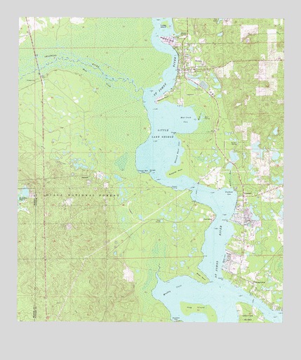
Welaka, FL USGS Topographic Map
Click on map above to begin viewing in our Map Viewer.

This topographic map contains these locations and features:
Feature Name Type Latitude Longitude GNIS ID View Map
Antonio J Triay GrantCivilN29.4641°W81.6612°306966View Map
Bear CreekStreamN29.4677°W81.6912°305252View Map
Beecher PointCapeN29.4677°W81.6817°305265View Map
Beecher RunStreamN29.4311°W81.6490°305266View Map
Beecher SpringSpringN29.4486°W81.6465°305267View Map
Black PointCapeN29.4016°W81.6517°305323View Map
Buckskin PrairieLakeN29.4285°W81.7464°305403View Map
Buzzard Roost CoveBayN29.4451°W81.6749°305421View Map
Buzzards PointCapeN29.4377°W81.6759°305422View Map
Cat Head PondLakeN29.4080°W81.6815°307812View Map
Church of God By FaithChurchN29.4806°W81.6664°2514317View Map
Croaker Hole CoveBayN29.4372°W81.6914°305524View Map
E Hudnal GrantCivilN29.3969°W81.6431°306963View Map
Emmanuel Episcopal ChurchChurchN29.4817°W81.6717°2514319View Map
First Baptist ChurchChurchN29.4872°W81.6719°2514321View Map
Fort GatesPopulated PlaceN29.4175°W81.6579°305695View Map
Fox LakeLakeN29.4996°W81.6546°305701View Map
Francis P Sanchez GrantCivilN29.4697°W81.7117°306961View Map
FruitlandPopulated PlaceN29.4272°W81.6437°305709View Map
Fruitland CoveBayN29.4285°W81.6503°305710View Map
GeorgetownPopulated PlaceN29.3914°W81.6387°305723View Map
Georgetown CemeteryCemeteryN29.3897°W81.6378°2514379View Map
Georgetown Fruitland Volunteer Fire DepartmentBuildingN29.3920°W81.6411°2514322View Map
Georgetown MarinaHarborN29.3873°W81.6403°2452704View Map
Georgetown Post OfficePost OfficeN29.3898°W81.6383°2514377View Map
Georgetown United Methodist ChurchChurchN29.3894°W81.6375°2514378View Map
H S Dexter GrantCivilN29.4330°W81.6559°306964View Map
Hog IslandIslandN29.3803°W81.6615°305818View Map
IslandLocaleN29.4244°W81.6979°306967View Map
Jenerson PointCapeN29.4166°W81.6504°305868View Map
Johns FerryPopulated PlaceN29.4319°W81.6637°306904View Map
Johnson Field Recreation SiteLocaleN29.4747°W81.7406°307041View Map
Juan Perchman GrantCivilN29.4647°W81.7401°306960View Map
Keeths PointCapeN29.3930°W81.6526°305898View Map
Laura LakeLakeN29.4169°W81.6820°305934View Map
Little Lake GeorgeLakeN29.4510°W81.6807°305962View Map
Little Lake George WildernessReserveN29.4570°W81.7070°307827View Map
Mount Royal AirportAirportN29.4343°W81.6603°2676658View Map
Mud CreekStreamN29.4577°W81.6654°306082View Map
Mud Creek CoveBayN29.4584°W81.6714°306083View Map
Mud SpringSpringN29.4594°W81.6626°306088View Map
Muddy CoveBayN29.3891°W81.6757°306090View Map
NorwalkPopulated PlaceN29.4350°W81.7165°306126View Map
Norwalk LandingLocaleN29.4305°W81.6776°306128View Map
Norwalk PointCapeN29.4364°W81.6876°306129View Map
Ocklawaha RiverStreamN29.4702°W81.6904°307088View Map
Orange PointCapeN29.4525°W81.6754°306166View Map
Pleasant Grove African Methodist Episcopal ChurchChurchN29.3956°W81.6367°2514380View Map
S Petty GrantCivilN29.4836°W81.6715°306965View Map
Saint James African Methodist Episcopal ChurchChurchN29.4783°W81.6675°2514316View Map
Saunders CoveBayN29.3771°W81.6758°306356View Map
Smith CoveBayN29.4012°W81.6525°306404View Map
Stephens PointCapeN29.4908°W81.6806°306447View Map
Syracuse IslandIslandN29.3966°W81.7023°307813View Map
Town of WelakaCivilN29.4819°W81.6659°2406853View Map
Turkey IslandIslandN29.4983°W81.6801°306519View Map
WelakaPopulated PlaceN29.4791°W81.6715°306568View Map
Welaka Baptist ChurchChurchN29.4820°W81.6715°2452277View Map
Welaka National Fish HatcheryParkN29.4457°W81.6503°2765555View Map
Welaka Police DepartmentBuildingN29.4793°W81.6705°2333157View Map
Welaka Post OfficePost OfficeN29.4830°W81.6718°2783477View Map
Welaka SpringsSpringN29.4941°W81.6737°306569View Map
Welaka TowerTowerN29.4539°W81.6570°306844View Map
Welaka Town HallBuildingN29.4794°W81.6706°2514318View Map
Welaka Town ParkParkN29.4728°W81.6678°2514320View Map
Welaka United Methodist ChurchChurchN29.4804°W81.6715°2452278View Map
Welaka Volunteer Fire DepartmentBuildingN29.4795°W81.6702°2514315View Map
William Gardner GrantCivilN29.3914°W81.6456°306962View Map
Woodmont Country ClubLocaleN29.4117°W81.6397°2452812View Map

Note: Coordinates in the location and feature list above are referenced to NAD83 datum.


Copyright (C) 2008-2024 Ryan Niemi / Sunset Dynamics ... All Rights Reserved