TopoQuest Logo
Do you find TopoQuest useful?
Help keep TopoQuest running and adding new maps/features by donating!
Bitcoin:  19c7KJd3qBynnjoSw5npx9KScwjBe4ifkT
Litecoin:  LXs6TkuXGGXo1vDsWCkWVdjQX94eUKd6ui
Home View Maps Find Maps Find Places Resources & Links


Weedville, Pennsylvania Topographic Map

USGS Map Title: Weedville, PA
USGS Map MRC: 41078C4
DRG (GeoTIFF) Download: o41078c4.tif


Neighboring USGS Topographic Map Quads:


  Saint Marys, PA  
41078D5
 

  Rathbun, PA  
41078D4
 

  West Creek, PA  
41078D3
 

  Kersey, PA  
41078C5
 

  Weedville, PA  
41078C4
 

  Dents Run, PA  
41078C3
 

  Penfield, PA  
41078B5
 

  Huntley, PA  
41078B4
 

  The Knobs, PA  
41078B3


Map MRC Location:

N42°
W79°
N42°
W78°
H8 H7 H6 H5 H4 H3 H2 H1
G8 G7 G6 G5 G4 G3 G2 G1
F8 F7 F6 F5 F4 F3 F2 F1
E8 E7 E6 E5 E4 E3 E2 E1
D8 D7 D6 D5 D4 D3 D2 D1
C8 C7 C6 C5 C4 C3 C2 C1
B8 B7 B6 B5 B4 B3 B2 B1
A8 A7 A6 A5 A4 A3 A2 A1
N41°
W79°
N41°
W78°

Weedville, PA USGS 1:24K Topographic Map Preview:
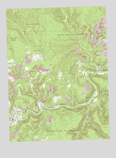
Weedville, PA USGS Topographic Map
Click on map above to begin viewing in our Map Viewer.

This topographic map contains these locations and features:
Feature Name Type Latitude Longitude GNIS ID View Map
Bakemans RunStreamN41.2806°W78.4461°1168592View Map
Barr HollowValleyN41.2926°W78.3879°1168751View Map
Bear RunStreamN41.2559°W78.4145°1168924View Map
Bell HollowValleyN41.2567°W78.4751°1169148View Map
Benezett Post OfficePost OfficeN41.3149°W78.3841°2779683View Map
BenezettePopulated PlaceN41.3167°W78.3864°1169236View Map
Browns RunStreamN41.2751°W78.4936°1170404View Map
CaledoniaPopulated PlaceN41.2873°W78.4600°1170876View Map
Caledonia RunStreamN41.2862°W78.4592°1202253View Map
Chase HollowValleyN41.3357°W78.4003°1171609View Map
Crooked Bridge HollowValleyN41.2805°W78.4763°1172711View Map
Gray CemeteryCemeteryN41.3044°W78.4527°1176021View Map
Gray HillSummitN41.3114°W78.4447°1176023View Map
Kersey RunStreamN41.2739°W78.4903°1192708View Map
Laurel RunStreamN41.2792°W78.4578°1192749View Map
Little Dents RunStreamN41.3745°W78.3820°1199051View Map
Little Wolf Lick RunStreamN41.3376°W78.4589°1179715View Map
McPherson HollowValleyN41.2694°W78.3811°1180803View Map
McPherson RunStreamN41.2695°W78.3814°1212791View Map
Medix RunPopulated PlaceN41.2901°W78.3972°1180861View Map
Medix RunStreamN41.2845°W78.3972°1180862View Map
Mount Zion ChurchChurchN41.3045°W78.4875°1181937View Map
Silver Mill HollowValleyN41.2842°W78.3934°1187685View Map
Silvermill Hollow RunStreamN41.2895°W78.3958°1212792View Map
Spring RunStreamN41.3381°W78.4064°1188274View Map
Stoney BrookStreamN41.3295°W78.4922°1200828View Map
Stony BrookStreamN41.3187°W78.4706°1188757View Map
Sullivan RunStreamN41.2673°W78.4047°1189003View Map
Township of JayCivilN41.3192°W78.4817°1216402View Map
Trout RunStreamN41.3137°W78.3847°1189868View Map
WeedvillePopulated PlaceN41.2767°W78.4917°1190770View Map
Weedville Census Designated PlaceCensusN41.2764°W78.4902°2630047View Map
Weedville Post OfficePost OfficeN41.2761°W78.4921°2773025View Map
Wolf Lick RunStreamN41.3226°W78.4511°1191663View Map

Note: Coordinates in the location and feature list above are referenced to NAD83 datum.


Copyright (C) 2008-2024 Ryan Niemi / Sunset Dynamics ... All Rights Reserved