TopoQuest Logo
Do you find TopoQuest useful?
Help keep TopoQuest running and adding new maps/features by donating!
Bitcoin:  19c7KJd3qBynnjoSw5npx9KScwjBe4ifkT
Litecoin:  LXs6TkuXGGXo1vDsWCkWVdjQX94eUKd6ui
Home View Maps Find Maps Find Places Resources & Links


Webb, West Virginia Topographic Map

USGS Map Title: Webb, WV
USGS Map MRC: 37082H4
DRG (GeoTIFF) Download: o37082h4.tif


Neighboring USGS Topographic Map Quads:


  Louisa, KY  
38082A5
 

  Radnor, WV  
38082A4
 

  Kiahsville, WV  
38082A3
 

  Milo, KY  
37082H5
 

  Webb, WV  
37082H4
 

  Wilsondale, WV  
37082H3
 

  Inez, KY  
37082G5
 

  Kermit, WV  
37082G4
 

  Naugatuck, WV  
37082G3


Map MRC Location:

N38°
W83°
N38°
W82°
H8 H7 H6 H5 H4 H3 H2 H1
G8 G7 G6 G5 G4 G3 G2 G1
F8 F7 F6 F5 F4 F3 F2 F1
E8 E7 E6 E5 E4 E3 E2 E1
D8 D7 D6 D5 D4 D3 D2 D1
C8 C7 C6 C5 C4 C3 C2 C1
B8 B7 B6 B5 B4 B3 B2 B1
A8 A7 A6 A5 A4 A3 A2 A1
N37°
W83°
N37°
W82°

Webb, WV USGS 1:24K Topographic Map Preview:
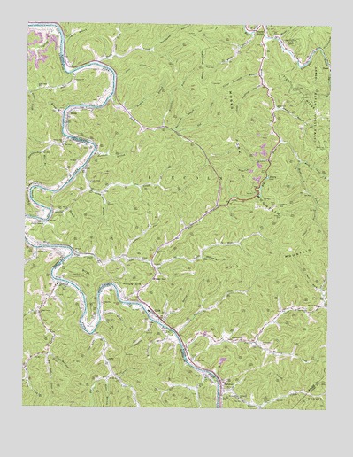
Webb, WV USGS Topographic Map
Click on map above to begin viewing in our Map Viewer.

This topographic map contains these locations and features:
Feature Name Type Latitude Longitude GNIS ID View Map
Arkansas BranchStreamN37.9926°W82.3788°1535004View Map
Asbury LakeReservoirN37.9505°W82.4005°1535042View Map
Baker Gap SchoolSchoolN37.9790°W82.4935°486248View Map
Bark Camp BranchStreamN37.9559°W82.3868°1535215View Map
Bear BranchStreamN37.9937°W82.4857°1535346View Map
Big BranchStreamN37.9031°W82.4685°487126View Map
Big Elk CreekStreamN37.8995°W82.4713°509881View Map
Big Elk Old Zion United Baptist ChurchChurchN37.8907°W82.4646°487169View Map
Big Mud LickStreamN37.8918°W82.4902°487223View Map
Blankenship BranchStreamN37.9629°W82.4824°487460View Map
Breezy GapGapN37.9170°W82.4468°1536318View Map
Browning CemeteryCemeteryN37.9604°W82.3774°1536420View Map
Bull CreekStreamN37.9243°W82.4810°1536688View Map
Bull Creek ChurchChurchN37.9256°W82.4454°1536692View Map
Bull ForkStreamN37.9145°W82.3774°1536695View Map
Bull MountainSummitN37.9207°W82.4124°1554026View Map
Burchett BranchStreamN37.9579°W82.4724°1536731View Map
Cainer BranchStreamN37.8843°W82.4596°488581View Map
Calf CreekLocaleN37.9262°W82.4938°488599View Map
Calf CreekStreamN37.9265°W82.4954°488601View Map
Camp CreekStreamN37.9529°W82.4771°1536908View Map
Camp Creek School (historical)SchoolN37.9484°W82.4732°1536920View Map
Cassie Post Office (historical)Post OfficeN37.9270°W82.4807°1558763View Map
Chaffin BranchStreamN37.9037°W82.4468°489304View Map
Chaffin CemeteryCemeteryN37.9084°W82.4549°489305View Map
Concord Baptist ChurchChurchN37.9818°W82.4799°489936View Map
Coon CreekStreamN37.9826°W82.4640°1537619View Map
Cotton HillSummitN37.9415°W82.3963°1554198View Map
CrumPopulated PlaceN37.9057°W82.4460°1537883View Map
Crum Census Designated PlaceCensusN37.9095°W82.4470°2586790View Map
Crum Elementary SchoolSchoolN37.9066°W82.4476°2088174View Map
Crum Middle SchoolSchoolN37.9067°W82.4484°2088175View Map
Crum Post OfficePost OfficeN37.9029°W82.4418°1728917View Map
Darnell CemeteryCemeteryN37.8773°W82.4007°1538007View Map
Dog ForkStreamN37.9648°W82.4376°1538236View Map
Drag CreekStreamN37.9762°W82.4657°1538307View Map
Drag Creek School (historical)SchoolN37.9731°W82.4602°1538308View Map
Dry ForkStreamN37.9062°W82.4940°491209View Map
Fluty CemeteryCemeteryN37.9381°W82.4938°492282View Map
Griffy BranchStreamN37.9987°W82.4910°493393View Map
Hagerman BranchStreamN37.9243°W82.4268°1539837View Map
Harmon CemeteryCemeteryN37.9248°W82.4843°493753View Map
Hobbs BranchStreamN37.8845°W82.4651°494320View Map
HodePopulated PlaceN37.8857°W82.4257°508260View Map
Horse CreekStreamN37.9870°W82.4713°1540479View Map
Hurricane BranchStreamN37.9656°W82.4385°1540617View Map
Jarrell BranchStreamN37.9048°W82.4682°495173View Map
Jennie CreekStreamN37.8940°W82.4338°1540863View Map
Jones BranchStreamN37.9490°W82.4815°495456View Map
Jonnies BranchStreamN37.9737°W82.3976°1541017View Map
Kermit Volunteer Fire Department Crum StationBuildingN37.9149°W82.4494°2577819View Map
Kirk CemeteryCemeteryN37.8754°W82.4526°495795View Map
Laurel BranchStreamN37.9423°W82.3799°1541376View Map
Left Fork Big Elk CreekStreamN37.8859°W82.4624°496197View Map
Lick BranchStreamN37.9020°W82.4429°1541846View Map
Little Elk CreekStreamN37.8857°W82.4213°496715View Map
Little Mud LickStreamN37.8926°W82.4890°496812View Map
Lower Sandlick BranchStreamN37.9840°W82.4040°1542571View Map
Marcum CemeteryCemeteryN37.8823°W82.4160°1542750View Map
Marcum CemeteryCemeteryN37.9382°W82.3946°1542752View Map
McCoy CemeteryCemeteryN37.9393°W82.4838°1542961View Map
Meade BranchStreamN37.9959°W82.3968°1543040View Map
Mill BranchStreamN37.9581°W82.4924°498218View Map
Millet (historical)Populated PlaceN37.9343°W82.4907°1558764View Map
Millhouse HollowValleyN37.9918°W82.4490°1543407View Map
Mills CemeteryCemeteryN37.9868°W82.4260°1543409View Map
Missouri BranchPopulated PlaceN37.9984°W82.4063°1555139View Map
Missouri BranchStreamN37.9998°W82.4021°1543458View Map
Moses ForkStreamN37.9965°W82.4024°1543593View Map
Moses Fork ChurchChurchN37.9737°W82.3968°1543594View Map
Moses Fork MountainSummitN37.9618°W82.4176°1543595View Map
Mossy BranchStreamN37.9712°W82.4849°498675View Map
Mothers United ChurchChurchN37.8973°W82.4099°1543604View Map
Mud LickStreamN37.8995°W82.4707°498991View Map
Mudlick ForkStreamN37.8970°W82.4040°1543948View Map
Old ForkStreamN37.9084°W82.3765°1544354View Map
Painter BranchStreamN37.9715°W82.4588°1544523View Map
Parsley CemeteryCemeteryN37.8918°W82.4304°1544599View Map
Perry CemeteryCemeteryN37.8848°W82.4682°500426View Map
Perry CemeteryCemeteryN37.9415°W82.3979°1544723View Map
Peters BranchStreamN37.9379°W82.4890°1544745View Map
Pine Grove ChurchChurchN37.9079°W82.3835°1544876View Map
Right Fork Bull CreekStreamN37.9220°W82.4474°1545619View Map
Right Fork Little Elk CreekStreamN37.8826°W82.4279°501901View Map
Right Fork Moses ForkStreamN37.9629°W82.3951°1545681View Map
Right Fork Stonecoal CreekStreamN37.8759°W82.4018°1545710View Map
Roberts BranchStreamN37.8912°W82.4965°502059View Map
Rocklick BranchStreamN37.9562°W82.3999°1545987View Map
Roman CemeteryCemeteryN37.8993°W82.4413°502303View Map
Sammons CemeteryCemeteryN37.9779°W82.4890°502816View Map
Shirttail ForkStreamN37.9123°W82.3763°1552875View Map
Silk ForkStreamN37.9898°W82.4640°1546777View Map
Silver CreekStreamN37.8993°W82.4368°1546781View Map
Spruce Pine ForkStreamN37.8879°W82.4982°504180View Map
StonecoalPopulated PlaceN37.8834°W82.4176°1547462View Map
Stonecoal CreekStreamN37.8795°W82.4185°1547470View Map
Stonecoal School (historical)SchoolN37.8784°W82.4107°1547476View Map
Stoney Hill ChurchChurchN37.8790°W82.4113°1547488View Map
Summer ForkStreamN37.9240°W82.4585°1547728View Map
Temple Bell ChurchChurchN37.9615°W82.4843°505057View Map
Thomas Copley ChurchChurchN37.9351°W82.4938°1548028View Map
Tick RidgeRidgeN37.9795°W82.3899°1548088View Map
Tick Ridge Lookout TowerTowerN37.9795°W82.3896°1729005View Map
TrippPopulated PlaceN37.9251°W82.4796°1558762View Map
Turkey CreekStreamN37.9151°W82.4802°505599View Map
Turkey Creek ChurchChurchN37.9056°W82.4935°505602View Map
Turkey Creek SchoolSchoolN37.9145°W82.4860°505605View Map
Turkey Creek Volunteer Fire DepartmentBuildingN37.9146°W82.4863°2636647View Map
Upper Sandlick BranchStreamN37.9809°W82.4029°1548550View Map
Upper Tug (historical)Populated PlaceN37.9497°W82.4820°2121019View Map
Upper Tug School (historical)SchoolN37.9497°W82.4820°2337823View Map
Vincent BranchStreamN37.9443°W82.4685°1548670View Map
Walnut Grove ChurchChurchN37.9087°W82.3782°1548760View Map
Walnut Grove School (historical)SchoolN37.9109°W82.3754°1548766View Map
WebbPopulated PlaceN37.9698°W82.4824°1548861View Map
Wells BranchStreamN37.9973°W82.4079°1548900View Map
Wells MountainSummitN37.9793°W82.4276°1548905View Map
Williams BranchStreamN37.9001°W82.4382°506791View Map
Williams ForkStreamN37.9668°W82.4438°1549173View Map
Williamson CemeteryCemeteryN37.8968°W82.4021°1549188View Map

Note: Coordinates in the location and feature list above are referenced to NAD83 datum.


Copyright (C) 2008-2024 Ryan Niemi / Sunset Dynamics ... All Rights Reserved