TopoQuest Logo
Do you find TopoQuest useful?
Help keep TopoQuest running and adding new maps/features by donating!
Bitcoin:  19c7KJd3qBynnjoSw5npx9KScwjBe4ifkT
Litecoin:  LXs6TkuXGGXo1vDsWCkWVdjQX94eUKd6ui
Home View Maps Find Maps Find Places Resources & Links


Waukee, Iowa Topographic Map

USGS Map Title: Waukee, IA
USGS Map MRC: 41093E8
DRG (GeoTIFF) Download: o41093e8.tif


Neighboring USGS Topographic Map Quads:


  Panther, IA  
41094F1
 

  Dallas Center, IA  
41093F8
 

  Grimes, IA  
41093F7
 

  Adel, IA  
41094E1
 

  Waukee, IA  
41093E8
 

  Commerce, IA  
41093E7
 

  Earlham East, IA  
41094D1
 

  Saint Charles NW, IA  
41093D8
 

  Cumming, IA  
41093D7


Map MRC Location:

N42°
W94°
N42°
W93°
H8 H7 H6 H5 H4 H3 H2 H1
G8 G7 G6 G5 G4 G3 G2 G1
F8 F7 F6 F5 F4 F3 F2 F1
E8 E7 E6 E5 E4 E3 E2 E1
D8 D7 D6 D5 D4 D3 D2 D1
C8 C7 C6 C5 C4 C3 C2 C1
B8 B7 B6 B5 B4 B3 B2 B1
A8 A7 A6 A5 A4 A3 A2 A1
N41°
W94°
N41°
W93°

Waukee, IA USGS 1:24K Topographic Map Preview:
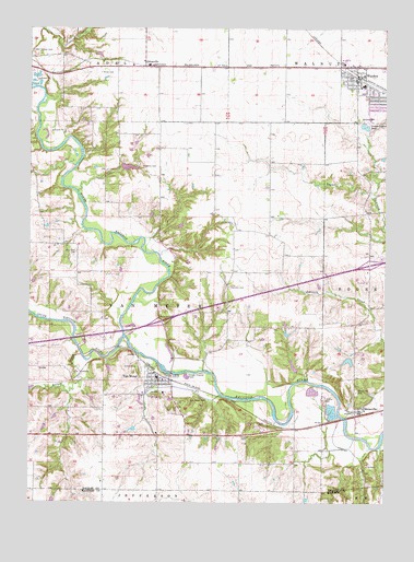
Waukee, IA USGS Topographic Map
Click on map above to begin viewing in our Map Viewer.

This topographic map contains these locations and features:
Feature Name Type Latitude Longitude GNIS ID View Map
Bob Feller Hometown ExhibitBuildingN41.5278°W93.9497°1996240View Map
BoonevillePopulated PlaceN41.5242°W93.8838°454758View Map
BoonevilleLocaleN41.5236°W93.8841°1996358View Map
Booneville AccessLocaleN41.5236°W93.8897°1996184View Map
Booneville CemeteryCemeteryN41.5295°W93.8853°454759View Map
Booneville Post OfficePost OfficeN41.5240°W93.8843°1996359View Map
Bulger CreekStreamN41.5389°W93.9816°454970View Map
City of Van MeterCivilN41.5204°W93.9427°2397116View Map
Clayton CemeteryCemeteryN41.5174°W93.9256°455449View Map
Heartland Co-op ElevatorLocaleN41.5242°W93.8838°1996360View Map
Interchange 113CrossingN41.5478°W93.9541°1996405View Map
Interchange 117CrossingN41.5628°W93.8808°1996404View Map
Miller CemeteryCemeteryN41.6133°W93.9752°459101View Map
North Raccoon RiverStreamN41.5442°W93.9663°459620View Map
Odd Fellows CemeteryCemeteryN41.6192°W93.9994°459798View Map
OrtonvillePopulated PlaceN41.6150°W93.9597°459902View Map
Ortonville (historical)LocaleN41.6150°W93.9597°1996193View Map
Ortonville Post Office (historical)Post OfficeN41.6150°W93.9597°1996192View Map
Otterman CemeteryCemeteryN41.5661°W93.9838°459949View Map
Prairie Village Mobile Home ParkPopulated PlaceN41.5200°W93.9197°1996361View Map
Puckerbrush AccessLocaleN41.5680°W93.9600°1996181View Map
South Raccoon RiverStreamN41.5439°W93.9666°461799View Map
Speak the Word ChurchChurchN41.6042°W93.9808°1996388View Map
Thornton CemeteryCemeteryN41.5569°W93.9300°462228View Map
Township of Van MeterCivilN41.5518°W93.9548°468859View Map
Trindle ParkParkN41.5236°W93.9475°1996183View Map
Trinity Lutheran ChurchChurchN41.5319°W93.9541°1996244View Map
Two Rivers AreaParkN41.5417°W93.9669°1996182View Map
Van MeterLocaleN41.5333°W93.9544°1996241View Map
Van MeterPopulated PlaceN41.5319°W93.9541°462534View Map
Van Meter Baptist ChurchChurchN41.5322°W93.9566°1996242View Map
Van Meter CemeteryCemeteryN41.5269°W93.9441°462535View Map
Van Meter City HallBuildingN41.5333°W93.9552°1996245View Map
Van Meter Elementary SchoolSchoolN41.5289°W93.9534°1996239View Map
Van Meter Junior - Senior High SchoolSchoolN41.5290°W93.9528°2719770View Map
Van Meter Post OfficePost OfficeN41.5333°W93.9555°1996246View Map
Van Meter Public LibraryBuildingN41.5333°W93.9552°1996247View Map
Van Meter United Methodist ChurchChurchN41.5286°W93.9597°1996243View Map
Van Meter Volunteer Fire Rescue DepartmentBuildingN41.5333°W93.9543°2577241View Map
WaukeeLocaleN41.6130°W93.8855°1996224View Map
WaukeePopulated PlaceN41.6117°W93.8852°462752View Map
Waukee Baptist ChurchChurchN41.6128°W93.8827°1996218View Map
Waukee CemeteryCemeteryN41.6017°W93.8844°462753View Map
Waukee Christian ChurchChurchN41.6139°W93.9105°1996223View Map
Waukee City HallBuildingN41.6155°W93.8863°1996211View Map
Waukee Elementary SchoolSchoolN41.6062°W93.8877°1996222View Map
Waukee Post OfficePost OfficeN41.6144°W93.8845°1996212View Map
Waukee Public LibraryBuildingN41.6111°W93.8855°1996213View Map
Waukee United Methodist ChurchChurchN41.6125°W93.8872°1996217View Map
Williams CemeteryCemeteryN41.5886°W93.9608°463053View Map

Note: Coordinates in the location and feature list above are referenced to NAD83 datum.


Copyright (C) 2008-2024 Ryan Niemi / Sunset Dynamics ... All Rights Reserved