TopoQuest Logo
Do you find TopoQuest useful?
Help keep TopoQuest running and adding new maps/features by donating!
Bitcoin:  19c7KJd3qBynnjoSw5npx9KScwjBe4ifkT
Litecoin:  LXs6TkuXGGXo1vDsWCkWVdjQX94eUKd6ui
Home View Maps Find Maps Find Places Resources & Links


Waterproof, Louisiana Topographic Map

USGS Map Title: Waterproof, LA
USGS Map MRC: 31091G4
DRG (GeoTIFF) Download: o31091g4.tif


Neighboring USGS Topographic Map Quads:


  Oakley, LA  
31091H5
 

  Gretna Green, LA  
31091H4
 

  Lake Bruin, LA  
31091H3
 

  Foules, LA  
31091G5
 

  Waterproof, LA  
31091G4
 

  Chamblee, LA  
31091G3
 

  Ferriday North, LA  
31091F5
 

  Spokane, LA  
31091F4
 

  Pine Ridge, MS  
31091F3


Map MRC Location:

N32°
W92°
N32°
W91°
H8 H7 H6 H5 H4 H3 H2 H1
G8 G7 G6 G5 G4 G3 G2 G1
F8 F7 F6 F5 F4 F3 F2 F1
E8 E7 E6 E5 E4 E3 E2 E1
D8 D7 D6 D5 D4 D3 D2 D1
C8 C7 C6 C5 C4 C3 C2 C1
B8 B7 B6 B5 B4 B3 B2 B1
A8 A7 A6 A5 A4 A3 A2 A1
N31°
W92°
N31°
W91°

Waterproof, LA USGS 1:24K Topographic Map Preview:
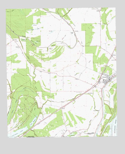
Waterproof, LA USGS Topographic Map
Click on map above to begin viewing in our Map Viewer.

This topographic map contains these locations and features:
Feature Name Type Latitude Longitude GNIS ID View Map
Ag Air Incorporated Airport (historical)AirportN31.7960°W91.4168°1633002View Map
Allen LakeLakeN31.8427°W91.4654°553285View Map
Arcola PlantationLocaleN31.7921°W91.4087°553314View Map
AzucenaPopulated PlaceN31.7779°W91.4379°542945View Map
BarcelonaPopulated PlaceN31.8527°W91.4229°542950View Map
Bell LakeLakeN31.8593°W91.4696°553584View Map
Black LakeLakeN31.8553°W91.4674°553690View Map
Boggy BayouGutN31.7799°W91.4676°533274View Map
Boggy LakeLakeN31.7669°W91.4997°553743View Map
Bowman LakeLakeN31.8448°W91.4807°553763View Map
Brushy LakeSwampN31.8424°W91.4685°533484View Map
Buffalo BayouGutN31.8141°W91.4140°533514View Map
Choctaw Baptist ChurchChurchN31.8713°W91.4510°553981View Map
Consuella (historical)Populated PlaceN31.7646°W91.4351°549298View Map
Cypress Grove ChurchChurchN31.8243°W91.3754°534370View Map
Fish lake (historical)LakeN31.8502°W91.4371°549306View Map
Fletchers LakeLakeN31.7539°W91.4935°554437View Map
Gin LakeLakeN31.8524°W91.4476°554534View Map
GoldmanPopulated PlaceN31.8285°W91.3807°543241View Map
Gorton ChuteLakeN31.7870°W91.3831°554559View Map
Green BayouGutN31.8068°W91.4701°535377View Map
Greenfield ChurchChurchN31.8449°W91.4923°535393View Map
HelenaPopulated PlaceN31.8713°W91.3934°541107View Map
Helena CemeteryCemeteryN31.8738°W91.3987°535617View Map
Helena Oil FieldOilfieldN31.8582°W91.4101°535618View Map
HighlandPopulated PlaceN31.8379°W91.4857°535666View Map
Independent RidgeRidgeN31.8252°W91.4932°549320View Map
L'Argent LandingLocaleN31.7507°W91.3940°549328View Map
Lake Saint John Oil and Gas FieldOilfieldN31.7718°W91.4704°536297View Map
Lisbon Elementary School (historical)SchoolN31.8029°W91.3913°549329View Map
Little Fletchers LakeLakeN31.7649°W91.4712°555071View Map
Little Tensas BayouLakeN31.7853°W91.4291°536617View Map
Luckett (historical)Populated PlaceN31.7671°W91.4590°549332View Map
Muddy BayouStreamN31.8488°W91.4862°537476View Map
Newfoundland PlantationLocaleN31.7854°W91.4243°549342View Map
Northeast Lake Saint John Gas FieldOilfieldN31.7741°W91.3998°549345View Map
Parish Governing Authority District 6CivilN31.8397°W91.4357°1930160View Map
Parish Governing Authority District 7CivilN31.8069°W91.3865°1930212View Map
RichlandPopulated PlaceN31.8366°W91.4512°541174View Map
Richland ChurchChurchN31.8388°W91.4448°538592View Map
Saint JohnPopulated PlaceN31.7563°W91.4332°549359View Map
Saint Mark ChurchChurchN31.8068°W91.4198°538962View Map
Saint Mark ChurchChurchN31.8138°W91.4601°538963View Map
Sandy BayouGutN31.8593°W91.3904°539145View Map
Shelley LakeLakeN31.8504°W91.4265°556018View Map
Shiloh Baptist ChurchChurchN31.7982°W91.4001°556025View Map
Skinner LakeLakeN31.8477°W91.4343°556059View Map
Steep BayouStreamN31.7877°W91.4896°539647View Map
Sunnybank PlantationLocaleN31.7854°W91.3979°549371View Map
Tensas Parish Fire District 1 Station 3BuildingN31.8044°W91.3836°2672844View Map
Tensas Parish Fire District 1 Station 9BuildingN31.8446°W91.4929°2673026View Map
Town of WaterproofCivilN31.8072°W91.3861°2406839View Map
TroyPopulated PlaceN31.8127°W91.4510°541200View Map
Ward SevenCivilN31.8049°W91.3871°545218View Map
Ward SixCivilN31.8418°W91.4451°545217View Map
WaterproofPopulated PlaceN31.8049°W91.3834°556371View Map
Waterproof CutoffChannelN31.7571°W91.3787°549378View Map
Waterproof High SchoolSchoolN31.8085°W91.3804°549380View Map
Waterproof LandingLocaleN31.7704°W91.3759°549381View Map
Waterproof Police DepartmentBuildingN31.8044°W91.3845°2755246View Map
Waterproof Post OfficePost OfficeN31.8045°W91.3842°1631114View Map
Waterproof United Methodist ChurchChurchN31.8068°W91.3829°549382View Map
Winona CemeteryCemeteryN31.7746°W91.3962°549385View Map
Winona PlantationLocaleN31.7749°W91.3954°556459View Map

Note: Coordinates in the location and feature list above are referenced to NAD83 datum.


Copyright (C) 2008-2024 Ryan Niemi / Sunset Dynamics ... All Rights Reserved