TopoQuest Logo
Do you find TopoQuest useful?
Help keep TopoQuest running and adding new maps/features by donating!
Bitcoin:  19c7KJd3qBynnjoSw5npx9KScwjBe4ifkT
Litecoin:  LXs6TkuXGGXo1vDsWCkWVdjQX94eUKd6ui
Home View Maps Find Maps Find Places Resources & Links


Water Valley East, Mississippi Topographic Map

USGS Map Title: Water Valley East, MS
USGS Map MRC: 34089B5
DRG (GeoTIFF) Download: o34089b5.tif


Neighboring USGS Topographic Map Quads:


  Splinter, MS  
34089C6
 

  Oxford South, MS  
34089C5
 

  Yocona, MS  
34089C4
 

  Water Valley West, MS  
34089B6
 

  Water Valley East, MS  
34089B5
 

  Paris, MS  
34089B4
 

  Velma, MS  
34089A6
 

  Pine Valley, MS  
34089A5
 

  Banner, MS  
34089A4


Map MRC Location:

N35°
W90°
N35°
W89°
H8 H7 H6 H5 H4 H3 H2 H1
G8 G7 G6 G5 G4 G3 G2 G1
F8 F7 F6 F5 F4 F3 F2 F1
E8 E7 E6 E5 E4 E3 E2 E1
D8 D7 D6 D5 D4 D3 D2 D1
C8 C7 C6 C5 C4 C3 C2 C1
B8 B7 B6 B5 B4 B3 B2 B1
A8 A7 A6 A5 A4 A3 A2 A1
N34°
W90°
N34°
W89°

Water Valley East, MS USGS 1:24K Topographic Map Preview:
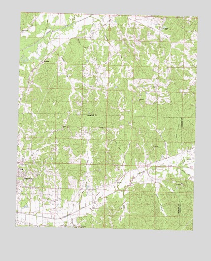
Water Valley East, MS USGS Topographic Map
Click on map above to begin viewing in our Map Viewer.

This topographic map contains these locations and features:
Feature Name Type Latitude Longitude GNIS ID View Map
Anchor Baptist ChurchChurchN34.2371°W89.5748°666248View Map
B Morris Catfish Ponds DamDamN34.1501°W89.5717°682487View Map
Brown CemeteryCemeteryN34.1359°W89.5559°667622View Map
Buck BranchStreamN34.2482°W89.5484°667723View Map
Davidson SchoolSchoolN34.1582°W89.6218°705921View Map
Douglas LakeReservoirN34.2419°W89.5259°669359View Map
Goodwin CreekStreamN34.2357°W89.6087°670513View Map
Gordon BranchStreamN34.1479°W89.5501°670532View Map
Greasy CreekStreamN34.1362°W89.5801°670640View Map
Hanna CreekStreamN34.1668°W89.5081°670885View Map
Higginbothan Store (historical)LocaleN34.2248°W89.5617°684381View Map
Hitchcock CreekStreamN34.1268°W89.5812°671247View Map
Holt CemeteryCemeteryN34.2190°W89.5304°671360View Map
Humphreys CemeteryCemeteryN34.1845°W89.5642°671582View Map
Humphreys ChurchChurchN34.1837°W89.5637°671583View Map
Humphreys CreekStreamN34.2487°W89.5756°671585View Map
Jones CreekStreamN34.2371°W89.6079°671996View Map
Keel CemeteryCemeteryN34.2059°W89.5073°672074View Map
Live Oak Academy (historical)SchoolN34.2201°W89.5679°684390View Map
Lows Store (historical)LocaleN34.1965°W89.5365°684391View Map
Mill CreekStreamN34.1632°W89.5242°673611View Map
Moore CreekStreamN34.1484°W89.5526°673782View Map
Mount Liberty Baptist ChurchChurchN34.1526°W89.5087°674050View Map
Mount Liberty CemeteryCemeteryN34.1520°W89.5087°674049View Map
Murray Creek Y-13a-2 DamDamN34.2334°W89.5001°682528View Map
O'Tuckalofa School (historical)SchoolN34.1526°W89.5540°705931View Map
Oak Ridge CemeteryCemeteryN34.1551°W89.6117°675091View Map
Otoucalofa ChurchChurchN34.1526°W89.5540°675324View Map
Otoucalofa Volunteer Fire DepartmentBuildingN34.1536°W89.5535°2665951View Map
PalestinePopulated PlaceN34.1834°W89.5937°705932View Map
Palestine CemeteryCemeteryN34.1829°W89.5926°675391View Map
Palestine ChurchChurchN34.1846°W89.5929°675404View Map
Pilgrim Rest CemeteryCemeteryN34.2012°W89.5404°675740View Map
Pilgrim Rest ChurchChurchN34.2012°W89.5401°675762View Map
Pine Flat (historical)LocaleN34.2432°W89.5065°706740View Map
Pine Flat CemeteryCemeteryN34.2412°W89.5042°675802View Map
Pine Flat ChurchChurchN34.2415°W89.5045°675803View Map
Pine Flat SchoolSchoolN34.2415°W89.5045°675804View Map
Pleasant Ridge ChurchChurchN34.2359°W89.5540°676124View Map
Sand CreekStreamN34.1643°W89.5498°679527View Map
Sand Hill ChurchChurchN34.1740°W89.5292°677349View Map
Sarter CreekStreamN34.1629°W89.5112°677423View Map
Ship CemeteryCemeteryN34.2309°W89.5756°677716View Map
Simmons BranchStreamN34.1326°W89.5862°677815View Map
Smith CreekStreamN34.1623°W89.5087°677930View Map
South Hopewell ChurchChurchN34.2393°W89.6237°678002View Map
Spring CreekStreamN34.1521°W89.5434°678077View Map
SpringdalePopulated PlaceN34.2218°W89.6093°678163View Map
Springdale CemeteryCemeteryN34.2170°W89.6067°706746View Map
Supervisor District 4CivilN34.2179°W89.6157°711931View Map
Taylor CreekStreamN34.2448°W89.5881°691623View Map
Tidwell CreekStreamN34.2432°W89.5906°678753View Map
Union HallPopulated PlaceN34.2246°W89.5429°684463View Map
Wyatt Chapel CemeteryCemeteryN34.1257°W89.5884°679900View Map
Young CemeteryCemeteryN34.2084°W89.5279°679964View Map
Zion CreekStreamN34.2098°W89.5870°691632View Map

Note: Coordinates in the location and feature list above are referenced to NAD83 datum.


Copyright (C) 2008-2024 Ryan Niemi / Sunset Dynamics ... All Rights Reserved