TopoQuest Logo
Do you find TopoQuest useful?
Help keep TopoQuest running and adding new maps/features by donating!
Bitcoin:  19c7KJd3qBynnjoSw5npx9KScwjBe4ifkT
Litecoin:  LXs6TkuXGGXo1vDsWCkWVdjQX94eUKd6ui
Home View Maps Find Maps Find Places Resources & Links


Wanatah, Indiana Topographic Map

USGS Map Title: Wanatah, IN
USGS Map MRC: 41086D8
DRG (GeoTIFF) Download: o41086d8.tif


Neighboring USGS Topographic Map Quads:


  Chesterton, IN  
41087E1
 

  Westville, IN  
41086E8
 

  LaPorte West, IN  
41086E7
 

  Valparaiso, IN  
41087D1
 

  Wanatah, IN  
41086D8
 

  Hanna, IN  
41086D7
 

  Kouts, IN  
41087C1
 

  La Crosse, IN  
41086C8
 

  English Lake, IN  
41086C7


Map MRC Location:

N42°
W87°
N42°
W86°
H8 H7 H6 H5 H4 H3 H2 H1
G8 G7 G6 G5 G4 G3 G2 G1
F8 F7 F6 F5 F4 F3 F2 F1
E8 E7 E6 E5 E4 E3 E2 E1
D8 D7 D6 D5 D4 D3 D2 D1
C8 C7 C6 C5 C4 C3 C2 C1
B8 B7 B6 B5 B4 B3 B2 B1
A8 A7 A6 A5 A4 A3 A2 A1
N41°
W87°
N41°
W86°

Wanatah, IN USGS 1:24K Topographic Map Preview:
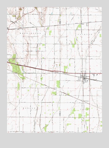
Wanatah, IN USGS Topographic Map
Click on map above to begin viewing in our Map Viewer.

This topographic map contains these locations and features:
Feature Name Type Latitude Longitude GNIS ID View Map
Cain DitchCanalN41.4517°W86.9870°431944View Map
Greiger DitchCanalN41.4167°W86.9470°435483View Map
HaskellPopulated PlaceN41.4839°W86.9020°435860View Map
LaPorte County Emergency Medical Services - WanatahBuildingN41.4336°W86.8974°2719331View Map
Luther CemeteryCemeteryN41.4495°W86.9939°438414View Map
Porter County Regional Airport Station 3000BuildingN41.4502°W86.9978°2701372View Map
Sacred Heart CemeteryCemeteryN41.4353°W86.9309°442442View Map
Samuelson's NurseryBuildingN41.4772°W86.9967°2634521View Map
Slocum DitchCanalN41.4003°W86.9125°443623View Map
South WanatahPopulated PlaceN41.4059°W86.8992°443866View Map
Town of WanatahCivilN41.4304°W86.8926°2397721View Map
Township of WashingtonCivilN41.4771°W86.9785°454014View Map
WanatahPopulated PlaceN41.4306°W86.8984°445456View Map
Wanatah Fire DepartmentBuildingN41.4283°W86.8990°2625948View Map
Wanatah Public SchoolSchoolN41.4273°W86.8936°447409View Map
Washington Township SchoolSchoolN41.4845°W86.9920°445522View Map
Washington Township Volunteer Fire Department ValparaisoBuildingN41.4836°W86.9924°2625870View Map
West Branch Crooked CreekStreamN41.4637°W86.9586°445720View Map
Wyckoff AirstripAirportN41.4920°W86.9526°449365View Map

Note: Coordinates in the location and feature list above are referenced to NAD83 datum.


Copyright (C) 2008-2024 Ryan Niemi / Sunset Dynamics ... All Rights Reserved