TopoQuest Logo
Do you find TopoQuest useful?
Help keep TopoQuest running and adding new maps/features by donating!
Bitcoin:  19c7KJd3qBynnjoSw5npx9KScwjBe4ifkT
Litecoin:  LXs6TkuXGGXo1vDsWCkWVdjQX94eUKd6ui
Home View Maps Find Maps Find Places Resources & Links


Waller, Texas Topographic Map

USGS Map Title: Waller, TX
USGS Map MRC: 30095A8
DRG (GeoTIFF) Download: o30095a8.tif


Neighboring USGS Topographic Map Quads:


  Howth, TX  
30096B1
 

  Waller NW, TX  
30095B8
 

  Magnolia West, TX  
30095B7
 

  Hempstead, TX  
30096A1
 

  Waller, TX  
30095A8
 

  Hockley, TX  
30095A7
 

  Sunny Side, TX  
29096H1
 

  Hockley Mound, TX  
29095H8
 

  Warren Lake, TX  
29095H7


Map MRC Location:

N31°
W96°
N31°
W95°
H8 H7 H6 H5 H4 H3 H2 H1
G8 G7 G6 G5 G4 G3 G2 G1
F8 F7 F6 F5 F4 F3 F2 F1
E8 E7 E6 E5 E4 E3 E2 E1
D8 D7 D6 D5 D4 D3 D2 D1
C8 C7 C6 C5 C4 C3 C2 C1
B8 B7 B6 B5 B4 B3 B2 B1
A8 A7 A6 A5 A4 A3 A2 A1
N30°
W96°
N30°
W95°

Waller, TX USGS 1:24K Topographic Map Preview:
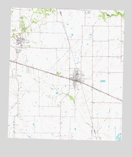
Waller, TX USGS Topographic Map
Click on map above to begin viewing in our Map Viewer.

This topographic map contains these locations and features:
Feature Name Type Latitude Longitude GNIS ID View Map
Adams LakeReservoirN30.1224°W95.9144°1860944View Map
Adams Lake DamDamN30.1235°W95.9136°1860943View Map
City of Prairie ViewCivilN30.0850°W95.9897°2411485View Map
City of WallerCivilN30.0628°W95.9222°2412170View Map
Dennison LakeReservoirN30.0025°W95.8787°1860942View Map
Dennison Lake DamDamN30.0069°W95.8769°1860941View Map
Faith Baptist ChurchChurchN30.0702°W95.9093°2470811View Map
Foster Hall (historical)BuildingN30.0947°W95.9891°2031189View Map
I T Holleman Elementary SchoolSchoolN30.0663°W95.9194°2009584View Map
Immanuel Baptist ChurchChurchN30.0850°W95.9877°2471030View Map
KPVU-FM (Prairie View)TowerN30.0894°W95.9963°1388066View Map
Little Mound CreekStreamN30.0038°W95.9008°1340139View Map
Mathis CemeteryCemeteryN30.0361°W95.9077°1341074View Map
Prairie ViewPopulated PlaceN30.0933°W95.9877°1344521View Map
Prairie View A and M CollegeSchoolN30.0922°W95.9897°1344522View Map
Prairie View City HallBuildingN30.0718°W95.9875°2753889View Map
Prairie View Police DepartmentBuildingN30.0734°W95.9922°2375851View Map
Prairie View Post OfficePost OfficeN30.0884°W95.9924°2731908View Map
Saint Marys CemeteryCemeteryN30.0330°W95.9447°1346031View Map
Schultz Middle SchoolSchoolN30.0513°W95.9088°2009591View Map
Shiloh ChurchChurchN30.1158°W95.9897°1347049View Map
WallerPopulated PlaceN30.0566°W95.9269°1349400View Map
Waller Baptist ChurchChurchN30.0577°W95.9269°2471315View Map
Waller CemeteryCemeteryN30.0530°W95.9100°1349402View Map
Waller City HallBuildingN30.0574°W95.9246°2753990View Map
Waller CountyCivilN30.0108°W95.9877°1384022View Map
Waller County Volunteer Emergency Medical ServicesBuildingN30.0575°W95.9247°2655820View Map
Waller Junior High SchoolSchoolN30.0624°W95.9263°2009593View Map
Waller Police DepartmentBuildingN30.0574°W95.9246°2375945View Map
Waller Post OfficePost OfficeN30.0550°W95.9175°2731383View Map
Waller Volunteer Fire DepartmentBuildingN30.0539°W95.9252°2552451View Map

Note: Coordinates in the location and feature list above are referenced to NAD83 datum.


Copyright (C) 2008-2024 Ryan Niemi / Sunset Dynamics ... All Rights Reserved