TopoQuest Logo
Do you find TopoQuest useful?
Help keep TopoQuest running and adding new maps/features by donating!
Bitcoin:  19c7KJd3qBynnjoSw5npx9KScwjBe4ifkT
Litecoin:  LXs6TkuXGGXo1vDsWCkWVdjQX94eUKd6ui
Home View Maps Find Maps Find Places Resources & Links


Wall, South Dakota Topographic Map

USGS Map Title: Wall, SD
USGS Map MRC: 43102H2
DRG (GeoTIFF) Download: o43102h2.tif


Neighboring USGS Topographic Map Quads:


  Wasta SE, SD  
44102A3
 

  Lake Hill, SD  
44102A2
 

  Elm Creek Ranch, SD  
44102A1
 

  Quinn Table NE, SD  
43102H3
 

  Wall, SD  
43102H2
 

  Wall NE, SD  
43102H1
 

  Quinn Table SE, SD  
43102G3
 

  Wall SW, SD  
43102G2
 

  Wall SE, SD  
43102G1


Map MRC Location:

N44°
W103°
N44°
W102°
H8 H7 H6 H5 H4 H3 H2 H1
G8 G7 G6 G5 G4 G3 G2 G1
F8 F7 F6 F5 F4 F3 F2 F1
E8 E7 E6 E5 E4 E3 E2 E1
D8 D7 D6 D5 D4 D3 D2 D1
C8 C7 C6 C5 C4 C3 C2 C1
B8 B7 B6 B5 B4 B3 B2 B1
A8 A7 A6 A5 A4 A3 A2 A1
N43°
W103°
N43°
W102°

Wall, SD USGS 1:24K Topographic Map Preview:
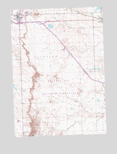
Wall, SD USGS Topographic Map
Click on map above to begin viewing in our Map Viewer.

This topographic map contains these locations and features:
Feature Name Type Latitude Longitude GNIS ID View Map
Bloom BasinBasinN43.9072°W102.1796°1261303View Map
Bud Bloom DamDamN43.9383°W102.1304°1262813View Map
Buffalo Gap National GrasslandForestN43.8931°W102.1418°1266753View Map
Ed Frien DamDamN43.9268°W102.2491°1262808View Map
Indian Village Landing Strip (historical)AirportN43.9167°W102.2365°1262770View Map
Interchange 110CrossingN43.9864°W102.2392°2725845View Map
Interchange 112CrossingN43.9862°W102.2093°2725846View Map
Interchange 116CrossingN43.9366°W102.1516°2725847View Map
Maco Sica Picnic GroundLocaleN43.9228°W102.2371°1267008View Map
National Grasslands Visitors CnterBuildingN43.9897°W102.2415°1940283View Map
Pinnacles Ranger StationLocaleN43.8805°W102.2377°1261086View Map
QuinnPopulated PlaceN43.9880°W102.1263°1262249View Map
Quinn DamDamN43.9967°W102.1321°1266968View Map
Quinn Post OfficePost OfficeN43.9857°W102.1276°2711114View Map
Quinn Volunteer Fire DepartmentBuildingN43.9876°W102.1281°2580961View Map
Town of QuinnCivilN43.9866°W102.1263°1267541View Map
Town of WallCivilN43.9914°W102.2421°1267622View Map
Township of FairviewCivilN43.9498°W102.1970°1268732View Map
WallPopulated PlaceN43.9925°W102.2415°1262653View Map
Wall CemeteryCemeteryN43.9853°W102.2380°2779307View Map
Wall City HallBuildingN43.9933°W102.2422°2725388View Map
Wall Community CenterBuildingN43.9933°W102.2422°2728109View Map
Wall Community LibraryBuildingN43.9937°W102.2421°2723789View Map
Wall Electronic SiteLocaleN43.9567°W102.2390°1267007View Map
Wall Elementary SchoolSchoolN43.9905°W102.2473°2729744View Map
Wall High SchoolSchoolN43.9905°W102.2473°2729746View Map
Wall Middle SchoolSchoolN43.9905°W102.2473°2729748View Map
Wall Police DepartmentBuildingN43.9936°W102.2421°2755530View Map
Wall Post OfficePost OfficeN43.9923°W102.2422°2712452View Map
Wall Volunteer Ambulance ServiceBuildingN43.9967°W102.2403°2658926View Map
Wall Volunteer Fire Department Station 1BuildingN43.9948°W102.2406°2580663View Map
Wounded Knee MuseumBuildingN43.9871°W102.2396°2729350View Map

Note: Coordinates in the location and feature list above are referenced to NAD83 datum.


Copyright (C) 2008-2024 Ryan Niemi / Sunset Dynamics ... All Rights Reserved