TopoQuest Logo
Do you find TopoQuest useful?
Help keep TopoQuest running and adding new maps/features by donating!
Bitcoin:  19c7KJd3qBynnjoSw5npx9KScwjBe4ifkT
Litecoin:  LXs6TkuXGGXo1vDsWCkWVdjQX94eUKd6ui
Home View Maps Find Maps Find Places Resources & Links


Walhalla Plateau, Arizona Topographic Map

USGS Map Title: Walhalla Plateau, AZ
USGS Map MRC: 36111B8
DRG (GeoTIFF) Download: o36111b8.tif


Neighboring USGS Topographic Map Quads:


  Little Park Lake, AZ  
36112C1
 

  Point Imperial, AZ  
36111C8
 

  Nankoweap Mesa, AZ  
36111C7
 

  Bright Angel Point, AZ  
36112B1
 

  Walhalla Plateau, AZ  
36111B8
 

  Cape Solitude, AZ  
36111B7
 

  Phantom Ranch, AZ  
36112A1
 

  Cape Royal, AZ  
36111A8
 

  Desert View, AZ  
36111A7


Map MRC Location:

N37°
W112°
N37°
W111°
H8 H7 H6 H5 H4 H3 H2 H1
G8 G7 G6 G5 G4 G3 G2 G1
F8 F7 F6 F5 F4 F3 F2 F1
E8 E7 E6 E5 E4 E3 E2 E1
D8 D7 D6 D5 D4 D3 D2 D1
C8 C7 C6 C5 C4 C3 C2 C1
B8 B7 B6 B5 B4 B3 B2 B1
A8 A7 A6 A5 A4 A3 A2 A1
N36°
W112°
N36°
W111°

Walhalla Plateau, AZ USGS 1:24K Topographic Map Preview:
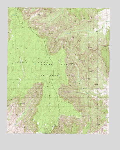
Walhalla Plateau, AZ USGS Topographic Map
Click on map above to begin viewing in our Map Viewer.

This topographic map contains these locations and features:
Feature Name Type Latitude Longitude GNIS ID View Map
Atoko PointCliffN36.2114°W111.9335°880View Map
Banta PointCliffN36.2178°W111.9132°1003View Map
Brady PeakSummitN36.2429°W111.9635°1934View Map
Butchart ButteSummitN36.2042°W111.8967°2558099View Map
Cape FinalCliffN36.1425°W111.9079°2450View Map
Cheyava FallsFallsN36.1461°W111.9743°2803View Map
Chiavria PointCliffN36.1739°W111.8932°2807View Map
Cliff SpringSpringN36.1251°W111.9540°3018View Map
Cochise ButteSummitN36.2124°W111.8826°3070View Map
Colter ButteSummitN36.2368°W111.9191°3133View Map
Duppa ButteSummitN36.2411°W111.8996°4196View Map
Francois Matthes PointCliffN36.1553°W111.9852°4823View Map
Greenland LakeLakeN36.2421°W111.9913°5369View Map
Hartman Natural BridgeArchN36.1953°W111.9199°42962View Map
Honan PointCliffN36.1389°W111.9741°5907View Map
Hubbell ButteSummitN36.1871°W111.8996°6090View Map
Hutton ButteSummitN36.2367°W111.9016°6153View Map
Jeffords PointCliffN36.2111°W111.9010°6386View Map
Juno TempleSummitN36.1503°W111.8918°6556View Map
Jupiter TempleSummitN36.1347°W111.8901°6562View Map
Kibbey ButteSummitN36.2490°W111.9785°6685View Map
Naji PointCliffN36.1722°W111.9252°8483View Map
Natch CanyonValleyN36.1662°W111.9058°8505View Map
Poston ButteSummitN36.1798°W111.9023°9683View Map
Roosevelt PointCliffN36.2180°W111.9529°45572View Map
Siegfried PyreSummitN36.1969°W111.9081°11272View Map
Swilling ButteSummitN36.2383°W111.9080°12061View Map
Thor TempleSummitN36.1305°W111.9809°12409View Map
Tritle PeakSummitN36.2245°W111.9480°12730View Map
Vista EncantadaPopulated PlaceN36.2305°W111.9735°24675View Map
Walhalla GladesFlatN36.1680°W111.9488°13281View Map
Walhalla PlateauPlainN36.1850°W111.9672°13282View Map

Note: Coordinates in the location and feature list above are referenced to NAD83 datum.


Copyright (C) 2008-2024 Ryan Niemi / Sunset Dynamics ... All Rights Reserved