TopoQuest Logo
Do you find TopoQuest useful?
Help keep TopoQuest running and adding new maps/features by donating!
Bitcoin:  19c7KJd3qBynnjoSw5npx9KScwjBe4ifkT
Litecoin:  LXs6TkuXGGXo1vDsWCkWVdjQX94eUKd6ui
Home View Maps Find Maps Find Places Resources & Links


Wakeley Lake, Michigan Topographic Map

USGS Map Title: Wakeley Lake, MI
USGS Map MRC: 44084F5
DRG (GeoTIFF) Download: o44084f5.tif


Neighboring USGS Topographic Map Quads:


  Big Bradford Lake, MI  
44084G6
 

  K P Lake, MI  
44084G5
 

  Lovells, MI  
44084G4
 

  Grayling, MI  
44084F6
 

  Wakeley Lake, MI  
44084F5
 

  Luzerne NW, MI  
44084F4
 

  Pere Cheney, MI  
44084E6
 

  Roscommon North, MI  
44084E5
 

  Eldorado, MI  
44084E4


Map MRC Location:

N45°
W85°
N45°
W84°
H8 H7 H6 H5 H4 H3 H2 H1
G8 G7 G6 G5 G4 G3 G2 G1
F8 F7 F6 F5 F4 F3 F2 F1
E8 E7 E6 E5 E4 E3 E2 E1
D8 D7 D6 D5 D4 D3 D2 D1
C8 C7 C6 C5 C4 C3 C2 C1
B8 B7 B6 B5 B4 B3 B2 B1
A8 A7 A6 A5 A4 A3 A2 A1
N44°
W85°
N44°
W84°

Wakeley Lake, MI USGS 1:24K Topographic Map Preview:
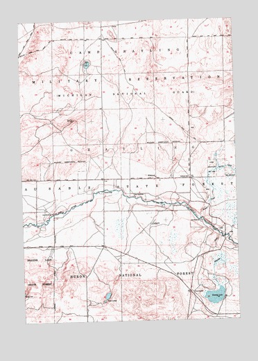
Wakeley Lake, MI USGS Topographic Map
Click on map above to begin viewing in our Map Viewer.

This topographic map contains these locations and features:
Feature Name Type Latitude Longitude GNIS ID View Map
Babbits ResortPopulated PlaceN44.6675°W84.6128°1622893View Map
Barker CreekStreamN44.6675°W84.5203°1619092View Map
BucksPopulated PlaceN44.7481°W84.5700°1619356View Map
Bucks Station (historical)LocaleN44.7483°W84.5700°2498846View Map
Camp Ginger QuillLocaleN44.6661°W84.5209°1619402View Map
Camp ShoppenagonLocaleN44.6770°W84.5595°1619413View Map
Camp Wa-Wa-SumLocaleN44.6703°W84.6078°1619417View Map
Crawford CountyCivilN44.6836°W84.6103°1622962View Map
Down River Fire TowerTowerN44.7089°W84.5939°1623326View Map
Feldhauser SchoolSchoolN44.6845°W84.5270°1619896View Map
Five CornersPopulated PlaceN44.6370°W84.5284°1619921View Map
Kneff LakesLakeN44.6356°W84.5764°1621986View Map
Kneff Lakes CampgroundLocaleN44.6378°W84.5770°1622889View Map
Kyle LakeLakeN44.7320°W84.5853°1620462View Map
Sigsbee Post Office (historical)Post OfficeN44.6806°W84.5694°2498850View Map
Stephan CemeteryCemeteryN44.6745°W84.5810°2498860View Map
Stephans BridgeBridgeN44.6792°W84.5775°1623652View Map
Wakeley CreekStreamN44.6603°W84.5103°1622047View Map
Wakeley LakeLakeN44.6347°W84.5137°1622048View Map
WildwoodPopulated PlaceN44.6847°W84.5464°1622164View Map

Note: Coordinates in the location and feature list above are referenced to NAD83 datum.


Copyright (C) 2008-2024 Ryan Niemi / Sunset Dynamics ... All Rights Reserved