TopoQuest Logo
Do you find TopoQuest useful?
Help keep TopoQuest running and adding new maps/features by donating!
Bitcoin:  19c7KJd3qBynnjoSw5npx9KScwjBe4ifkT
Litecoin:  LXs6TkuXGGXo1vDsWCkWVdjQX94eUKd6ui
Home View Maps Find Maps Find Places Resources & Links


Vigil, Colorado Topographic Map

USGS Map Title: Vigil, CO
USGS Map MRC: 37104B8
DRG (GeoTIFF) Download: o37104b8.tif


Neighboring USGS Topographic Map Quads:


  Cucharas Pass, CO  
37105C1
 

  Herlick Canyon, CO  
37104C8
 

  Gulnare, CO  
37104C7
 

  Stonewall, CO  
37105B1
 

  Vigil, CO  
37104B8
 

  Weston, CO  
37104B7
 

  Torres, CO  
37105A1
 

  Tercio, CO  
37104A8
 

  Little Pine Canyon, CO  
37104A7


Map MRC Location:

N38°
W105°
N38°
W104°
H8 H7 H6 H5 H4 H3 H2 H1
G8 G7 G6 G5 G4 G3 G2 G1
F8 F7 F6 F5 F4 F3 F2 F1
E8 E7 E6 E5 E4 E3 E2 E1
D8 D7 D6 D5 D4 D3 D2 D1
C8 C7 C6 C5 C4 C3 C2 C1
B8 B7 B6 B5 B4 B3 B2 B1
A8 A7 A6 A5 A4 A3 A2 A1
N37°
W105°
N37°
W104°

Vigil, CO USGS 1:24K Topographic Map Preview:
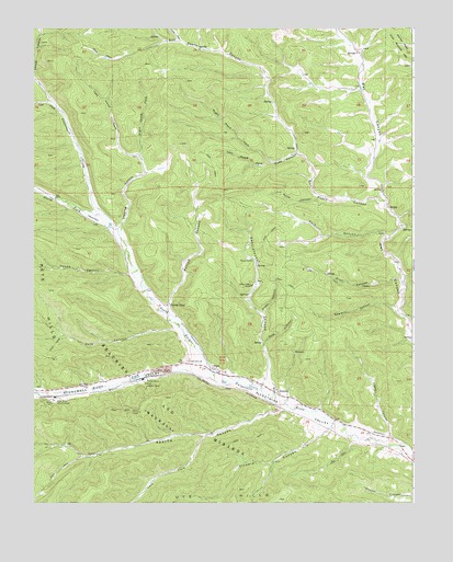
Vigil, CO USGS Topographic Map
Click on map above to begin viewing in our Map Viewer.

This topographic map contains these locations and features:
Feature Name Type Latitude Longitude GNIS ID View Map
Allen MineMineN37.1570°W104.9625°194615View Map
Allen MineMineN37.1653°W104.9992°1735198View Map
Apache CanyonValleyN37.1499°W104.9173°193165View Map
Cave CanyonValleyN37.1948°W104.8846°194604View Map
Ciruela CanyonValleyN37.1447°W104.8998°194616View Map
Coal CreekStreamN37.2292°W104.9928°192966View Map
Dude CanyonValleyN37.2171°W104.9136°194600View Map
Gold CanyonValleyN37.1667°W104.9243°194612View Map
Guajatoyah CreekStreamN37.2011°W104.9767°192970View Map
Hicks CanyonValleyN37.2467°W104.9521°192960View Map
Left Fork Apache CanyonValleyN37.1428°W104.9439°193164View Map
Left Hand Fork Dude CanyonValleyN37.2146°W104.9212°194601View Map
Left Hand Fork Logging CanyonValleyN37.2153°W104.9648°194599View Map
Logging CanyonValleyN37.1959°W104.9717°194597View Map
Lopez CanyonValleyN37.1418°W104.8820°194607View Map
Middle Fork Purgatoire RiverStreamN37.1572°W104.9408°193079View Map
North CanyonValleyN37.2055°W104.9058°194603View Map
North Fork Purgatoire RiverStreamN37.1572°W104.9408°192948View Map
Pando CanyonValleyN37.1854°W104.9683°194596View Map
Parras CanyonValleyN37.1763°W104.9560°194609View Map
Parras PlazaPopulated PlaceN37.1772°W104.9564°194610View Map
Pete CanyonValleyN37.1711°W104.9539°194594View Map
Pete HillsRangeN37.1792°W104.9969°194595View Map
Piņon Valley RanchLocaleN37.1822°W104.9450°194614View Map
Pratt CanyonValleyN37.1833°W104.8789°194605View Map
Right Hand Fork Dude CanyonValleyN37.2147°W104.9210°194602View Map
Right Hand Fork Logging CanyonValleyN37.2155°W104.9644°194598View Map
San Pablo CanyonValleyN37.2037°W104.8844°194511View Map
Santistevan CanyonValleyN37.1531°W104.9205°194611View Map
Sawmill CanyonValleyN37.1761°W104.8811°194606View Map
Snake CanyonValleyN37.1742°W104.9246°194613View Map
Stonewall Fire Protection District Wet Canyon StationBuildingN37.2255°W104.8889°2666995View Map
Stonewall ValleyValleyN37.1598°W104.9482°193080View Map
VigilPopulated PlaceN37.1611°W104.9417°194617View Map
Weston DivisionCivilN37.1481°W104.9185°1935595View Map
ZamaraPopulated PlaceN37.1539°W104.9206°194608View Map

Note: Coordinates in the location and feature list above are referenced to NAD83 datum.


Copyright (C) 2008-2024 Ryan Niemi / Sunset Dynamics ... All Rights Reserved