TopoQuest Logo
Do you find TopoQuest useful?
Help keep TopoQuest running and adding new maps/features by donating!
Bitcoin:  19c7KJd3qBynnjoSw5npx9KScwjBe4ifkT
Litecoin:  LXs6TkuXGGXo1vDsWCkWVdjQX94eUKd6ui
Home View Maps Find Maps Find Places Resources & Links


Vermillion, Kansas Topographic Map

USGS Map Title: Vermillion, KS
USGS Map MRC: 39096F3
DRG (GeoTIFF) Download: o39096f3.tif


Neighboring USGS Topographic Map Quads:


  Beattie, KS  
39096G4
 

  Axtell, KS  
39096G3
 

  Baileyville, KS  
39096G2
 

  Frankfort, KS  
39096F4
 

  Vermillion, KS  
39096F3
 

  Centralia, KS  
39096F2
 

  Frankfort SW, KS  
39096E4
 

  Wheaton, KS  
39096E3
 

  Duluth, KS  
39096E2


Map MRC Location:

N40°
W97°
N40°
W96°
H8 H7 H6 H5 H4 H3 H2 H1
G8 G7 G6 G5 G4 G3 G2 G1
F8 F7 F6 F5 F4 F3 F2 F1
E8 E7 E6 E5 E4 E3 E2 E1
D8 D7 D6 D5 D4 D3 D2 D1
C8 C7 C6 C5 C4 C3 C2 C1
B8 B7 B6 B5 B4 B3 B2 B1
A8 A7 A6 A5 A4 A3 A2 A1
N39°
W97°
N39°
W96°

Vermillion, KS USGS 1:24K Topographic Map Preview:
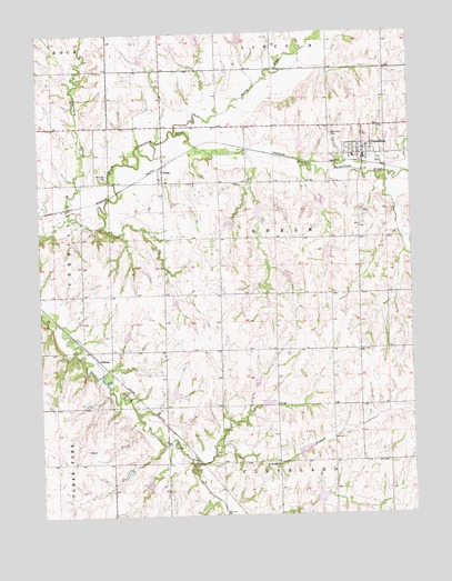
Vermillion, KS USGS Topographic Map
Click on map above to begin viewing in our Map Viewer.

This topographic map contains these locations and features:
Feature Name Type Latitude Longitude GNIS ID View Map
Ackerman CreekStreamN39.7031°W96.3650°472938View Map
City of VermillionCivilN39.7181°W96.2655°2397128View Map
Kearney BranchStreamN39.6386°W96.3233°473202View Map
Morrison CemeteryCemeteryN39.7125°W96.3530°473205View Map
North Fork Black Vermillion RiverStreamN39.7244°W96.3295°472710View Map
SullivanPopulated PlaceN39.6653°W96.3558°484627View Map
Township of NobleCivilN39.6968°W96.2956°473200View Map
VermillionPopulated PlaceN39.7194°W96.2658°473204View Map
Vermillion CemeteryCemeteryN39.7233°W96.2767°473206View Map
Vermillion Post OfficePost OfficeN39.7184°W96.2655°2694003View Map
Vermillion Public LibraryBuildingN39.7167°W96.2656°2694682View Map
Vermillion Unified School District OfficeSchoolN39.7178°W96.2691°2506463View Map
Vermillion United Methodist ChurchChurchN39.7184°W96.2670°2690235View Map
Vermillion Wastewater Treatment FacilityLocaleN39.7153°W96.2560°2692016View Map
VlietsPopulated PlaceN39.7139°W96.3336°473203View Map

Note: Coordinates in the location and feature list above are referenced to NAD83 datum.


Copyright (C) 2008-2024 Ryan Niemi / Sunset Dynamics ... All Rights Reserved