TopoQuest Logo
Do you find TopoQuest useful?
Help keep TopoQuest running and adding new maps/features by donating!
Bitcoin:  19c7KJd3qBynnjoSw5npx9KScwjBe4ifkT
Litecoin:  LXs6TkuXGGXo1vDsWCkWVdjQX94eUKd6ui
Home View Maps Find Maps Find Places Resources & Links


Vastus, Missouri Topographic Map

USGS Map Title: Vastus, MO
USGS Map MRC: 36090E4
DRG (GeoTIFF) Download: o36090e4.tif


Neighboring USGS Topographic Map Quads:


  Fairdealing, MO  
36090F5
 

  Harviell, MO  
36090F4
 

  Hanleyville, MO  
36090F3
 

  Naylor, MO  
36090E5
 

  Vastus, MO  
36090E4
 

  Oglesville, MO  
36090E3
 

  Corning, AR  
36090D5
 

  McDougal, AR  
36090D4
 

  Pollard, AR  
36090D3


Map MRC Location:

N37°
W91°
N37°
W90°
H8 H7 H6 H5 H4 H3 H2 H1
G8 G7 G6 G5 G4 G3 G2 G1
F8 F7 F6 F5 F4 F3 F2 F1
E8 E7 E6 E5 E4 E3 E2 E1
D8 D7 D6 D5 D4 D3 D2 D1
C8 C7 C6 C5 C4 C3 C2 C1
B8 B7 B6 B5 B4 B3 B2 B1
A8 A7 A6 A5 A4 A3 A2 A1
N36°
W91°
N36°
W90°

Vastus, MO USGS 1:24K Topographic Map Preview:
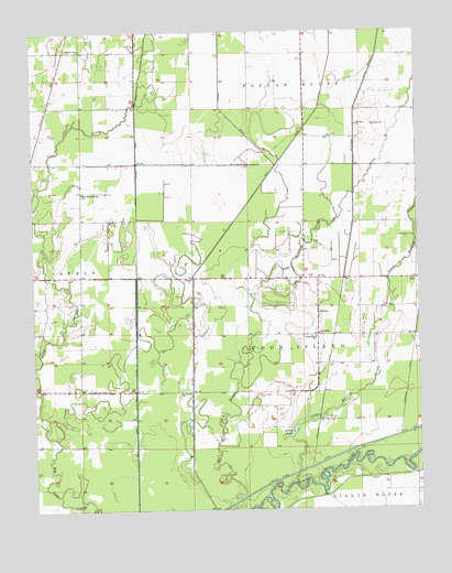
Vastus, MO USGS Topographic Map
Click on map above to begin viewing in our Map Viewer.

This topographic map contains these locations and features:
Feature Name Type Latitude Longitude GNIS ID View Map
Allred LakeLakeN36.5203°W90.4162°713241View Map
Barks ChurchChurchN36.5603°W90.4490°730053View Map
Big Hunting SloughStreamN36.5026°W90.4340°714182View Map
Bordens School (historical)SchoolN36.5317°W90.4879°746853View Map
Burdett Landing (historical)LocaleN36.5048°W90.4193°746854View Map
Butler County Fire Protection District Coon Island StationBuildingN36.5450°W90.4078°2621323View Map
Cane CreekStreamN36.5253°W90.4993°749188View Map
Cane Creek DitchCanalN36.5528°W90.4665°715347View Map
Chester BendBendN36.5095°W90.3773°739585View Map
Conley Grove ChurchChurchN36.6203°W90.4837°716194View Map
Coon Island CemeteryCemeteryN36.5298°W90.4276°716269View Map
Coon Island SchoolSchoolN36.5451°W90.4084°716270View Map
El Bethel ChurchChurchN36.5306°W90.4526°717430View Map
Factory BendBendN36.5103°W90.3857°739586View Map
Friendship ChurchChurchN36.5456°W90.4079°718234View Map
Havam School (historical)SchoolN36.6039°W90.3929°746855View Map
Hvam CemeteryCemeteryN36.6003°W90.3893°720054View Map
Little Hunting SloughStreamN36.5064°W90.4168°721251View Map
New Hope School (historical)SchoolN36.6195°W90.4937°746852View Map
New Morning Star ChurchChurchN36.5831°W90.4840°723286View Map
Stillcamp ChurchChurchN36.6003°W90.3946°727101View Map
Stillcamp DitchCanalN36.6020°W90.3951°727102View Map
Township of Coon IslandCivilN36.5488°W90.4095°766352View Map
VastusPopulated PlaceN36.5512°W90.4082°728152View Map
WalshLocaleN36.5987°W90.4976°735309View Map

Note: Coordinates in the location and feature list above are referenced to NAD83 datum.


Copyright (C) 2008-2024 Ryan Niemi / Sunset Dynamics ... All Rights Reserved