TopoQuest Logo
Do you find TopoQuest useful?
Help keep TopoQuest running and adding new maps/features by donating!
Bitcoin:  19c7KJd3qBynnjoSw5npx9KScwjBe4ifkT
Litecoin:  LXs6TkuXGGXo1vDsWCkWVdjQX94eUKd6ui
Home View Maps Find Maps Find Places Resources & Links


Valley View, Pennsylvania Topographic Map

USGS Map Title: Valley View, PA
USGS Map MRC: 40076F5
DRG (GeoTIFF) Download: o40076f5.tif


Neighboring USGS Topographic Map Quads:


  Trevorton, PA  
40076G6
 

  Shamokin, PA  
40076G5
 

  Mount Carmel, PA  
40076G4
 

  Klingerstown, PA  
40076F6
 

  Valley View, PA  
40076F5
 

  Tremont, PA  
40076F4
 

  Lykens, PA  
40076E6
 

  Tower City, PA  
40076E5
 

  Pine Grove, PA  
40076E4


Map MRC Location:

N41°
W77°
N41°
W76°
H8 H7 H6 H5 H4 H3 H2 H1
G8 G7 G6 G5 G4 G3 G2 G1
F8 F7 F6 F5 F4 F3 F2 F1
E8 E7 E6 E5 E4 E3 E2 E1
D8 D7 D6 D5 D4 D3 D2 D1
C8 C7 C6 C5 C4 C3 C2 C1
B8 B7 B6 B5 B4 B3 B2 B1
A8 A7 A6 A5 A4 A3 A2 A1
N40°
W77°
N40°
W76°

Valley View, PA USGS 1:24K Topographic Map Preview:
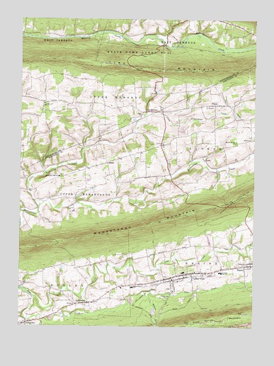
Valley View, PA USGS Topographic Map
Click on map above to begin viewing in our Map Viewer.

This topographic map contains these locations and features:
Feature Name Type Latitude Longitude GNIS ID View Map
Christ ChurchChurchN40.7165°W76.6058°1171817View Map
Deep CreekStreamN40.6373°W76.6164°1173057View Map
Friedens ChurchChurchN40.6509°W76.5036°1175245View Map
Good Spring MountainSummitN40.6284°W76.5052°1192525View Map
Hegins Area AmbulanceBuildingN40.6405°W76.5413°2722317View Map
Hegins Post OfficePost OfficeN40.6491°W76.5004°2772741View Map
Hegins Township Police DepartmentBuildingN40.6396°W76.5421°2780149View Map
Hegins-Hubley SchoolSchoolN40.6412°W76.5639°1176766View Map
HeplerPopulated PlaceN40.6918°W76.5775°1203787View Map
Heplers ChurchChurchN40.7015°W76.5016°1176862View Map
Heplers Summer ChurchChurchN40.7004°W76.5094°1176863View Map
Jacobs CemeteryCemeteryN40.7115°W76.5591°1177953View Map
KehlerPopulated PlaceN40.6943°W76.5272°1203921View Map
Leck Kill SchoolSchoolN40.7156°W76.6119°1179106View Map
Line MountainPopulated PlaceN40.7126°W76.5572°1204031View Map
Line MountainRidgeN40.7318°W76.5747°1192788View Map
Little Mahantango CreekStreamN40.6740°W76.6150°1192805View Map
Mahantango Fire Company District 10 Station 1BuildingN40.7156°W76.5202°2653566View Map
Mahantango Valley SchoolSchoolN40.6859°W76.6036°1180213View Map
Mahantongo Valley AmbulanceBuildingN40.7156°W76.5202°2722342View Map
Masser FieldAirportN40.6339°W76.5985°2442869View Map
PitmanPopulated PlaceN40.7151°W76.5208°1183975View Map
Pitman Post OfficePost OfficeN40.7150°W76.5263°2779582View Map
Pitman Post Office (historical)Post OfficeN40.6995°W76.5447°1214145View Map
Rausch CreekStreamN40.6393°W76.5577°1184704View Map
SacramentoPopulated PlaceN40.6345°W76.5889°1185680View Map
Sacramento Community Fire Company District 14 Station 1BuildingN40.6350°W76.5847°2652817View Map
Sacramento Post OfficePost OfficeN40.6343°W76.5909°2772956View Map
Saint James ChurchChurchN40.7148°W76.5238°1186021View Map
Saint Pauls ChurchChurchN40.6340°W76.5944°1186606View Map
Saint Pauls ChurchChurchN40.6993°W76.5477°1186613View Map
Spring GlenPopulated PlaceN40.6262°W76.6208°1193422View Map
Spring Glen Post OfficePost OfficeN40.6270°W76.6185°2772987View Map
State Game Lands Number 132ParkN40.6781°W76.5108°1188443View Map
State Game Lands Number 84ParkN40.7370°W76.5850°1199605View Map
Township of East CameronCivilN40.7464°W76.5177°1216915View Map
Township of HeginsCivilN40.6474°W76.5066°1217003View Map
Township of HubleyCivilN40.6402°W76.6171°1217004View Map
Township of Upper MahantongoCivilN40.6737°W76.6150°1217020View Map
Tri Valley High SchoolSchoolN40.6473°W76.5163°1189758View Map
Valley ViewPopulated PlaceN40.6459°W76.5391°1190318View Map
Valley View Census Designated PlaceCensusN40.6481°W76.5352°2390426View Map
Valley View Fire Company District 13 Station 2BuildingN40.6448°W76.5372°2653189View Map
Valley View ParkParkN40.6370°W76.5475°1198136View Map
Valley View Post OfficePost OfficeN40.6459°W76.5401°2773011View Map

Note: Coordinates in the location and feature list above are referenced to NAD83 datum.


Copyright (C) 2008-2024 Ryan Niemi / Sunset Dynamics ... All Rights Reserved