TopoQuest Logo
Do you find TopoQuest useful?
Help keep TopoQuest running and adding new maps/features by donating!
Bitcoin:  19c7KJd3qBynnjoSw5npx9KScwjBe4ifkT
Litecoin:  LXs6TkuXGGXo1vDsWCkWVdjQX94eUKd6ui
Home View Maps Find Maps Find Places Resources & Links


Union City, Pennsylvania Topographic Map

USGS Map Title: Union City, PA
USGS Map MRC: 41079H7
DRG (GeoTIFF) Download: o41079h7.tif


Neighboring USGS Topographic Map Quads:


  Hammett, PA  
42079A8
 

  Wattsburg, PA  
42079A7
 

  Clymer, NY  
42079A6
 

  Waterford, PA  
41079H8
 

  Union City, PA  
41079H7
 

  Corry, PA  
41079H6
 

  Millers Station, PA  
41079G8
 

  Lake Canadohta, PA  
41079G7
 

  Spartansburg, PA  
41079G6


Map MRC Location:

N42°
W80°
N42°
W79°
H8 H7 H6 H5 H4 H3 H2 H1
G8 G7 G6 G5 G4 G3 G2 G1
F8 F7 F6 F5 F4 F3 F2 F1
E8 E7 E6 E5 E4 E3 E2 E1
D8 D7 D6 D5 D4 D3 D2 D1
C8 C7 C6 C5 C4 C3 C2 C1
B8 B7 B6 B5 B4 B3 B2 B1
A8 A7 A6 A5 A4 A3 A2 A1
N41°
W80°
N41°
W79°

Union City, PA USGS 1:24K Topographic Map Preview:
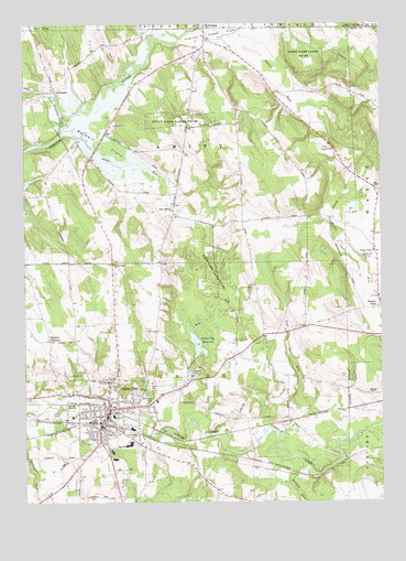
Union City, PA USGS Topographic Map
Click on map above to begin viewing in our Map Viewer.

This topographic map contains these locations and features:
Feature Name Type Latitude Longitude GNIS ID View Map
Alder RunStreamN41.9712°W79.8612°1168131View Map
ArbucklePopulated PlaceN41.9828°W79.8639°1168368View Map
Baldwin FlatsFlatN41.9692°W79.8478°1168656View Map
Baldwin SchoolSchoolN41.9378°W79.8442°1196848View Map
Beaver DamPopulated PlaceN41.9273°W79.7503°1169011View Map
Bentley RunStreamN41.8973°W79.8367°1169280View Map
Bisbee FarmsLocaleN41.9467°W79.8047°2712273View Map
Blossom FarmLocaleN41.8806°W79.7958°2712272View Map
Borough of Union CityCivilN41.8970°W79.8437°1215218View Map
Carters CornersLocaleN41.9556°W79.8745°1196842View Map
Chaffee SchoolSchoolN41.9737°W79.7995°1196847View Map
Emerson SchoolSchoolN41.8831°W79.8556°1196843View Map
Evergreen CemeteryCemeteryN41.8927°W79.8370°1174371View Map
Fenno SchoolSchoolN41.9039°W79.8217°1197588View Map
French Creek FlatsFlatN41.9967°W79.8078°1175222View Map
Hatch Hollow ChurchChurchN41.9514°W79.8226°1176643View Map
Hatch Hollow SchoolSchoolN41.9520°W79.8217°1196850View Map
Horizon Hill RanchLocaleN41.9047°W79.7531°2712237View Map
Howard SchoolSchoolN41.9067°W79.7728°1196845View Map
Hubbel RunStreamN41.9978°W79.8095°1177533View Map
Hungry RunStreamN41.8853°W79.7781°1177596View Map
Kimble CornersPopulated PlaceN41.9173°W79.8662°1178465View Map
Lake Pleasant OutletStreamN41.9737°W79.8606°1178784View Map
Maplewood CemeteryCemeteryN41.9513°W79.8215°2712269View Map
Memorial HospitalHospitalN41.9062°W79.8453°1180910View Map
Pennsylvania State Police Troop E Corry StationBuildingN41.9196°W79.7586°2777336View Map
Pine RunStreamN41.8926°W79.7853°1183887View Map
Saint Teresa CemeteryCemeteryN41.9010°W79.8306°1186735View Map
Sherwood SchoolSchoolN41.9276°W79.8276°1196849View Map
Shreve FarmsLocaleN41.8764°W79.8661°2712274View Map
Sills SchoolSchoolN41.8806°W79.8114°1196844View Map
Smith SchoolSchoolN41.9192°W79.7820°1196846View Map
Smith's Dairy FarmLocaleN41.9617°W79.8008°2712275View Map
State Game Lands Number 102ParkN41.9331°W79.8087°1188429View Map
State Game Lands Number 162ParkN41.9737°W79.8153°1188462View Map
State Game Lands Number 167ParkN41.9901°W79.7753°1188466View Map
Titus BogSwampN41.9435°W79.7632°1201321View Map
Township of AmityCivilN41.9685°W79.8249°1216407View Map
Township of UnionCivilN41.8940°W79.8228°1216424View Map
Union CityPopulated PlaceN41.8995°W79.8453°1190150View Map
Union City Ambulance ServiceBuildingN41.8966°W79.8487°2719685View Map
Union City Fish HatcheryLocaleN41.9075°W79.8178°2712277View Map
Union City Junior-Senior High SchoolSchoolN41.8901°W79.8381°1211446View Map
Union City Police DepartmentBuildingN41.8975°W79.8461°2777254View Map
Union City Post OfficePost OfficeN41.9032°W79.8459°2711907View Map
Union City Public LibraryBuildingN41.8967°W79.8467°2711896View Map
Union City ReservoirReservoirN41.9161°W79.8144°1190152View Map
Union City Reservoir DamDamN41.9134°W79.8148°1195852View Map
Union City Volunteer Fire Department 113BuildingN41.8968°W79.8487°2645577View Map
Union-Amity ChurchChurchN41.9376°W79.8437°1190185View Map
Wayne Valley ChurchChurchN41.9403°W79.7509°1190719View Map
West Branch French CreekStreamN41.9989°W79.8130°970759View Map

Note: Coordinates in the location and feature list above are referenced to NAD83 datum.


Copyright (C) 2008-2024 Ryan Niemi / Sunset Dynamics ... All Rights Reserved