TopoQuest Logo
Do you find TopoQuest useful?
Help keep TopoQuest running and adding new maps/features by donating!
Bitcoin:  19c7KJd3qBynnjoSw5npx9KScwjBe4ifkT
Litecoin:  LXs6TkuXGGXo1vDsWCkWVdjQX94eUKd6ui
Home View Maps Find Maps Find Places Resources & Links


Underhill, Vermont Topographic Map

USGS Map Title: Underhill, VT
USGS Map MRC: 44072E8
DRG (GeoTIFF) Download: o44072e8.tif


Neighboring USGS Topographic Map Quads:


  Milton, VT  
44073F1
 

  Gilson Mountain, VT  
44072F8
 

  Jeffersonville, VT  
44072F7
 

  Essex Center, VT  
44073E1
 

  Underhill, VT  
44072E8
 

  Mount Mansfield, VT  
44072E7
 

  Essex Junction, VT  
44073D1
 

  Richmond, VT  
44072D8
 

  Bolton Mountain, VT  
44072D7


Map MRC Location:

N45°
W73°
N45°
W72°
H8 H7 H6 H5 H4 H3 H2 H1
G8 G7 G6 G5 G4 G3 G2 G1
F8 F7 F6 F5 F4 F3 F2 F1
E8 E7 E6 E5 E4 E3 E2 E1
D8 D7 D6 D5 D4 D3 D2 D1
C8 C7 C6 C5 C4 C3 C2 C1
B8 B7 B6 B5 B4 B3 B2 B1
A8 A7 A6 A5 A4 A3 A2 A1
N44°
W73°
N44°
W72°

Underhill, VT USGS 1:24K Topographic Map Preview:
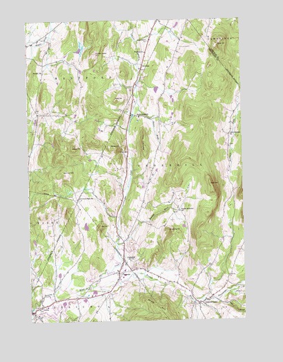
Underhill, VT USGS Topographic Map
Click on map above to begin viewing in our Map Viewer.

This topographic map contains these locations and features:
Feature Name Type Latitude Longitude GNIS ID View Map
Browns River Middle SchoolSchoolN44.5192°W72.9444°2058403View Map
Buker HillSummitN44.6142°W72.8879°1456631View Map
Calvary Episopal ChurchChurchN44.5214°W72.9462°2058402View Map
Cap HillSummitN44.5389°W72.9587°1456763View Map
Castle CemeteryCemeteryN44.5124°W72.9582°1918588View Map
Clay BrookStreamN44.5087°W72.8926°1456911View Map
CloverdalePopulated PlaceN44.6064°W72.9312°1456927View Map
Creek SchoolSchoolN44.5703°W72.9412°1457056View Map
Davis Private AirportAirportN44.5165°W72.9815°1461933View Map
Deborah Rawson Memorial LibraryBuildingN44.5181°W72.9460°2058404View Map
Delaporte Memorial LibraryBuildingN44.5076°W72.8998°1918634View Map
Duffy HillSummitN44.5920°W72.9476°1457209View Map
English Settlement SchoolSchoolN44.5456°W72.9115°1457371View Map
First United Pentecostal ChurchChurchN44.5053°W72.9937°2058420View Map
Flynn HillSummitN44.5567°W72.8935°1457463View Map
Good Shepherd Lutheran ChurchChurchN44.5120°W72.9571°2058409View Map
Governors Right SchoolSchoolN44.5512°W72.9701°1457590View Map
Hedgehog HillSummitN44.5373°W72.9182°1457792View Map
Irish Settlement CemeteryCemeteryN44.5727°W72.8824°1918729View Map
Irish Settlement SchoolSchoolN44.5776°W72.8823°1457974View Map
Jack Lot HillSummitN44.5612°W72.9793°1457981View Map
JerichoPopulated PlaceN44.5039°W72.9976°1458001View Map
Jericho Center Historic DistrictParkN44.5045°W72.9971°1918731View Map
Jericho Congregational ChurchChurchN44.5056°W72.9951°1918733View Map
Jericho Elementary SchoolSchoolN44.5059°W72.9901°1918735View Map
Jericho Post OfficePost OfficeN44.5067°W72.9918°1918736View Map
Jericho Town HallBuildingN44.5062°W72.9948°2058423View Map
Jericho United Methodist ChurchChurchN44.5062°W72.9940°2058417View Map
Lee RiverStreamN44.5017°W72.9987°1458187View Map
McLean HillSummitN44.5723°W72.9504°1458399View Map
Metcalf HillSummitN44.5709°W72.9304°1458424View Map
Morgan HillSummitN44.6031°W72.9949°1458536View Map
North UnderhillPopulated PlaceN44.5853°W72.9324°1458767View Map
North Underhill CemeteryCemeteryN44.6163°W72.9282°1458768View Map
North Underhill CemeteryCemeteryN44.5623°W72.9279°1918794View Map
Number Eleven HillSummitN44.6114°W72.9590°1458794View Map
Old Mill Museum and ParkParkN44.5048°W72.9987°1918803View Map
Old Red Mill and Mill House (historical)LocaleN44.5048°W72.9987°1918807View Map
Osgood Hill CemeteryCemeteryN44.5881°W72.9945°1918812View Map
Pleasant View CemeteryCemeteryN44.5049°W72.9933°1918734View Map
Poker Hill SchoolSchoolN44.5588°W72.9286°2427442View Map
RiversidePopulated PlaceN44.5203°W72.9476°1459199View Map
Roaring BrookStreamN44.5312°W72.9485°1459213View Map
Saint Thomas Catholic ChurchChurchN44.5067°W72.9001°1918862View Map
Saint Thomas CemeteryCemeteryN44.5066°W72.9054°1918861View Map
Sand Hill CemeteryCemeteryN44.5111°W72.9055°1918865View Map
Saxon Hill Cooperative SchoolSchoolN44.5050°W73.0000°2427425View Map
South HillSummitN44.5059°W72.9279°1459591View Map
South Hill Riverside CampgroundLocaleN44.5159°W72.9476°1918892View Map
Stevensville BrookStreamN44.5117°W72.8840°1459708View Map
Stewart HillSummitN44.5720°W72.9740°1459709View Map
The CreekStreamN44.5148°W72.9615°1459850View Map
Town of UnderhillCivilN44.5383°W72.8861°1462232View Map
UnderhillPopulated PlaceN44.5259°W72.9451°1459983View Map
Underhill CenterPopulated PlaceN44.5076°W72.8996°1459984View Map
Underhill Center Post OfficePost OfficeN44.5073°W72.9019°1918918View Map
Underhill Central SchoolSchoolN44.5104°W72.8936°1918917View Map
Underhill Flats CemeteryCemeteryN44.5216°W72.9406°1918919View Map
Underhill ID Elementary SchoolSchoolN44.5180°W72.9456°1918920View Map
Underhill Jericho Fire DepartmentBuildingN44.5276°W72.9444°2058401View Map
Underhill Post OfficePost OfficeN44.5226°W72.9417°1918921View Map
Underhill Town HallBuildingN44.5076°W72.8982°2058414View Map
United Christian AssemblyChurchN44.5176°W72.9565°2058406View Map
United Church of UnderhillChurchN44.5253°W72.9446°1918927View Map
Village of JerichoCivilN44.5049°W72.9878°2378310View Map
Villeneuve HeliportAirportN44.5159°W72.9507°1461963View Map
Waters Memorial LibraryBuildingN44.5323°W72.9473°1918942View Map
Westford SchoolSchoolN44.6114°W72.9293°1460182View Map

Note: Coordinates in the location and feature list above are referenced to NAD83 datum.


Copyright (C) 2008-2024 Ryan Niemi / Sunset Dynamics ... All Rights Reserved