TopoQuest Logo
Do you find TopoQuest useful?
Help keep TopoQuest running and adding new maps/features by donating!
Bitcoin:  19c7KJd3qBynnjoSw5npx9KScwjBe4ifkT
Litecoin:  LXs6TkuXGGXo1vDsWCkWVdjQX94eUKd6ui
Home View Maps Find Maps Find Places Resources & Links


Umbagog Lake South, New Hampshire Topographic Map

USGS Map Title: Umbagog Lake South, NH
USGS Map MRC: 44071F1
DRG (GeoTIFF) Download: o44071f1.tif


Neighboring USGS Topographic Map Quads:


  Errol, NH  
44071G2
 

  Umbagog Lake North, NH  
44071G1
 

  Middle Dam, ME  
44070G8
 

  Teakettle Ridge, NH  
44071F2
 

  Umbagog Lake South, NH  
44071F1
 

  B Pond, ME  
44070F8
 

  Milan, NH  
44071E2
 

  Success Pond, NH  
44071E1
 

  Old Speck Mountain, ME  
44070E8


Map MRC Location:

N45°
W72°
N45°
W71°
H8 H7 H6 H5 H4 H3 H2 H1
G8 G7 G6 G5 G4 G3 G2 G1
F8 F7 F6 F5 F4 F3 F2 F1
E8 E7 E6 E5 E4 E3 E2 E1
D8 D7 D6 D5 D4 D3 D2 D1
C8 C7 C6 C5 C4 C3 C2 C1
B8 B7 B6 B5 B4 B3 B2 B1
A8 A7 A6 A5 A4 A3 A2 A1
N44°
W72°
N44°
W71°

Umbagog Lake South, NH USGS 1:24K Topographic Map Preview:
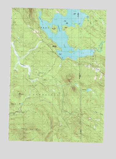
Umbagog Lake South, NH USGS Topographic Map
Click on map above to begin viewing in our Map Viewer.

This topographic map contains these locations and features:
Feature Name Type Latitude Longitude GNIS ID View Map
Bear IslandIslandN44.7384°W71.0562°865448View Map
Big IslandIslandN44.7306°W71.0695°865578View Map
Blake IslandIslandN44.7353°W71.0520°865650View Map
Cambridge Black MountainSummitN44.6353°W71.0923°865914View Map
Dead Cambridge RiverStreamN44.7126°W71.0173°564869View Map
Hampshire HillsSummitN44.6742°W71.0404°867340View Map
Little Roundtop MountainSummitN44.6681°W71.1137°868090View Map
Metallak IslandIslandN44.7451°W71.0434°873201View Map
Mill MountainSummitN44.7476°W71.1026°868449View Map
Mollidgewock PondLakeN44.6746°W71.0213°571487View Map
Mud PondLakeN44.6601°W71.1087°868649View Map
Roundtop MountainSummitN44.6587°W71.1231°869623View Map
Sargent CoveBayN44.7073°W71.0579°869789View Map
Thurston CoveBayN44.7348°W71.0845°870433View Map
Tidswell PointCapeN44.7295°W71.0492°870437View Map
Township of CambridgeCivilN44.6587°W71.1069°873555View Map
Tyler BrookStreamN44.7420°W71.0242°577515View Map
Tyler CoveBayN44.7442°W71.0298°577517View Map
UptonPopulated PlaceN44.6942°W71.0106°577675View Map

Note: Coordinates in the location and feature list above are referenced to NAD83 datum.


Copyright (C) 2008-2024 Ryan Niemi / Sunset Dynamics ... All Rights Reserved