TopoQuest Logo
Do you find TopoQuest useful?
Help keep TopoQuest running and adding new maps/features by donating!
Bitcoin:  19c7KJd3qBynnjoSw5npx9KScwjBe4ifkT
Litecoin:  LXs6TkuXGGXo1vDsWCkWVdjQX94eUKd6ui
Home View Maps Find Maps Find Places Resources & Links


Bluff Creek, Louisiana Topographic Map

USGS Map Title: Bluff Creek, LA
USGS Map MRC: 30090G8
DRG (GeoTIFF) Download: o30090g8.tif


Neighboring USGS Topographic Map Quads:


  Wilson, LA  
30091H1
 

  Felps, LA  
30090H8
 

  Chipola, LA  
30090H7
 

  Clinton, LA  
30091G1
 

  Bluff Creek, LA  
30090G8
 

  Hatchersville, LA  
30090G7
 

  Fred, LA  
30091F1
 

  Pride, LA  
30090F8
 

  Pine Grove, LA  
30090F7


Map MRC Location:

N31°
W91°
N31°
W90°
H8 H7 H6 H5 H4 H3 H2 H1
G8 G7 G6 G5 G4 G3 G2 G1
F8 F7 F6 F5 F4 F3 F2 F1
E8 E7 E6 E5 E4 E3 E2 E1
D8 D7 D6 D5 D4 D3 D2 D1
C8 C7 C6 C5 C4 C3 C2 C1
B8 B7 B6 B5 B4 B3 B2 B1
A8 A7 A6 A5 A4 A3 A2 A1
N30°
W91°
N30°
W90°

Bluff Creek, LA USGS 1:24K Topographic Map Preview:
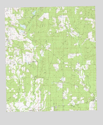
Bluff Creek, LA USGS Topographic Map
Click on map above to begin viewing in our Map Viewer.

This topographic map contains these locations and features:
Feature Name Type Latitude Longitude GNIS ID View Map
Avondale Boy Scout LakeReservoirN30.8683°W90.9593°556771View Map
Avondale Boy Scout Lake DamDamN30.8668°W90.9601°556770View Map
BlairstownPopulated PlaceN30.7527°W90.9626°553708View Map
Bluff Creek Baptist ChurchChurchN30.7626°W90.8788°2601409View Map
Bluff Creek Volunteer Fire DepartmentBuildingN30.7621°W90.8811°2332473View Map
Booker CemeteryCemeteryN30.8074°W90.9009°533324View Map
Cobb BranchStreamN30.8385°W90.9626°534013View Map
De Armond CemeteryCemeteryN30.8655°W90.9559°534422View Map
Gilead CemeteryCemeteryN30.8352°W90.8851°535215View Map
Gilead Church (historical)ChurchN30.8352°W90.8848°550115View Map
Haney CemeteryCemeteryN30.7963°W90.9465°535517View Map
Horton BayouStreamN30.8330°W90.8998°535819View Map
Hunter BayouStreamN30.8080°W90.9551°554803View Map
Idlewild LakeReservoirN30.8098°W90.9708°556774View Map
Idlewild Lake DamDamN30.8085°W90.9684°556773View Map
Independence Church (historical)ChurchN30.8107°W90.9357°550121View Map
Irwin CemeteryCemeteryN30.7638°W90.9984°535949View Map
Lipscomb CemeteryCemeteryN30.7532°W90.9932°536469View Map
Louisiana State University Experiment StationLocaleN30.8127°W90.9659°556650View Map
Lutheran Church (historical)ChurchN30.8077°W90.9862°550130View Map
McGee Lake DamDamN30.8452°W90.9734°556772View Map
McQuinney BranchStreamN30.7760°W90.8848°537019View Map
Nesom (historical)Populated PlaceN30.8074°W90.9195°550134View Map
Nesom CemeteryCemeteryN30.7863°W90.9234°537540View Map
Nesom Pond DamDamN30.7885°W90.9201°556775View Map
New Zion CemeteryCemeteryN30.7657°W90.9220°537639View Map
New Zion ChurchChurchN30.7713°W90.9215°537643View Map
Parish Governing Authority District 6CivilN30.8498°W90.9030°1930132View Map
Precinct SchoolSchoolN30.7810°W90.9073°538394View Map
Richards BayouStreamN30.7635°W90.9873°538583View Map
Roberts BayouStreamN30.8293°W90.9607°538635View Map
Saint Johns ChurchChurchN30.8516°W90.9248°538892View Map
Stone BayouStreamN30.8466°W90.9668°539679View Map
Sunbeam (historical)Populated PlaceN30.7566°W90.9220°550143View Map
Wall School (historical)SchoolN30.7577°W90.9045°550148View Map
Ward SixCivilN30.7985°W90.9009°545018View Map
White BayouStreamN30.8388°W90.8979°540356View Map
Willis PondLakeN30.7567°W90.9074°540447View Map

Note: Coordinates in the location and feature list above are referenced to NAD83 datum.


Copyright (C) 2008-2024 Ryan Niemi / Sunset Dynamics ... All Rights Reserved