TopoQuest Logo
Do you find TopoQuest useful?
Help keep TopoQuest running and adding new maps/features by donating!
Bitcoin:  19c7KJd3qBynnjoSw5npx9KScwjBe4ifkT
Litecoin:  LXs6TkuXGGXo1vDsWCkWVdjQX94eUKd6ui
Home View Maps Find Maps Find Places Resources & Links


Trout Lake, Washington Topographic Map

USGS Map Title: Trout Lake, WA
USGS Map MRC: 46121A5
DRG (GeoTIFF) Download: o46121a5.tif


Neighboring USGS Topographic Map Quads:


  Steamboat Mountain, WA  
46121B6
 

  Mount Adams West, WA  
46121B5
 

  Mount Adams East, WA  
46121B4
 

  Sleeping Beauty, WA  
46121A6
 

  Trout Lake, WA  
46121A5
 

  King Mountain, WA  
46121A4
 

  Little Huckleberry Mountain, WA  
45121H6
 

  Guler Mountain, WA  
45121H5
 

  Quigley Butte, WA  
45121H4


Map MRC Location:

N47°
W122°
N47°
W121°
H8 H7 H6 H5 H4 H3 H2 H1
G8 G7 G6 G5 G4 G3 G2 G1
F8 F7 F6 F5 F4 F3 F2 F1
E8 E7 E6 E5 E4 E3 E2 E1
D8 D7 D6 D5 D4 D3 D2 D1
C8 C7 C6 C5 C4 C3 C2 C1
B8 B7 B6 B5 B4 B3 B2 B1
A8 A7 A6 A5 A4 A3 A2 A1
N46°
W122°
N46°
W121°

Trout Lake, WA USGS 1:24K Topographic Map Preview:
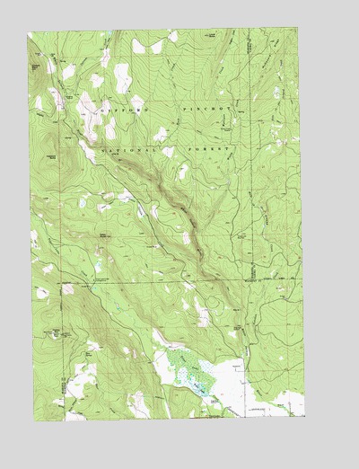
Trout Lake, WA USGS Topographic Map
Click on map above to begin viewing in our Map Viewer.

This topographic map contains these locations and features:
Feature Name Type Latitude Longitude GNIS ID View Map
Bear SpringSpringN46.0211°W121.6025°1516293View Map
Buck CreekStreamN46.0754°W121.5665°1517028View Map
Cakey ButteSummitN46.0587°W121.5912°1517212View Map
Cascade CreekStreamN46.1040°W121.6084°1517442View Map
Crofton CreekStreamN46.1182°W121.5334°1518333View Map
East Flattop LookoutLocaleN46.0165°W121.6120°1530304View Map
Eckhart PointSummitN46.1126°W121.6245°1519177View Map
Flattop MountainSummitN46.0282°W121.6140°1519646View Map
Gotchen CreekStreamN46.0085°W121.5087°1520167View Map
Green CanyonValleyN46.0493°W121.5487°1530132View Map
Green Canyon CreekStreamN46.0490°W121.5484°1520286View Map
Haystack ButteSummitN46.0843°W121.6134°1520627View Map
Hole in the Ground CreekStreamN46.0385°W121.5198°1520861View Map
Hollenbeck Landing Strip (historical)AirportN46.0018°W121.5334°1534176View Map
Klickitat County Fire District 1BuildingN46.0013°W121.5462°2643341View Map
Lower ButteSummitN46.1223°W121.5426°1522531View Map
McDonald RidgeRidgeN46.1235°W121.5090°1522892View Map
Morrison CreekStreamN46.0760°W121.5343°1523375View Map
Morrison Creek Horse CampLocaleN46.1221°W121.5179°1529578View Map
Mount Adams Forest CampLocaleN46.0146°W121.5270°1534103View Map
Ninefoot CreekStreamN46.0960°W121.6056°1523668View Map
Trout LakeLakeN46.0099°W121.5493°1527409View Map
Trout Lake AirportAirportN46.0024°W121.5216°1534002View Map
Trout Lake Big TreeLocaleN46.0585°W121.5304°1527416View Map
Trout Lake Creek CampgroundLocaleN46.0448°W121.5970°1527419View Map
West Flattop LookoutLocaleN46.0282°W121.6165°1530268View Map
Wicky CreekStreamN46.0604°W121.5504°1528116View Map
Wicky Creek ShelterLocaleN46.0923°W121.5331°1528117View Map

Note: Coordinates in the location and feature list above are referenced to NAD83 datum.


Copyright (C) 2008-2024 Ryan Niemi / Sunset Dynamics ... All Rights Reserved