TopoQuest Logo
Do you find TopoQuest useful?
Help keep TopoQuest running and adding new maps/features by donating!
Bitcoin:  19c7KJd3qBynnjoSw5npx9KScwjBe4ifkT
Litecoin:  LXs6TkuXGGXo1vDsWCkWVdjQX94eUKd6ui
Home View Maps Find Maps Find Places Resources & Links


Trinity Mountain, California Topographic Map

USGS Map Title: Trinity Mountain, CA
USGS Map MRC: 41123A4
DRG (GeoTIFF) Download: o41123a4.tif


Neighboring USGS Topographic Map Quads:


  Hopkins Butte, CA  
41123B5
 

  Salmon Mountain, CA  
41123B4
 

  Youngs Peak, CA  
41123B3
 

  Tish Tang Point, CA  
41123A5
 

  Trinity Mountain, CA  
41123A4
 

  Dees Peak, CA  
41123A3
 

  Salyer, CA  
40123H5
 

  Denny, CA  
40123H4
 

  Jim Jam Ridge, CA  
40123H3


Map MRC Location:

N42°
W124°
N42°
W123°
H8 H7 H6 H5 H4 H3 H2 H1
G8 G7 G6 G5 G4 G3 G2 G1
F8 F7 F6 F5 F4 F3 F2 F1
E8 E7 E6 E5 E4 E3 E2 E1
D8 D7 D6 D5 D4 D3 D2 D1
C8 C7 C6 C5 C4 C3 C2 C1
B8 B7 B6 B5 B4 B3 B2 B1
A8 A7 A6 A5 A4 A3 A2 A1
N41°
W124°
N41°
W123°

Trinity Mountain, CA USGS 1:24K Topographic Map Preview:
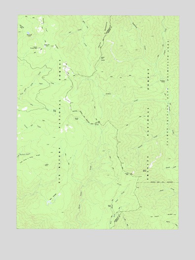
Trinity Mountain, CA USGS Topographic Map
Click on map above to begin viewing in our Map Viewer.

This topographic map contains these locations and features:
Feature Name Type Latitude Longitude GNIS ID View Map
Bell SwampsSwampN41.0182°W123.4714°254598View Map
Bret CreekStreamN41.0757°W123.4995°219797View Map
Bret HoleFlatN41.0690°W123.4728°219805View Map
Crogan CreekStreamN41.0846°W123.4887°255001View Map
Crogan HoleBasinN41.0818°W123.4692°252344View Map
Deadman SpringSpringN41.0865°W123.3867°222128View Map
Devils HoleBasinN41.0640°W123.4562°222314View Map
Dot CreekStreamN41.1201°W123.4495°222533View Map
Eightmile CreekStreamN41.0965°W123.3937°223006View Map
Fawn ButteSummitN41.0340°W123.3998°1658529View Map
Fawn RidgeRidgeN41.0085°W123.3800°223417View Map
Graveyard PrairieFlatN41.0387°W123.4887°252340View Map
Grizzly CampLocaleN41.0135°W123.4284°224627View Map
Ladder RockPillarN41.0371°W123.4798°226739View Map
Langworthy CabinLocaleN41.0607°W123.3828°275952View Map
Lipps CampLocaleN41.0618°W123.4367°227180View Map
Mill Creek LakesLakeN41.1143°W123.4929°228708View Map
North Trinity MountainSummitN41.1057°W123.4851°229772View Map
One Mile SpringSpringN41.0990°W123.4364°276008View Map
Onemile CampLocaleN41.1001°W123.4364°230048View Map
Oregan CreekStreamN41.0846°W123.4892°276010View Map
Red Cap HoleFlatN41.1168°W123.4984°231316View Map
Soldier CreekStreamN41.0676°W123.3839°234861View Map
Trinity MountainSummitN41.0321°W123.4134°236550View Map
Trinity Summit Forest Service FacilityLocaleN41.0735°W123.4639°276005View Map
Water Dog LakesLakeN41.1070°W123.4803°237322View Map

Note: Coordinates in the location and feature list above are referenced to NAD83 datum.


Copyright (C) 2008-2024 Ryan Niemi / Sunset Dynamics ... All Rights Reserved