TopoQuest Logo
Do you find TopoQuest useful?
Help keep TopoQuest running and adding new maps/features by donating!
Bitcoin:  19c7KJd3qBynnjoSw5npx9KScwjBe4ifkT
Litecoin:  LXs6TkuXGGXo1vDsWCkWVdjQX94eUKd6ui
Home View Maps Find Maps Find Places Resources & Links


Treadwell, New York Topographic Map

USGS Map Title: Treadwell, NY
USGS Map MRC: 42075C1
DRG (GeoTIFF) Download: o42075c1.tif


Neighboring USGS Topographic Map Quads:


  Otego, NY  
42075D2
 

  Oneonta, NY  
42075D1
 

  West Davenport, NY  
42074D8
 

  Franklin, NY  
42075C2
 

  Treadwell, NY  
42075C1
 

  Delhi, NY  
42074C8
 

  Walton West, NY  
42075B2
 

  Walton East, NY  
42075B1
 

  Hamden, NY  
42074B8


Map MRC Location:

N43°
W76°
N43°
W75°
H8 H7 H6 H5 H4 H3 H2 H1
G8 G7 G6 G5 G4 G3 G2 G1
F8 F7 F6 F5 F4 F3 F2 F1
E8 E7 E6 E5 E4 E3 E2 E1
D8 D7 D6 D5 D4 D3 D2 D1
C8 C7 C6 C5 C4 C3 C2 C1
B8 B7 B6 B5 B4 B3 B2 B1
A8 A7 A6 A5 A4 A3 A2 A1
N42°
W76°
N42°
W75°

Treadwell, NY USGS 1:24K Topographic Map Preview:
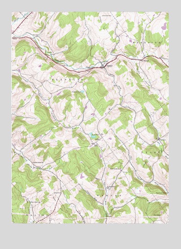
Treadwell, NY USGS Topographic Map
Click on map above to begin viewing in our Map Viewer.

This topographic map contains these locations and features:
Feature Name Type Latitude Longitude GNIS ID View Map
ArabiaPopulated PlaceN42.2998°W75.0552°972170View Map
Arabia CemeteryCemeteryN42.2992°W75.0551°2548270View Map
Bennett Hollow School (historical)SchoolN42.2859°W75.1082°943675View Map
Blue School (historical)SchoolN42.3615°W75.1041°944333View Map
Blueberry FieldAirportN42.2917°W75.0667°2443129View Map
Bourn PondLakeN42.3013°W75.0608°944497View Map
Chisholm PondLakeN42.3280°W75.0684°946594View Map
Croton Union CemeteryCemeteryN42.3447°W75.0501°947831View Map
Crystal BrookStreamN42.2618°W75.0510°947886View Map
Dunk HillSummitN42.2587°W75.0857°948798View Map
Freer Hollow School (historical)SchoolN42.2626°W75.1099°950674View Map
Goldsmith CemeteryCemeteryN42.2804°W75.0361°951298View Map
Jackson HillSummitN42.3729°W75.0529°970242View Map
Lumbert HillSummitN42.2856°W75.0199°956149View Map
Milk And Maple FarmLocaleN42.3628°W75.1033°2557740View Map
MundalePopulated PlaceN42.2548°W75.0496°972825View Map
North Hamden School (historical)SchoolN42.2823°W75.0385°958802View Map
Poverty HollowValleyN42.3467°W75.0279°961069View Map
Roaring BrookStreamN42.3451°W75.0538°962627View Map
School Number 11 (historical)SchoolN42.2970°W75.0596°974967View Map
School Number 5 (historical)SchoolN42.2681°W75.0854°964605View Map
Stony Creek FarmLocaleN42.2522°W75.1058°2560305View Map
Stoodley Hollow School (historical)SchoolN42.2712°W75.0496°966598View Map
The CobbleSummitN42.2554°W75.0096°967219View Map
Town of FranklinCivilN42.3335°W75.1112°978970View Map
TreadwellPopulated PlaceN42.3423°W75.0513°967774View Map
Treadwell Fire DepartmentBuildingN42.3421°W75.0508°2718446View Map
Treadwell United Methodist ChurchChurchN42.3432°W75.0529°2616357View Map
Waterman PeakSummitN42.3729°W75.0529°970751View Map
West DelhiPopulated PlaceN42.2995°W75.0082°973226View Map
West Delhi CemeteryCemeteryN42.3004°W75.0077°2508030View Map
West Delhi Presbyterian ChurchChurchN42.3000°W75.0075°2508029View Map
West MeredithPopulated PlaceN42.3465°W75.0227°973244View Map
West Meredith CemeteryCemeteryN42.3467°W75.0262°2548271View Map

Note: Coordinates in the location and feature list above are referenced to NAD83 datum.


Copyright (C) 2008-2024 Ryan Niemi / Sunset Dynamics ... All Rights Reserved