TopoQuest Logo
Do you find TopoQuest useful?
Help keep TopoQuest running and adding new maps/features by donating!
Bitcoin:  19c7KJd3qBynnjoSw5npx9KScwjBe4ifkT
Litecoin:  LXs6TkuXGGXo1vDsWCkWVdjQX94eUKd6ui
Home View Maps Find Maps Find Places Resources & Links


Trade River, Wisconsin Topographic Map

USGS Map Title: Trade River, WI
USGS Map MRC: 45092F6
DRG (GeoTIFF) Download: o45092f6.tif


Neighboring USGS Topographic Map Quads:


  Bass Creek, MN  
45092G7
 

  Grantsburg, WI  
45092G6
 

  Falun, WI  
45092G5
 

  Randall, WI  
45092F7
 

  Trade River, WI  
45092F6
 

  Trade Lake, WI  
45092F5
 

  Sunrise, MN  
45092E7
 

  Cushing, WI  
45092E6
 

  Milltown, WI  
45092E5


Map MRC Location:

N46°
W93°
N46°
W92°
H8 H7 H6 H5 H4 H3 H2 H1
G8 G7 G6 G5 G4 G3 G2 G1
F8 F7 F6 F5 F4 F3 F2 F1
E8 E7 E6 E5 E4 E3 E2 E1
D8 D7 D6 D5 D4 D3 D2 D1
C8 C7 C6 C5 C4 C3 C2 C1
B8 B7 B6 B5 B4 B3 B2 B1
A8 A7 A6 A5 A4 A3 A2 A1
N45°
W93°
N45°
W92°

Trade River, WI USGS 1:24K Topographic Map Preview:
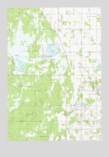
Trade River, WI USGS Topographic Map
Click on map above to begin viewing in our Map Viewer.

This topographic map contains these locations and features:
Feature Name Type Latitude Longitude GNIS ID View Map
Anderson TownhallBuildingN45.6861°W92.7127°1843092View Map
Bass LakeLakeN45.6944°W92.6284°1561254View Map
Bethany ChurchChurchN45.7288°W92.6821°1561623View Map
BranstadPopulated PlaceN45.7375°W92.6830°1562155View Map
Branstad SchoolSchoolN45.7447°W92.6816°1562156View Map
Canute Creek FlowageReservoirN45.7098°W92.6925°1793590View Map
Circle T AirportAirportN45.6838°W92.6893°2444135View Map
Daniels FlowageReservoirN45.7039°W92.7011°1843117View Map
Dueholm FlowageReservoirN45.6921°W92.7355°1843123View Map
Fish Lake Canute Flowage G12.410 DamDamN45.7066°W92.6885°1793589View Map
Fish Lake Pines State Natural AreaParkN45.7108°W92.7213°2061901View Map
Fish Lake State Wildlife AreaParkN45.7125°W92.7210°1843114View Map
Grettum SchoolSchoolN45.7086°W92.6802°1565896View Map
Holmes LakeLakeN45.6583°W92.6488°1566563View Map
Holmes Lake OrchardLocaleN45.6547°W92.6511°2611792View Map
Isaac LakeLakeN45.7191°W92.6371°1843134View Map
Little Holmes LakeLakeN45.6566°W92.6584°1843143View Map
Logging CreekStreamN45.6402°W92.7472°1568498View Map
Logging Creek CemeteryCemeteryN45.6755°W92.7335°1843144View Map
Logging Creek Dike H12.395 DamDamN45.6916°W92.7419°1793393View Map
Logging Creek Flowage 6ReservoirN45.6909°W92.7407°1793394View Map
Lone Pine LakeLakeN45.6384°W92.6360°1568508View Map
North Fork Trade RiverStreamN45.6569°W92.6927°1577435View Map
Saint Olaf CemeteryCemeteryN45.7277°W92.6891°1843174View Map
Trade RiverPopulated PlaceN45.6483°W92.6727°1575565View Map
Trade River SchoolSchoolN45.6575°W92.6730°1575567View Map
Wood River SchoolSchoolN45.7438°W92.6313°1576976View Map

Note: Coordinates in the location and feature list above are referenced to NAD83 datum.


Copyright (C) 2008-2024 Ryan Niemi / Sunset Dynamics ... All Rights Reserved