TopoQuest Logo
Do you find TopoQuest useful?
Help keep TopoQuest running and adding new maps/features by donating!
Bitcoin:  19c7KJd3qBynnjoSw5npx9KScwjBe4ifkT
Litecoin:  LXs6TkuXGGXo1vDsWCkWVdjQX94eUKd6ui
Home View Maps Find Maps Find Places Resources & Links


Tomahawk, North Carolina Topographic Map

USGS Map Title: Tomahawk, NC
USGS Map MRC: 34078F3
DRG (GeoTIFF) Download: o34078f3.tif


Neighboring USGS Topographic Map Quads:


  Garland, NC  
34078G4
 

  Ingold, NC  
34078G3
 

  Delway, NC  
34078G2
 

  White Lake, NC  
34078F4
 

  Tomahawk, NC  
34078F3
 

  Harrells, NC  
34078F2
 

  Singletary Lake, NC  
34078E4
 

  Rowan, NC  
34078E3
 

  Atkinson, NC  
34078E2


Map MRC Location:

N35°
W79°
N35°
W78°
H8 H7 H6 H5 H4 H3 H2 H1
G8 G7 G6 G5 G4 G3 G2 G1
F8 F7 F6 F5 F4 F3 F2 F1
E8 E7 E6 E5 E4 E3 E2 E1
D8 D7 D6 D5 D4 D3 D2 D1
C8 C7 C6 C5 C4 C3 C2 C1
B8 B7 B6 B5 B4 B3 B2 B1
A8 A7 A6 A5 A4 A3 A2 A1
N34°
W79°
N34°
W78°

Tomahawk, NC USGS 1:24K Topographic Map Preview:
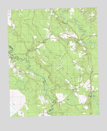
Tomahawk, NC USGS Topographic Map
Click on map above to begin viewing in our Map Viewer.

This topographic map contains these locations and features:
Feature Name Type Latitude Longitude GNIS ID View Map
Baylam CemeteryCemeteryN34.6943°W78.3022°980663View Map
Big BranchStreamN34.7346°W78.2808°1025145View Map
Big IslandIslandN34.6316°W78.3608°1025149View Map
Big Tomahawk CreekStreamN34.7029°W78.3406°1025158View Map
Bloody BluffCliffN34.6491°W78.2606°981606View Map
Canty Mill CreekStreamN34.7096°W78.2608°1025219View Map
Clear Run Middle SchoolSchoolN34.7454°W78.3119°1006933View Map
Cobb BranchStreamN34.7179°W78.2594°1025247View Map
Delta LandingLocaleN34.6496°W78.2581°1019948View Map
Devane BranchStreamN34.7068°W78.2667°1025282View Map
Dismal BaySwampN34.7033°W78.3020°984202View Map
Eb BaySwampN34.6793°W78.3008°984580View Map
Enoch Mill CreekStreamN34.6549°W78.3228°1025311View Map
Evening Light ChapelChurchN34.7218°W78.3636°984863View Map
Fennels CoveBayN34.7221°W78.2675°985050View Map
Fowler LandingPopulated PlaceN34.6821°W78.3481°1020340View Map
GingerberryFlatN34.6404°W78.3725°985708View Map
Harmony ChurchChurchN34.6549°W78.2847°1003694View Map
Herring CemeteryCemeteryN34.7460°W78.3108°986656View Map
Jackie LandingLocaleN34.6527°W78.2544°1020916View Map
Juniper BranchStreamN34.7341°W78.2789°1025441View Map
Keith BaySwampN34.6841°W78.2964°987892View Map
Kelso BayBasinN34.6679°W78.3697°1025452View Map
KerrPopulated PlaceN34.6563°W78.2819°987935View Map
Kerr CemeteryCemeteryN34.7113°W78.3442°987937View Map
Kerr MarshSwampN34.7110°W78.3653°987939View Map
Little Tomahawk CreekStreamN34.7029°W78.3406°1025485View Map
Memorial MonumentLocaleN34.6260°W78.3283°1003696View Map
Murphy BaySwampN34.6377°W78.3583°990803View Map
Murphy ChapelChurchN34.6779°W78.3589°1003697View Map
MurphytownPopulated PlaceN34.6752°W78.3533°1021590View Map
Newkirk Lookout TowerTowerN34.6954°W78.2642°1023701View Map
Newton CemeteryCemeteryN34.6702°W78.3189°991140View Map
Pilgrim Rest ChurchChurchN34.6596°W78.2828°1003695View Map
Pridgen FlatsFlatN34.6418°W78.2922°992816View Map
Riverside ChurchChurchN34.6918°W78.3719°993388View Map
Rocky BranchStreamN34.7082°W78.2733°1025654View Map
Sloans BaySwampN34.6266°W78.3700°994918View Map
Smith CrossroadsPopulated PlaceN34.6943°W78.3742°1025713View Map
Sutton CemeteryCemeteryN34.6899°W78.3675°995728View Map
TomahawkPopulated PlaceN34.7113°W78.3275°996137View Map
Tomahawk ChurchChurchN34.7116°W78.3303°1003692View Map
Tomahawk CreekStreamN34.6921°W78.3503°1025754View Map
Trinity ChurchChurchN34.7129°W78.3258°996231View Map
Trueway ChurchChurchN34.6752°W78.2592°1003693View Map

Note: Coordinates in the location and feature list above are referenced to NAD83 datum.


Copyright (C) 2008-2024 Ryan Niemi / Sunset Dynamics ... All Rights Reserved