TopoQuest Logo
Do you find TopoQuest useful?
Help keep TopoQuest running and adding new maps/features by donating!
Bitcoin:  19c7KJd3qBynnjoSw5npx9KScwjBe4ifkT
Litecoin:  LXs6TkuXGGXo1vDsWCkWVdjQX94eUKd6ui
Home View Maps Find Maps Find Places Resources & Links


Tipton, California Topographic Map

USGS Map Title: Tipton, CA
USGS Map MRC: 36119A3
DRG (GeoTIFF) Download: o36119a3.tif


Neighboring USGS Topographic Map Quads:


  Paige, CA  
36119B4
 

  Tulare, CA  
36119B3
 

  Cairns Corner, CA  
36119B2
 

  Taylor Weir, CA  
36119A4
 

  Tipton, CA  
36119A3
 

  Woodville, CA  
36119A2
 

  Alpaugh, CA  
35119H4
 

  Pixley, CA  
35119H3
 

  Sausalito School, CA  
35119H2


Map MRC Location:

N37°
W120°
N37°
W119°
H8 H7 H6 H5 H4 H3 H2 H1
G8 G7 G6 G5 G4 G3 G2 G1
F8 F7 F6 F5 F4 F3 F2 F1
E8 E7 E6 E5 E4 E3 E2 E1
D8 D7 D6 D5 D4 D3 D2 D1
C8 C7 C6 C5 C4 C3 C2 C1
B8 B7 B6 B5 B4 B3 B2 B1
A8 A7 A6 A5 A4 A3 A2 A1
N36°
W120°
N36°
W119°

Tipton, CA USGS 1:24K Topographic Map Preview:
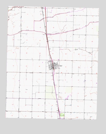
Tipton, CA USGS Topographic Map
Click on map above to begin viewing in our Map Viewer.

This topographic map contains these locations and features:
Feature Name Type Latitude Longitude GNIS ID View Map
A and R Vieira DairyLocaleN36.0639°W119.3658°2681423View Map
Alfac (historical)Populated PlaceN36.0319°W119.3082°1661882View Map
Atsma DairyLocaleN36.0056°W119.3253°2681428View Map
Aukeman Farms DairyLocaleN36.1033°W119.3697°2701871View Map
Borba DairyLocaleN36.0578°W119.2731°2681510View Map
Borges DairyLocaleN36.0861°W119.2703°2681511View Map
Bosma DairyLocaleN36.0764°W119.2633°2701879View Map
Codorniz DairyLocaleN36.1153°W119.3606°2681512View Map
Edendale School (historical)SchoolN36.0080°W119.2512°1661892View Map
El Monte DairyLocaleN36.0836°W119.3364°2701963View Map
F M Ranch Dairy Number 1LocaleN36.0936°W119.3289°2681521View Map
Faria Farms DairyLocaleN36.0425°W119.2706°2701966View Map
Five Star DairyLocaleN36.0281°W119.2531°2681422View Map
Hanby School (historical)SchoolN36.1080°W119.3221°1661896View Map
Hettinga Farms DairyLocaleN36.0114°W119.2728°2702220View Map
J and A DairyLocaleN36.1111°W119.2983°2702225View Map
J R DairyLocaleN36.0319°W119.3356°2702226View Map
M and L DairyLocaleN36.0342°W119.3058°2681607View Map
Mitchell SloughStreamN36.0780°W119.3034°246044View Map
North Branch Tule RiverStreamN36.0980°W119.3393°246595View Map
OctolPopulated PlaceN36.1238°W119.3284°252949View Map
P and M DairyLocaleN36.0781°W119.3603°2681634View Map
Par DairyLocaleN36.1206°W119.3158°2702270View Map
Piers DairyLocaleN36.0681°W119.2706°2681636View Map
QuailPopulated PlaceN36.0097°W119.3034°1661267View Map
Rib - Arrow DairyLocaleN36.1214°W119.2722°2702299View Map
Ribeiro DairyLocaleN36.1147°W119.2906°2702300View Map
Saint Johns SchoolSchoolN36.0569°W119.3068°1835775View Map
Scheenstra DairyLocaleN36.0942°W119.3447°2702307View Map
South Branch Tule RiverStreamN36.0977°W119.3390°249686View Map
Surprise School (historical)SchoolN36.1233°W119.2504°1661918View Map
TiptonPopulated PlaceN36.0594°W119.3121°1652801View Map
Tipton Branch Tulare County LibraryBuildingN36.0608°W119.3107°1835783View Map
Tipton CemeteryCemeteryN36.0505°W119.3401°250504View Map
Tipton Census Designated PlaceCensusN36.0585°W119.3130°2409325View Map
Tipton DivisionCivilN36.0526°W119.3262°1935341View Map
Tipton Elementary SchoolSchoolN36.0622°W119.3098°1835784View Map
Tipton Post OfficePost OfficeN36.0608°W119.3132°2781000View Map
Tipton United Methodist ChurchChurchN36.0625°W119.3109°1835785View Map
Top of the Morn Farms DairyLocaleN36.1036°W119.2636°2702314View Map
Triple V DairyLocaleN36.1178°W119.3333°2681685View Map
Tulare County Fire Department Battalion 2 Tipton Fire Station 26BuildingN36.0576°W119.3124°2624422View Map
Tule River DairyLocaleN36.0717°W119.3622°2702316View Map
Vanderham West DairyLocaleN36.0383°W119.3514°2702322View Map
Veterans Memorial BuildingBuildingN36.0586°W119.3065°1835790View Map

Note: Coordinates in the location and feature list above are referenced to NAD83 datum.


Copyright (C) 2008-2024 Ryan Niemi / Sunset Dynamics ... All Rights Reserved