TopoQuest Logo
Do you find TopoQuest useful?
Help keep TopoQuest running and adding new maps/features by donating!
Bitcoin:  19c7KJd3qBynnjoSw5npx9KScwjBe4ifkT
Litecoin:  LXs6TkuXGGXo1vDsWCkWVdjQX94eUKd6ui
Home View Maps Find Maps Find Places Resources & Links


Tidbits Mountain, Oregon Topographic Map

USGS Map Title: Tidbits Mountain, OR
USGS Map MRC: 44122C3
DRG (GeoTIFF) Download: o44122c3.tif


Neighboring USGS Topographic Map Quads:


  Cascadia, OR  
44122D4
 

  Upper Soda, OR  
44122D3
 

  Harter Mountain, OR  
44122D2
 

  Swamp Mountain, OR  
44122C4
 

  Tidbits Mountain, OR  
44122C3
 

  Carpenter Mountain, OR  
44122C2
 

  Mount Hagan, OR  
44122B4
 

  Blue River, OR  
44122B3
 

  McKenzie Bridge, OR  
44122B2


Map MRC Location:

N45°
W123°
N45°
W122°
H8 H7 H6 H5 H4 H3 H2 H1
G8 G7 G6 G5 G4 G3 G2 G1
F8 F7 F6 F5 F4 F3 F2 F1
E8 E7 E6 E5 E4 E3 E2 E1
D8 D7 D6 D5 D4 D3 D2 D1
C8 C7 C6 C5 C4 C3 C2 C1
B8 B7 B6 B5 B4 B3 B2 B1
A8 A7 A6 A5 A4 A3 A2 A1
N44°
W123°
N44°
W122°

Tidbits Mountain, OR USGS 1:24K Topographic Map Preview:
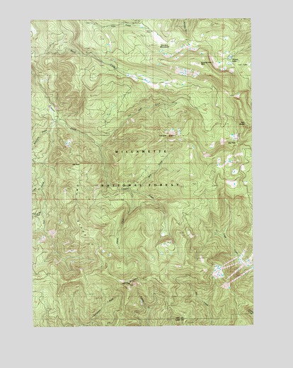
Tidbits Mountain, OR USGS Topographic Map
Click on map above to begin viewing in our Map Viewer.

This topographic map contains these locations and features:
Feature Name Type Latitude Longitude GNIS ID View Map
Bear PassGapN44.3240°W122.2601°1117392View Map
Boundary CreekStreamN44.3298°W122.3665°1117989View Map
Coley CreekStreamN44.3162°W122.3695°1159210View Map
Cul de Sac CreekStreamN44.2979°W122.3704°1133774View Map
Elbow CreekStreamN44.3051°W122.3209°1120422View Map
Gold Hill Trail (historical)TrailN44.2540°W122.3273°1121210View Map
Gordon LakesLakeN44.3582°W122.2626°1121259View Map
Gordon MeadowsFlatN44.3669°W122.3038°1121260View Map
Loon CreekStreamN44.3060°W122.3712°1159211View Map
Lost LakeLakeN44.3561°W122.2527°1123507View Map
Moe CreekStreamN44.3051°W122.3173°1124276View Map
Owl CreekStreamN44.3337°W122.3631°1125084View Map
Owl RidgeRidgeN44.2993°W122.3517°1125087View Map
Pipe RockPillarN44.3165°W122.3420°1147766View Map
Seventeen CreekStreamN44.2507°W122.3498°1135976View Map
Soapgrass MountainSummitN44.3568°W122.2815°1136763View Map
Tidbits MountainSummitN44.2676°W122.3190°1128087View Map
Twin ButtesSummitN44.3335°W122.2501°1136849View Map
Two GirlsSummitN44.3268°W122.2973°1128380View Map
Two Girls CreekStreamN44.3235°W122.3387°1128381View Map
Wet Horse CreekStreamN44.3262°W122.3334°1156432View Map

Note: Coordinates in the location and feature list above are referenced to NAD83 datum.


Copyright (C) 2008-2024 Ryan Niemi / Sunset Dynamics ... All Rights Reserved