TopoQuest Logo
Do you find TopoQuest useful?
Help keep TopoQuest running and adding new maps/features by donating!
Bitcoin:  19c7KJd3qBynnjoSw5npx9KScwjBe4ifkT
Litecoin:  LXs6TkuXGGXo1vDsWCkWVdjQX94eUKd6ui
Home View Maps Find Maps Find Places Resources & Links


Thornfield, Missouri Topographic Map

USGS Map Title: Thornfield, MO
USGS Map MRC: 36092F6
DRG (GeoTIFF) Download: o36092f6.tif


Neighboring USGS Topographic Map Quads:


  Brownbranch, MO  
36092G7
 

  Smallett, MO  
36092G6
 

  Wasola, MO  
36092G5
 

  Protem NE, MO  
36092F7
 

  Thornfield, MO  
36092F6
 

  Willhoit, MO  
36092F5
 

  Protem, MO  
36092E7
 

  Theodosia, MO  
36092E6
 

  Isabella, MO  
36092E5


Map MRC Location:

N37°
W93°
N37°
W92°
H8 H7 H6 H5 H4 H3 H2 H1
G8 G7 G6 G5 G4 G3 G2 G1
F8 F7 F6 F5 F4 F3 F2 F1
E8 E7 E6 E5 E4 E3 E2 E1
D8 D7 D6 D5 D4 D3 D2 D1
C8 C7 C6 C5 C4 C3 C2 C1
B8 B7 B6 B5 B4 B3 B2 B1
A8 A7 A6 A5 A4 A3 A2 A1
N36°
W93°
N36°
W92°

Thornfield, MO USGS 1:24K Topographic Map Preview:
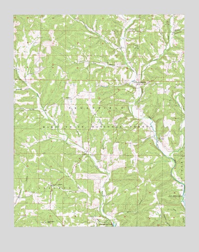
Thornfield, MO USGS Topographic Map
Click on map above to begin viewing in our Map Viewer.

This topographic map contains these locations and features:
Feature Name Type Latitude Longitude GNIS ID View Map
Bear BranchStreamN36.7491°W92.6703°748725View Map
Buttram HollowValleyN36.7064°W92.7382°749142View Map
Buzzard Roost HollowValleyN36.6703°W92.6268°749147View Map
Caney HollowValleyN36.6945°W92.7324°749195View Map
Dry HollowValleyN36.7201°W92.6685°749727View Map
Etuchee DamDamN36.7401°W92.7418°764056View Map
Etuchee LakeReservoirN36.7413°W92.7427°764057View Map
Graham CemeteryCemeteryN36.6459°W92.7346°750097View Map
HammondPopulated PlaceN36.6756°W92.6443°750206View Map
Hammond School (historical)SchoolN36.6812°W92.6460°733804View Map
Hay HollowValleyN36.6715°W92.6999°750260View Map
Igo School (historical)SchoolN36.6889°W92.7285°733802View Map
Little CreekStreamN36.7114°W92.6620°750759View Map
Long RunStreamN36.6370°W92.6877°750854View Map
LongrunPopulated PlaceN36.6492°W92.7232°750858View Map
Mount Lebanon ChurchChurchN36.7401°W92.6321°751181View Map
Mount Lebanon HollowValleyN36.7395°W92.6341°751182View Map
Mount Lebanon School (historical)SchoolN36.7401°W92.6329°733803View Map
Mount Pleasant School (historical)SchoolN36.7184°W92.6957°734284View Map
Northview School (historical)SchoolN36.6373°W92.6441°734286View Map
Otter CreekStreamN36.7295°W92.6716°751454View Map
Panther HollowValleyN36.6515°W92.6260°751487View Map
Pleasant ValleyValleyN36.6634°W92.6891°751671View Map
PondforkPopulated PlaceN36.7001°W92.7099°751704View Map
Thompson HollowValleyN36.6826°W92.6266°752533View Map
ThornfieldPopulated PlaceN36.7087°W92.6593°752535View Map
Thornfield Post OfficePost OfficeN36.7092°W92.6592°2783209View Map
Thornfield Volunteer Fire DepartmentBuildingN36.7094°W92.6596°2620843View Map
Township of LongrunCivilN36.6544°W92.7298°767131View Map
Township of ThornfieldCivilN36.7191°W92.6802°767138View Map
True Vine School (historical)SchoolN36.6651°W92.6896°733805View Map
Truevine CemeteryCemeteryN36.6670°W92.6918°752584View Map
Turkey CreekStreamN36.6656°W92.6371°752599View Map
Turkey Creek School (historical)SchoolN36.6709°W92.6324°734285View Map
United States Forest Service Fire TowerTowerN36.6281°W92.7263°753120View Map
Wallace CemeteryCemeteryN36.6434°W92.6835°752735View Map
Washington BaldSummitN36.6278°W92.7266°752772View Map
Wells HollowValleyN36.6303°W92.6777°752801View Map
Welsh CemeteryCemeteryN36.6742°W92.7077°752803View Map
White Star School (historical)SchoolN36.7126°W92.7424°733801View Map
Willhoit HollowValleyN36.6290°W92.6816°752908View Map

Note: Coordinates in the location and feature list above are referenced to NAD83 datum.


Copyright (C) 2008-2024 Ryan Niemi / Sunset Dynamics ... All Rights Reserved