TopoQuest Logo
Do you find TopoQuest useful?
Help keep TopoQuest running and adding new maps/features by donating!
Bitcoin:  19c7KJd3qBynnjoSw5npx9KScwjBe4ifkT
Litecoin:  LXs6TkuXGGXo1vDsWCkWVdjQX94eUKd6ui
Home View Maps Find Maps Find Places Resources & Links


Thorn Creek SE, Idaho Topographic Map

USGS Map Title: Thorn Creek SE, ID
USGS Map MRC: 43114A5
DRG (GeoTIFF) Download: o43114a5.tif


Neighboring USGS Topographic Map Quads:


  McHan Reservoir, ID  
43114B6
 

  Thorn Creek Reservoir, ID  
43114B5
 

  Summit Reservoir, ID  
43114B4
 

  Thorn Creek SW, ID  
43114A6
 

  Thorn Creek SE, ID  
43114A5
 

  Mammoth Cave, ID  
43114A4
 

  Gooding, ID  
42114H6
 

  Tunupa, ID  
42114H5
 

  Shoshone, ID  
42114H4


Map MRC Location:

N44°
W115°
N44°
W114°
H8 H7 H6 H5 H4 H3 H2 H1
G8 G7 G6 G5 G4 G3 G2 G1
F8 F7 F6 F5 F4 F3 F2 F1
E8 E7 E6 E5 E4 E3 E2 E1
D8 D7 D6 D5 D4 D3 D2 D1
C8 C7 C6 C5 C4 C3 C2 C1
B8 B7 B6 B5 B4 B3 B2 B1
A8 A7 A6 A5 A4 A3 A2 A1
N43°
W115°
N43°
W114°

Thorn Creek SE, ID USGS 1:24K Topographic Map Preview:
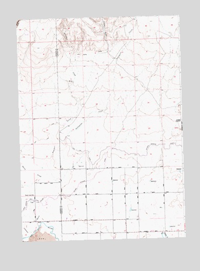
Thorn Creek SE, ID USGS Topographic Map
Click on map above to begin viewing in our Map Viewer.

This topographic map contains these locations and features:
Feature Name Type Latitude Longitude GNIS ID View Map
700 DrainCanalN43.0237°W114.5205°2707079View Map
Gooding ReservoirReservoirN43.0666°W114.5009°395420View Map
High Line CanalCanalN43.0499°W114.5723°373069View Map
Lateral 700CanalN43.0212°W114.5096°2729226View Map
Lateral 700A1CanalN43.0160°W114.5052°2729227View Map
Lateral 700BCanalN43.0120°W114.5209°2729228View Map
Lateral 900CanalN43.0442°W114.5258°2729722View Map
Lateral 916CanalN43.0121°W114.5956°2729728View Map
Lateral 916ACanalN43.0250°W114.5339°2729731View Map
Lateral 916BCanalN43.0358°W114.5436°2729733View Map
Lateral 916CCanalN43.0139°W114.5567°2729734View Map
Lateral 916C1CanalN43.0127°W114.5492°2729736View Map
Lateral 916C1ACanalN43.0125°W114.5502°2729738View Map
Lateral 916C1BCanalN43.0058°W114.5499°2729740View Map
Lateral 916C2CanalN43.0219°W114.5519°2729742View Map
Lateral 916C3CanalN43.0187°W114.5655°2729743View Map
Lateral 916C4CanalN43.0191°W114.5574°2729745View Map
Lateral 916DCanalN43.0185°W114.5989°2729747View Map
Lateral 916ECanalN43.0255°W114.5550°2729749View Map
Lateral 916SCanalN43.0319°W114.5630°2729751View Map
Lateral 992CanalN43.0476°W114.5353°2729762View Map
Lateral 993ACanalN43.0409°W114.5697°2729763View Map
Lateral 993BCanalN43.0474°W114.5850°2729764View Map
Lateral HCanalN43.0033°W114.5029°2729773View Map
Patterson DamDamN43.1232°W114.5325°398646View Map
Portuguese CreekStreamN43.0516°W114.5978°374512View Map
Preacher CreekStreamN43.0341°W114.6062°374530View Map
Shoshone City Rural Fire District Station 2BuildingN43.0253°W114.5504°2619227View Map
Thorn CreekStreamN43.0091°W114.6123°375494View Map
Thorn Creek SchoolSchoolN43.0257°W114.6151°375497View Map
Thorne Creek Wildlife Habitat AreaReserveN43.1013°W114.6167°399272View Map
Timber GulchValleyN43.1066°W114.5550°375525View Map

Note: Coordinates in the location and feature list above are referenced to NAD83 datum.


Copyright (C) 2008-2024 Ryan Niemi / Sunset Dynamics ... All Rights Reserved