TopoQuest Logo
Do you find TopoQuest useful?
Help keep TopoQuest running and adding new maps/features by donating!
Bitcoin:  19c7KJd3qBynnjoSw5npx9KScwjBe4ifkT
Litecoin:  LXs6TkuXGGXo1vDsWCkWVdjQX94eUKd6ui
Home View Maps Find Maps Find Places Resources & Links


Thor Mountain, Idaho Topographic Map

USGS Map Title: Thor Mountain, ID
USGS Map MRC: 47115B5
DRG (GeoTIFF) Download: o47115b5.tif


Neighboring USGS Topographic Map Quads:


  Shefoot Mountain, ID  
47115C6
 

  Adair, ID  
47115C5
 

  McGee Peak, MT  
47115C4
 

  Three Sisters, ID  
47115B6
 

  Thor Mountain, ID  
47115B5
 

  Conrad Peak, ID  
47115B4
 

  Montana Peak, ID  
47115A6
 

  Bathtub Mountain, ID  
47115A5
 

  Peggy Peak, ID  
47115A4


Map MRC Location:

N48°
W116°
N48°
W115°
H8 H7 H6 H5 H4 H3 H2 H1
G8 G7 G6 G5 G4 G3 G2 G1
F8 F7 F6 F5 F4 F3 F2 F1
E8 E7 E6 E5 E4 E3 E2 E1
D8 D7 D6 D5 D4 D3 D2 D1
C8 C7 C6 C5 C4 C3 C2 C1
B8 B7 B6 B5 B4 B3 B2 B1
A8 A7 A6 A5 A4 A3 A2 A1
N47°
W116°
N47°
W115°

Thor Mountain, ID USGS 1:24K Topographic Map Preview:
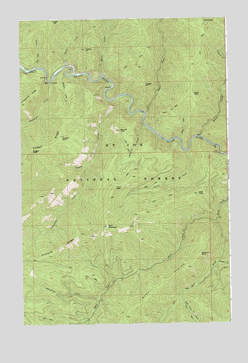
Thor Mountain, ID USGS Topographic Map
Click on map above to begin viewing in our Map Viewer.

This topographic map contains these locations and features:
Feature Name Type Latitude Longitude GNIS ID View Map
Adams PeakSummitN47.2494°W115.5135°397363View Map
Bad Luck CreekStreamN47.1377°W115.5293°376814View Map
Bennett CreekStreamN47.2058°W115.5513°377365View Map
Bennett PointSummitN47.2044°W115.5660°377372View Map
Bluff DivideRidgeN47.1277°W115.5638°377968View Map
Bluff PointSummitN47.1783°W115.5202°377969View Map
Bottle CreekStreamN47.2308°W115.5985°378057View Map
Bullet CreekStreamN47.2008°W115.5304°378487View Map
Dominion PointSummitN47.1533°W115.5185°397635View Map
Eagle CreekStreamN47.2110°W115.5510°380986View Map
Eagle PointSummitN47.2191°W115.5213°397665View Map
East Fork Bluff CreekStreamN47.1671°W115.5088°381058View Map
Fuzzy CreekStreamN47.1955°W115.5254°382134View Map
Fuzzy PeakCapeN47.1805°W115.5704°382136View Map
Halfway HillSummitN47.2380°W115.5863°382818View Map
Hardpan CreekStreamN47.2271°W115.5979°382903View Map
Hardpan PointSummitN47.2016°W115.6015°372988View Map
Malin CreekStreamN47.2271°W115.5765°386406View Map
Nugget CreekStreamN47.2141°W115.5604°387882View Map
Nugget HillSummitN47.2230°W115.5510°397958View Map
Nugget PointCapeN47.1969°W115.6182°387884View Map
Periwinkle CreekStreamN47.1899°W115.5857°388344View Map
Pinnacle RidgeRidgeN47.1560°W115.6040°388537View Map
Prospector CreekStreamN47.2244°W115.6074°388913View Map
Quartz CreekStreamN47.2016°W115.5174°388970View Map
Siamese CreekStreamN47.1499°W115.5085°390399View Map
Thor MountainSummitN47.1652°W115.5740°392047View Map
Tin Can CreekStreamN47.2305°W115.6146°392169View Map
Tin Can Flat CampgroundLocaleN47.2299°W115.6210°392170View Map
West Fork Bluff CreekStreamN47.1674°W115.5090°393059View Map
Whistling CreekStreamN47.1349°W115.5796°393304View Map

Note: Coordinates in the location and feature list above are referenced to NAD83 datum.


Copyright (C) 2008-2024 Ryan Niemi / Sunset Dynamics ... All Rights Reserved