TopoQuest Logo
Do you find TopoQuest useful?
Help keep TopoQuest running and adding new maps/features by donating!
Bitcoin:  19c7KJd3qBynnjoSw5npx9KScwjBe4ifkT
Litecoin:  LXs6TkuXGGXo1vDsWCkWVdjQX94eUKd6ui
Home View Maps Find Maps Find Places Resources & Links


Thompsons Harbor, Michigan Topographic Map

USGS Map Title: Thompsons Harbor, MI
USGS Map MRC: 45083C5
DRG (GeoTIFF) Download: o45083c5.tif


Neighboring USGS Topographic Map Quads:


  Adams Point, MI  
45083D6


  Posen, MI  
45083C6
 

  Thompsons Harbor, MI  
45083C5
 

  Presque Isle, MI  
45083C4
 

  Polaski, MI  
45083B6
 

  Long Lake West, MI  
45083B5
 

  Long Lake East, MI  
45083B4


Map MRC Location:

N46°
W84°
N46°
W83°
H8 H7 H6 H5 H4 H3 H2 H1
G8 G7 G6 G5 G4 G3 G2 G1
F8 F7 F6 F5 F4 F3 F2 F1
E8 E7 E6 E5 E4 E3 E2 E1
D8 D7 D6 D5 D4 D3 D2 D1
C8 C7 C6 C5 C4 C3 C2 C1
B8 B7 B6 B5 B4 B3 B2 B1
A8 A7 A6 A5 A4 A3 A2 A1
N45°
W84°
N45°
W83°

Thompsons Harbor, MI USGS 1:24K Topographic Map Preview:
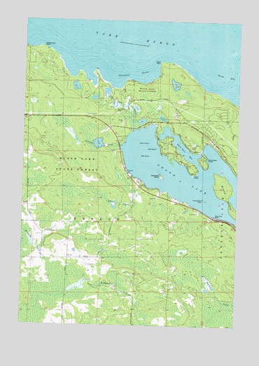
Thompsons Harbor, MI USGS Topographic Map
Click on map above to begin viewing in our Map Viewer.

This topographic map contains these locations and features:
Feature Name Type Latitude Longitude GNIS ID View Map
Allen IslandIslandN45.3225°W83.5475°619974View Map
Applegate IslandIslandN45.3114°W83.5447°620182View Map
Bear IslandIslandN45.3197°W83.5508°620845View Map
Birch Tree PointCapeN45.2947°W83.5125°621419View Map
Black Bass BayBayN45.3214°W83.5300°621472View Map
Black PointCapeN45.3578°W83.5455°621521View Map
Burnham's Landing Historical MarkerParkN45.3247°W83.5144°2374345View Map
Fisher Post Office (historical)Post OfficeN45.3500°W83.5806°2374016View Map
Grand IslandIslandN45.3070°W83.5097°627087View Map
Grand LakeLakeN45.2940°W83.5028°627090View Map
Grand Lake OutletStreamN45.3478°W83.5733°627091View Map
Grand PointCapeN45.3114°W83.5258°627101View Map
Indian IslandIslandN45.3247°W83.5517°628981View Map
Macombers IslandIslandN45.3178°W83.5200°631302View Map
North BayBayN45.3525°W83.5075°633477View Map
Observatory PointCapeN45.3639°W83.6155°633931View Map
Schalks CreekStreamN45.3245°W83.5667°637321View Map
Schaut CreekStreamN45.3120°W83.5614°637327View Map
Thompson's Harbor State ParkParkN45.3417°W83.5681°2374310View Map
Thompsons HarborBayN45.3536°W83.5614°1614782View Map
Three Sisters IslandIslandN45.3017°W83.5191°1614823View Map
Township of KrakowCivilN45.2806°W83.5795°1625140View Map

Note: Coordinates in the location and feature list above are referenced to NAD83 datum.


Copyright (C) 2008-2024 Ryan Niemi / Sunset Dynamics ... All Rights Reserved