TopoQuest Logo
Do you find TopoQuest useful?
Help keep TopoQuest running and adding new maps/features by donating!
Bitcoin:  19c7KJd3qBynnjoSw5npx9KScwjBe4ifkT
Litecoin:  LXs6TkuXGGXo1vDsWCkWVdjQX94eUKd6ui
Home View Maps Find Maps Find Places Resources & Links


Targhee Pass, Idaho Topographic Map

USGS Map Title: Targhee Pass, ID
USGS Map MRC: 44111F3
DRG (GeoTIFF) Download: o44111f3.tif


Neighboring USGS Topographic Map Quads:


  Earthquake Lake, MT  
44111G4
 

  Hebgen Dam, MT  
44111G3
 

  Mount Hebgen, MT  
44111G2
 

  Targhee Peak, ID  
44111F4
 

  Targhee Pass, ID  
44111F3
 

  Madison Arm, MT  
44111F2
 

  Sawtell Peak, ID  
44111E4
 

  Big Springs, ID  
44111E3
 

  Reas Pass, ID  
44111E2


Map MRC Location:

N45°
W112°
N45°
W111°
H8 H7 H6 H5 H4 H3 H2 H1
G8 G7 G6 G5 G4 G3 G2 G1
F8 F7 F6 F5 F4 F3 F2 F1
E8 E7 E6 E5 E4 E3 E2 E1
D8 D7 D6 D5 D4 D3 D2 D1
C8 C7 C6 C5 C4 C3 C2 C1
B8 B7 B6 B5 B4 B3 B2 B1
A8 A7 A6 A5 A4 A3 A2 A1
N44°
W112°
N44°
W111°

Targhee Pass, ID USGS 1:24K Topographic Map Preview:
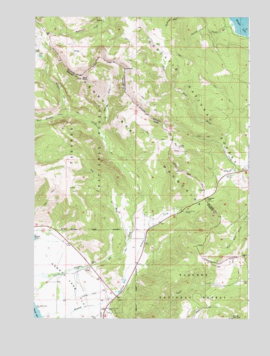
Targhee Pass, ID USGS Topographic Map
Click on map above to begin viewing in our Map Viewer.

This topographic map contains these locations and features:
Feature Name Type Latitude Longitude GNIS ID View Map
Bald PeakSummitN44.7244°W111.3480°397401View Map
Cherry CreekStreamN44.7491°W111.2616°781185View Map
Cherry Creek CampgroundLocaleN44.7463°W111.2636°794927View Map
Dry ForkStreamN44.6566°W111.3219°380851View Map
East Fork Targhee CreekStreamN44.7044°W111.3386°381184View Map
Henry's Lake AirportAirportN44.6344°W111.3453°400854View Map
Howard SpringSpringN44.6687°W111.2871°394856View Map
Howard Spring WaysideParkN44.6685°W111.2872°394681View Map
Howard Spring WaysideParkN44.6685°W111.2875°383477View Map
Howard SpringsSpringN44.6749°W111.2675°1743652View Map
Island Park Fire Department Station 4BuildingN44.6333°W111.3273°2619020View Map
LionheadSummitN44.7285°W111.3238°384706View Map
Lionhead Ski AreaLocaleN44.6955°W111.2911°799332View Map
Lionshead RV Park and CampgroundLocaleN44.6880°W111.2522°1737955View Map
Mountain Spring RanchLocaleN44.6877°W111.2538°794928View Map
Mountain SpringsSpringN44.6860°W111.2619°1743651View Map
Sunset LodgeLocaleN44.6313°W111.3286°398993View Map
Targhee CemeteryCemeteryN44.6477°W111.3422°391847View Map
Targhee PassGapN44.6746°W111.2758°391849View Map
Targhee Pass Historical MarkerParkN44.6758°W111.2730°1737972View Map
Tygee Creek BasinBasinN44.6399°W111.2555°394682View Map
West Targhee CreekStreamN44.7094°W111.3552°393246View Map

Note: Coordinates in the location and feature list above are referenced to NAD83 datum.


Copyright (C) 2008-2024 Ryan Niemi / Sunset Dynamics ... All Rights Reserved