TopoQuest Logo
Do you find TopoQuest useful?
Help keep TopoQuest running and adding new maps/features by donating!
Bitcoin:  19c7KJd3qBynnjoSw5npx9KScwjBe4ifkT
Litecoin:  LXs6TkuXGGXo1vDsWCkWVdjQX94eUKd6ui
Home View Maps Find Maps Find Places Resources & Links


Talmo, Georgia Topographic Map

USGS Map Title: Talmo, GA
USGS Map MRC: 31082C5
DRG (GeoTIFF) Download: o31082c5.tif


Neighboring USGS Topographic Map Quads:


  Wilsonville, GA  
31082D6
 

  Beach, GA  
31082D5
 

  Crawley, GA  
31082D4
 

  Axson, GA  
31082C6
 

  Talmo, GA  
31082C5
 

  Dixie Union, GA  
31082C4
 

  Cogdell, GA  
31082B6
 

  Pine Valley, GA  
31082B5
 

  Waycross West, GA  
31082B4


Map MRC Location:

N32°
W83°
N32°
W82°
H8 H7 H6 H5 H4 H3 H2 H1
G8 G7 G6 G5 G4 G3 G2 G1
F8 F7 F6 F5 F4 F3 F2 F1
E8 E7 E6 E5 E4 E3 E2 E1
D8 D7 D6 D5 D4 D3 D2 D1
C8 C7 C6 C5 C4 C3 C2 C1
B8 B7 B6 B5 B4 B3 B2 B1
A8 A7 A6 A5 A4 A3 A2 A1
N31°
W83°
N31°
W82°

Talmo, GA USGS 1:24K Topographic Map Preview:
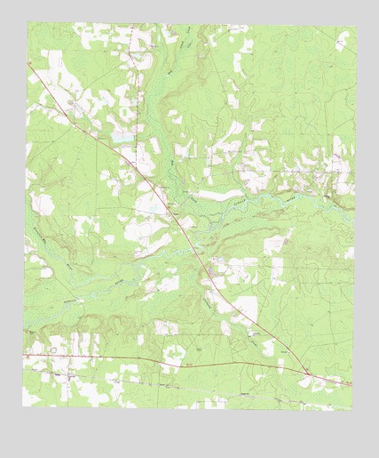
Talmo, GA USGS Topographic Map
Click on map above to begin viewing in our Map Viewer.

This topographic map contains these locations and features:
Feature Name Type Latitude Longitude GNIS ID View Map
Cane CreekStreamN31.3633°W82.5674°312287View Map
Chauncey CemeteryCemeteryN31.3008°W82.5832°312595View Map
FairfaxPopulated PlaceN31.2605°W82.6076°314035View Map
Friendship ChurchChurchN31.2741°W82.5376°314393View Map
Fullwood CreekStreamN31.2994°W82.5693°314455View Map
Gerbin LakeReservoirN31.3646°W82.5833°340911View Map
Gerbin Lake DamDamN31.3652°W82.5815°340910View Map
HastyPopulated PlaceN31.2577°W82.5729°331928View Map
Hephzibah ChurchChurchN31.3199°W82.5090°315336View Map
Hog CreekStreamN31.3135°W82.5493°315501View Map
King 0 Lee LakeReservoirN31.3375°W82.5882°342131View Map
King 0 Lee Lake DamDamN31.3385°W82.5849°342130View Map
Newbern ChurchChurchN31.3374°W82.5974°319566View Map
Oak Grove ChurchChurchN31.3677°W82.5774°319769View Map
SappvillePopulated PlaceN31.2547°W82.5421°332980View Map
Seventeen Mile RiverStreamN31.2966°W82.5807°322720View Map
TalmoPopulated PlaceN31.3133°W82.5690°333187View Map
Taylors ChapelChurchN31.3038°W82.6249°323957View Map
Telmore ChurchChurchN31.3219°W82.5729°323975View Map
VivianiPopulated PlaceN31.2541°W82.5346°357721View Map
Walden CemeteryCemeteryN31.2744°W82.6226°324755View Map
Waresboro DivisionCivilN31.2511°W82.5366°1936624View Map

Note: Coordinates in the location and feature list above are referenced to NAD83 datum.


Copyright (C) 2008-2024 Ryan Niemi / Sunset Dynamics ... All Rights Reserved