TopoQuest Logo
Do you find TopoQuest useful?
Help keep TopoQuest running and adding new maps/features by donating!
Bitcoin:  19c7KJd3qBynnjoSw5npx9KScwjBe4ifkT
Litecoin:  LXs6TkuXGGXo1vDsWCkWVdjQX94eUKd6ui
Home View Maps Find Maps Find Places Resources & Links


Table Mountain, Nevada Topographic Map

USGS Map Title: Table Mountain, NV
USGS Map MRC: 39118E3
DRG (GeoTIFF) Download: o39118e3.tif


Neighboring USGS Topographic Map Quads:


  Pintail Bay, NV  
39118F4
 

  Cox Canyon, NV  
39118F3
 

  I X L Canyon, NV  
39118F2
 

  Foxtail Lake, NV  
39118E4
 

  Table Mountain, NV  
39118E3
 

  Job Peak, NV  
39118E2
 

  Diamond Canyon, NV  
39118D4
 

  La Plata Canyon, NV  
39118D3
 

  Pirouette Mountain, NV  
39118D2


Map MRC Location:

N40°
W119°
N40°
W118°
H8 H7 H6 H5 H4 H3 H2 H1
G8 G7 G6 G5 G4 G3 G2 G1
F8 F7 F6 F5 F4 F3 F2 F1
E8 E7 E6 E5 E4 E3 E2 E1
D8 D7 D6 D5 D4 D3 D2 D1
C8 C7 C6 C5 C4 C3 C2 C1
B8 B7 B6 B5 B4 B3 B2 B1
A8 A7 A6 A5 A4 A3 A2 A1
N39°
W119°
N39°
W118°

Table Mountain, NV USGS 1:24K Topographic Map Preview:
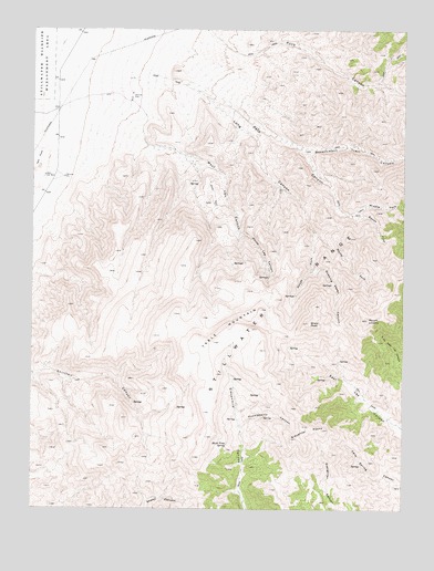
Table Mountain, NV USGS Topographic Map
Click on map above to begin viewing in our Map Viewer.

This topographic map contains these locations and features:
Feature Name Type Latitude Longitude GNIS ID View Map
Carson Table SummitSummitN39.5413°W118.2987°847660View Map
Churchill CountyCivilN39.5809°W118.3358°858638View Map
East Lee SpringSpringN39.5388°W118.2723°847659View Map
Elevenmile SpringsSpringN39.5233°W118.3068°848429View Map
Government Trail CanyonValleyN39.5946°W118.2865°840734View Map
Hard Time SpringSpringN39.5169°W118.3104°840894View Map
Huckleberry CanyonValleyN39.5210°W118.3051°841190View Map
Long CanyonValleyN39.6108°W118.3254°841794View Map
Long Canyon SpringSpringN39.5694°W118.2812°847662View Map
Long Canyon SpringSpringN39.5559°W118.2869°847663View Map
Long Canyon WellWellN39.6052°W118.3687°847667View Map
Middle Fork Pete CanyonValleyN39.5769°W118.2707°842083View Map
Mount LincolnSummitN39.5494°W118.2632°841648View Map
North Fork Long CanyonValleyN39.5727°W118.2818°842515View Map
North Lee CanyonValleyN39.5724°W118.3065°842541View Map
Pete CanyonValleyN39.6119°W118.3310°842786View Map
Quaking Aspen CanyonValleyN39.5616°W118.2821°843019View Map
Shaly PeakSummitN39.5485°W118.2832°843600View Map
Sheep Canyon SpringSpringN39.5027°W118.3335°848428View Map
Side SpringSpringN39.5102°W118.3701°847666View Map
Slaughter PeaksSummitN39.5216°W118.2849°843755View Map
South Fork Long CanyonValleyN39.5727°W118.2818°843856View Map
South Fork Pete CanyonValleyN39.5769°W118.2707°843861View Map
Stone House SpringSpringN39.5596°W118.2954°847661View Map
Table MountainSummitN39.5413°W118.2996°845692View Map
Trap Corral SpringSpringN39.5021°W118.3246°847665View Map
West Lee CanyonValleyN39.5946°W118.3385°844727View Map
West Lee WellWellN39.5869°W118.3718°848675View Map

Note: Coordinates in the location and feature list above are referenced to NAD83 datum.


Copyright (C) 2008-2024 Ryan Niemi / Sunset Dynamics ... All Rights Reserved