TopoQuest Logo
Do you find TopoQuest useful?
Help keep TopoQuest running and adding new maps/features by donating!
Bitcoin:  19c7KJd3qBynnjoSw5npx9KScwjBe4ifkT
Litecoin:  LXs6TkuXGGXo1vDsWCkWVdjQX94eUKd6ui
Home View Maps Find Maps Find Places Resources & Links


Sylvania, Alabama Topographic Map

USGS Map Title: Sylvania, AL
USGS Map MRC: 34085E7
DRG (GeoTIFF) Download: o34085e7.tif


Neighboring USGS Topographic Map Quads:


  Hollywood, AL  
34085F8
 

  Henagar, AL  
34085F7
 

  Ider, AL  
34085F6
 

  Dutton, AL  
34085E8
 

  Sylvania, AL  
34085E7
 

  Dugout Valley, AL  
34085E6
 

  Fyffe, AL  
34085D8
 

  Chavies, AL  
34085D7
 

  Fort Payne, AL  
34085D6


Map MRC Location:

N35°
W86°
N35°
W85°
H8 H7 H6 H5 H4 H3 H2 H1
G8 G7 G6 G5 G4 G3 G2 G1
F8 F7 F6 F5 F4 F3 F2 F1
E8 E7 E6 E5 E4 E3 E2 E1
D8 D7 D6 D5 D4 D3 D2 D1
C8 C7 C6 C5 C4 C3 C2 C1
B8 B7 B6 B5 B4 B3 B2 B1
A8 A7 A6 A5 A4 A3 A2 A1
N34°
W86°
N34°
W85°

Sylvania, AL USGS 1:24K Topographic Map Preview:
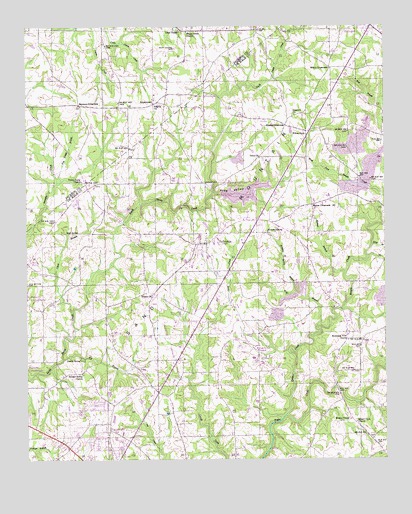
Sylvania, AL USGS Topographic Map
Click on map above to begin viewing in our Map Viewer.

This topographic map contains these locations and features:
Feature Name Type Latitude Longitude GNIS ID View Map
Bengis CreekStreamN34.5126°W85.7852°150088View Map
Big BranchStreamN34.5290°W85.8628°150105View Map
Bing BranchStreamN34.5615°W85.7544°150111View Map
BlakePopulated PlaceN34.5056°W85.7550°158267View Map
Bowman CrossroadsPopulated PlaceN34.6023°W85.8564°156102View Map
Brooks CrossroadsPopulated PlaceN34.5965°W85.7844°156117View Map
Browder SpringSpringN34.5659°W85.7908°150127View Map
Browder Spring BranchStreamN34.5487°W85.7816°150128View Map
BrowntownPopulated PlaceN34.6029°W85.8305°115024View Map
Clark BranchStreamN34.5429°W85.8589°150156View Map
Concord ChurchChurchN34.5993°W85.7814°150166View Map
Concord School (historical)SchoolN34.5962°W85.7700°1700399View Map
Cooper School (historical)SchoolN34.5651°W85.8522°1700400View Map
Dean ChapelChurchN34.6237°W85.8214°117173View Map
Dean Chapel CemeteryCemeteryN34.6187°W85.8227°117174View Map
Dean School (historical)SchoolN34.6243°W85.8214°139153View Map
Deberry School (historical)SchoolN34.5065°W85.8027°1700401View Map
DeKalb County Public LakeReservoirN34.5769°W85.7989°150679View Map
Dekalb County Public Lake DamDamN34.5767°W85.8069°150637View Map
Deshield School (historical)SchoolN34.5287°W85.8300°1700402View Map
Double SpringSpringN34.5287°W85.8564°150198View Map
Double Spring ChurchChurchN34.5248°W85.8561°150199View Map
Elliott CrossroadsPopulated PlaceN34.6129°W85.7686°156306View Map
Emmett School (historical)SchoolN34.5365°W85.7630°1700403View Map
Free Holiness Church (historical)ChurchN34.5870°W85.8186°1700404View Map
Frog ValleyValleyN34.5768°W85.8089°150244View Map
Happy Home ChurchChurchN34.6234°W85.8191°119703View Map
Henagar Police DepartmentBuildingN34.6247°W85.7549°2751979View Map
Henegar Volunteer Fire DepartmentBuildingN34.6227°W85.7557°2682868View Map
Lacy ChurchChurchN34.6237°W85.7855°150323View Map
Little Country ChurchChurchN34.5173°W85.7655°150710View Map
Mahan (historical)Populated PlaceN34.5737°W85.8127°150714View Map
Mahan BranchStreamN34.5540°W85.7639°150366View Map
Mahan CemeteryCemeteryN34.5795°W85.8122°150367View Map
Mahan CrossroadsPopulated PlaceN34.5734°W85.7752°150368View Map
Mahan School (historical)SchoolN34.5729°W85.7769°1700405View Map
Morgans StoreLocaleN34.5301°W85.7941°1700406View Map
Mount Calvary ChurchChurchN34.5573°W85.8736°150725View Map
Mount Olive ChurchChurchN34.5106°W85.7605°150400View Map
Mountain View ChurchChurchN34.5343°W85.7630°150412View Map
Musgrove (historical)Populated PlaceN34.5131°W85.8255°150728View Map
New Bethel CemeteryCemeteryN34.5504°W85.8750°150417View Map
Oak Grove ChurchChurchN34.5320°W85.7950°150433View Map
Pilgrim ChurchChurchN34.6020°W85.8303°124730View Map
Pole Bridge BranchStreamN34.5798°W85.8644°125087View Map
Ragsdell Store (historical)LocaleN34.6237°W85.8025°139256View Map
Rainsville-Sylvania DivisionCivilN34.5184°W85.8237°165756View Map
Rock SpringSpringN34.5655°W85.8612°150487View Map
Rucks Store (historical)LocaleN34.5195°W85.8297°157537View Map
Samples CemeteryCemeteryN34.6137°W85.8455°149594View Map
Slingle Mill (historical)LocaleN34.6223°W85.8486°1959390View Map
Straight Creek ChurchChurchN34.5409°W85.8697°157540View Map
Sweet Home AirportAirportN34.5822°W85.7545°2676310View Map
SylvaniaPopulated PlaceN34.5623°W85.8125°150546View Map
Sylvania Fire Department Station 1BuildingN34.5602°W85.8021°2682675View Map
Sylvania Fire Department Station 2BuildingN34.5627°W85.8177°2683179View Map
Sylvania Police DepartmentBuildingN34.5614°W85.7992°2751939View Map
Sylvania Post OfficePost OfficeN34.5694°W85.7977°168458View Map
Sylvania SchoolSchoolN34.5643°W85.8147°150748View Map
Town of SylvaniaCivilN34.5621°W85.8048°2406707View Map
Trinity Methodist ChurchChurchN34.5476°W85.8314°158941View Map
Union Grove ChurchChurchN34.5804°W85.8558°128326View Map
Union Grove School (historical)SchoolN34.5987°W85.8555°139302View Map
Unity CemeteryCemeteryN34.5867°W85.7922°1805503View Map
Unity ChurchChurchN34.5870°W85.7936°150566View Map
Wesley ChapelChurchN34.5115°W85.7625°158953View Map
Wilkes StoreLocaleN34.5937°W85.7772°150594View Map
Wolf BranchStreamN34.5381°W85.7739°150599View Map

Note: Coordinates in the location and feature list above are referenced to NAD83 datum.


Copyright (C) 2008-2024 Ryan Niemi / Sunset Dynamics ... All Rights Reserved