TopoQuest Logo
Do you find TopoQuest useful?
Help keep TopoQuest running and adding new maps/features by donating!
Bitcoin:  19c7KJd3qBynnjoSw5npx9KScwjBe4ifkT
Litecoin:  LXs6TkuXGGXo1vDsWCkWVdjQX94eUKd6ui
Home View Maps Find Maps Find Places Resources & Links


Sycamore, Missouri Topographic Map

USGS Map Title: Sycamore, MO
USGS Map MRC: 36092F3
DRG (GeoTIFF) Download: o36092f3.tif


Neighboring USGS Topographic Map Quads:


  Rockbridge, MO  
36092G4
 

  Gentryville, MO  
36092G3
 

  Dora, MO  
36092G2
 

  Gainesville NW, MO  
36092F4
 

  Sycamore, MO  
36092F3
 

  Cureall NW, MO  
36092F2
 

  Gainesville, MO  
36092E4
 

  Udall, MO  
36092E3
 

  Bakersfield, MO  
36092E2


Map MRC Location:

N37°
W93°
N37°
W92°
H8 H7 H6 H5 H4 H3 H2 H1
G8 G7 G6 G5 G4 G3 G2 G1
F8 F7 F6 F5 F4 F3 F2 F1
E8 E7 E6 E5 E4 E3 E2 E1
D8 D7 D6 D5 D4 D3 D2 D1
C8 C7 C6 C5 C4 C3 C2 C1
B8 B7 B6 B5 B4 B3 B2 B1
A8 A7 A6 A5 A4 A3 A2 A1
N36°
W93°
N36°
W92°

Sycamore, MO USGS 1:24K Topographic Map Preview:
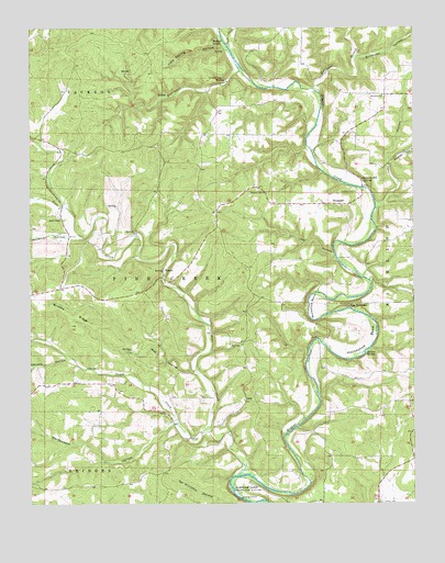
Sycamore, MO USGS Topographic Map
Click on map above to begin viewing in our Map Viewer.

This topographic map contains these locations and features:
Feature Name Type Latitude Longitude GNIS ID View Map
Bee HollowValleyN36.6598°W92.3227°713870View Map
Birdtown HollowValleyN36.7423°W92.2685°748872View Map
Bollinger BranchStreamN36.7337°W92.2827°748954View Map
Brixey SpringSpringN36.6648°W92.2657°714726View Map
Brushy RidgeRidgeN36.6745°W92.3624°714922View Map
Bushong School (historical)SchoolN36.6781°W92.2938°733817View Map
Caney CreekStreamN36.6451°W92.3171°715356View Map
Caney School (historical)SchoolN36.7214°W92.3721°733815View Map
Cave Spring HollowValleyN36.7448°W92.3118°715547View Map
Christy HollowValleyN36.6628°W92.3632°715826View Map
High View School (historical)SchoolN36.6498°W92.3004°733818View Map
Hodgson Mill SpringSpringN36.7095°W92.2668°719664View Map
Holdman HollowValleyN36.6953°W92.3632°719701View Map
Horseshoe BendBendN36.6703°W92.2713°719856View Map
Hurricane CreekStreamN36.7359°W92.3027°720035View Map
Job HollowValleyN36.6887°W92.2754°720327View Map
Lottie HollowValleyN36.7026°W92.2621°750869View Map
LunaPopulated PlaceN36.6520°W92.3057°741031View Map
Luna ChurchChurchN36.6487°W92.3315°721673View Map
Luna SchoolSchoolN36.6423°W92.3249°734275View Map
Martin CemeteryCemeteryN36.6889°W92.2707°721920View Map
Muleshoe BendBendN36.6770°W92.2821°723054View Map
Needmore ChurchChurchN36.7323°W92.2599°735743View Map
Negro FordCrossingN36.7459°W92.3113°734270View Map
New Hope School (historical)SchoolN36.7226°W92.3090°734271View Map
Osburn FordCrossingN36.6842°W92.2663°734273View Map
Patrick CemeteryCemeteryN36.6523°W92.3199°724077View Map
Pine CreekStreamN36.6323°W92.3082°724375View Map
Pleasant Hill School (historical)SchoolN36.7078°W92.2993°733816View Map
Rattail PointCliffN36.7462°W92.3143°725111View Map
Russel FordCrossingN36.6939°W92.2746°734272View Map
Sanders CemeteryCemeteryN36.7064°W92.2693°726028View Map
Sanfield FordCrossingN36.6528°W92.2813°734274View Map
School Number 88 (historical)SchoolN36.6951°W92.3452°734269View Map
Shipley HollowValleyN36.7145°W92.2574°752126View Map
Smith ChapelChurchN36.7001°W92.3657°726606View Map
SycamorePopulated PlaceN36.7034°W92.2743°741309View Map
The NarrowsRidgeN36.6770°W92.2721°727563View Map
Township of Pine CreekCivilN36.6836°W92.3405°767134View Map
Trail CreekStreamN36.7448°W92.3102°727756View Map
Upton CemeteryCemeteryN36.6606°W92.3535°728082View Map
Weidensaul HollowValleyN36.6459°W92.3288°728477View Map
ZanoniPopulated PlaceN36.6862°W92.3318°741379View Map

Note: Coordinates in the location and feature list above are referenced to NAD83 datum.


Copyright (C) 2008-2024 Ryan Niemi / Sunset Dynamics ... All Rights Reserved