TopoQuest Logo
Do you find TopoQuest useful?
Help keep TopoQuest running and adding new maps/features by donating!
Bitcoin:  19c7KJd3qBynnjoSw5npx9KScwjBe4ifkT
Litecoin:  LXs6TkuXGGXo1vDsWCkWVdjQX94eUKd6ui
Home View Maps Find Maps Find Places Resources & Links


Swallow Fork Peak, New Mexico Topographic Map

USGS Map Title: Swallow Fork Peak, NM
USGS Map MRC: 32108B7
DRG (GeoTIFF) Download: o32108b7.tif


Neighboring USGS Topographic Map Quads:


  Mondel, NM  
32108C8
 

  Gary, NM  
32108C7
 

  Lordsburg, NM  
32108C6
 

  Steins, NM  
32108B8
 

  Swallow Fork Peak, NM  
32108B7
 

  Pyramid Peak, NM  
32108B6
 

  Cotton City, NM  
32108A8
 

  Table Top Mountain, NM  
32108A7
 

  South Pyramid Peak, NM  
32108A6


Map MRC Location:

N33°
W109°
N33°
W108°
H8 H7 H6 H5 H4 H3 H2 H1
G8 G7 G6 G5 G4 G3 G2 G1
F8 F7 F6 F5 F4 F3 F2 F1
E8 E7 E6 E5 E4 E3 E2 E1
D8 D7 D6 D5 D4 D3 D2 D1
C8 C7 C6 C5 C4 C3 C2 C1
B8 B7 B6 B5 B4 B3 B2 B1
A8 A7 A6 A5 A4 A3 A2 A1
N32°
W109°
N32°
W108°

Swallow Fork Peak, NM USGS 1:24K Topographic Map Preview:
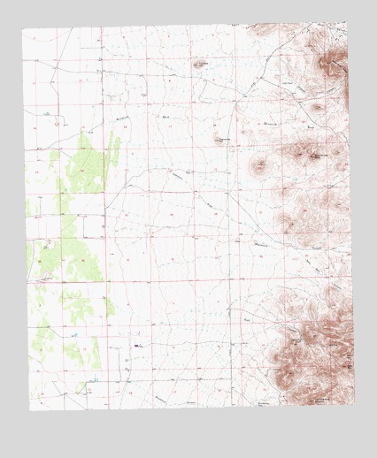
Swallow Fork Peak, NM USGS Topographic Map
Click on map above to begin viewing in our Map Viewer.

This topographic map contains these locations and features:
Feature Name Type Latitude Longitude GNIS ID View Map
10031 Water WellWellN32.2451°W108.8456°921398View Map
10032 Water WellWellN32.2398°W108.8459°921396View Map
10056 Water WellWellN32.1343°W108.8526°921389View Map
Able SeepSpringN32.1444°W108.7602°885537View Map
Bug House MineMineN32.1668°W108.7506°939997View Map
C C C TankReservoirN32.2304°W108.7757°887009View Map
Cedar LodeMineN32.1418°W108.7506°917154View Map
Fourmile HillSummitN32.2370°W108.8078°889191View Map
Goat Camp TankReservoirN32.1462°W108.7706°889440View Map
Goat CanyonValleyN32.1568°W108.8126°889442View Map
Goat MountainSummitN32.1376°W108.7531°889454View Map
Hampton DrawValleyN32.2070°W108.8445°889743View Map
Hill WellLocaleN32.2276°W108.8278°890008View Map
Jose Placencia CanyonValleyN32.1776°W108.8381°890575View Map
Kerr RanchLocaleN32.1806°W108.8662°933949View Map
Leitendorf (historical)Populated PlaceN32.2481°W108.7570°924488View Map
Light Load MineMineN32.1668°W108.7506°915394View Map
Lighting Dock Area KGRAAreaN32.1334°W108.7923°924823View Map
Lightning Dock MountainSummitN32.1265°W108.7662°891075View Map
Lucky Strike LodeMineN32.1584°W108.7506°915025View Map
Mansfield WashStreamN32.2176°W108.8456°891580View Map
Mexican HatSummitN32.1406°W108.7534°891922View Map
Nation WellLocaleN32.2020°W108.8134°892376View Map
New WellWellN32.1604°W108.7501°892480View Map
New Well CanyonValleyN32.1765°W108.7717°892506View Map
Road WellLocaleN32.1456°W108.7937°894005View Map
Schlesinger Ranch (historical)LocaleN32.1548°W108.8548°933951View Map
Seven Twelve Ranch (historical)LocaleN32.1668°W108.8431°933950View Map
Silver Bell MineMineN32.2423°W108.7631°894840View Map
South WellLocaleN32.1965°W108.7578°895151View Map
Swallow Fork PeakSummitN32.2062°W108.7645°895450View Map
Twelvemile HillSummitN32.2123°W108.8003°895932View Map
Well A Water WellWellN32.1459°W108.8331°921390View Map
Wheelbarrow TankReservoirN32.1255°W108.7883°896473View Map
Wildcat CanyonValleyN32.2354°W108.8023°896600View Map
Woodhaul CanyonValleyN32.1337°W108.8364°896753View Map

Note: Coordinates in the location and feature list above are referenced to NAD83 datum.


Copyright (C) 2008-2024 Ryan Niemi / Sunset Dynamics ... All Rights Reserved